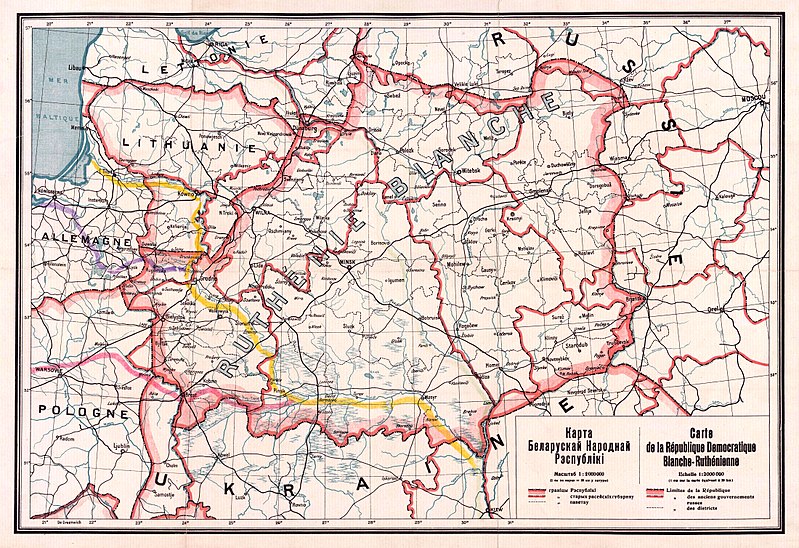
File:BNR (Ruthienie Blanche) Map 1918.jpg

Size of this preview: 800 × 548 pixels. Other resolutions: 320 × 219 pixels | 640 × 439 pixels | 1,024 × 702 pixels | 1,280 × 877 pixels | 2,560 × 1,754 pixels | 4,400 × 3,015 pixels.
Original file (4,400 × 3,015 pixels, file size: 10.27 MB, MIME type: image/jpeg)
File history
Click on a date/time to view the file as it appeared at that time.
| Date/Time | Thumbnail | Dimensions | User | Comment | |
|---|---|---|---|---|---|
| current | 13:56, 26 October 2017 |  | 4,400 × 3,015 (10.27 MB) | Kazimier Lachnovič | better quality |
| 14:18, 3 September 2005 |  | 1,000 × 700 (195 KB) | EugeneZelenko | Map of Belarusian National Republic (published in 1918). Originally uploaded to English Wikipedia by Rydel (21:53, 2 January 2005) as en:Image:BNR ruthienie blanche.jpg. Category:Historical maps of Belarus |
File usage
The following 10 pages use this file:
Global file usage
The following other wikis use this file:
- Usage on ar.wikipedia.org
- Usage on ast.wikipedia.org
- Usage on be-tarask.wikipedia.org
- Usage on be.wikipedia.org
- Usage on bg.wikipedia.org
- Usage on ca.wikipedia.org
- Usage on cs.wikipedia.org
- Usage on cy.wikipedia.org
- Usage on da.wikipedia.org
- Usage on de.wikipedia.org
- Usage on eo.wikipedia.org
- Usage on es.wikipedia.org
- Usage on et.wikipedia.org
- Usage on eu.wikipedia.org
- Usage on fr.wikipedia.org
- Usage on hu.wikipedia.org
- Usage on it.wikipedia.org
- Usage on lt.wikipedia.org
- Usage on lv.wikipedia.org
- Usage on nl.wikipedia.org
- Usage on no.wikipedia.org
- Usage on pl.wikipedia.org
- Usage on pt.wikipedia.org
View more global usage of this file.
