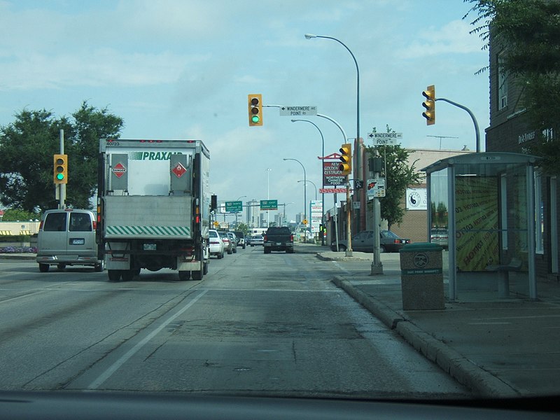
File:August 15 2007 downtown 002.jpg

Size of this preview: 800 × 600 pixels. Other resolutions: 320 × 240 pixels | 640 × 480 pixels | 1,024 × 768 pixels | 1,280 × 960 pixels | 2,304 × 1,728 pixels.
Original file (2,304 × 1,728 pixels, file size: 1.02 MB, MIME type: image/jpeg)
Summary
| DescriptionAugust 15 2007 downtown 002.jpg | English: Heading north bound Pembina Hwy |
| Date | |
| Source | Transferred from en.wikipedia to Commons. |
| Author | Jd.101 (talk) (Uploads) |
| Camera location | 49° 50′ 52.7″ N, 97° 09′ 10.3″ W | View this and other nearby images on: OpenStreetMap |
|---|
Licensing
Jd.101Jd.101Jd.101 at the English Wikipedia, the copyright holder of this work, hereby publishes it under the following license:

|
Permission is granted to copy, distribute and/or modify this document under the terms of the GNU Free Documentation License, Version 1.2 or any later version published by the Free Software Foundation; with no Invariant Sections, no Front-Cover Texts, and no Back-Cover Texts. A copy of the license is included in the section entitled GNU Free Documentation License.http://www.gnu.org/copyleft/fdl.htmlGFDLGNU Free Documentation Licensetruetrue |
| This file is licensed under the Creative Commons Attribution-Share Alike 3.0 Unported license. | ||
| Attribution: Jd.101Jd.101Jd.101 at the English Wikipedia | ||
| ||
| This licensing tag was added to this file as part of the GFDL licensing update.http://creativecommons.org/licenses/by-sa/3.0/CC BY-SA 3.0Creative Commons Attribution-Share Alike 3.0truetrue |
Original upload log
The original description page was here. All following user names refer to en.wikipedia.
| Date/Time | Dimensions | User | Comment |
|---|---|---|---|
| 2007-08-21 18:08 | 2304×1728× (1067338 bytes) | Jd.101 | heading north bound Pembina Hwy |
Captions
Northbound traffic on Pembina Hwy. (Route 42) in Fort Garry.
Items portrayed in this file
depicts
Fort Garry
truck
Praxair (Canada)
Winnipeg Route 42
bus stop
copyright status
copyrighted
copyright license
Creative Commons Attribution-ShareAlike 3.0 Unported
GNU Free Documentation License, version 1.2 or later
inception
15 August 2007
exposure time
0.00294117647058823529 second
f-number
5
focal length
13.3 millimetre
ISO speed
100
instance of
photograph
coordinates of the point of view
49°50'52.699"N, 97°9'10.300"W
media type
image/jpeg
checksum
2f8e45aca3cfbff21aec0aba18608c50c09acef8
determination method or standard: SHA-1
data size
1,067,338 byte
height
1,728 pixel
width
2,304 pixel
File history
Click on a date/time to view the file as it appeared at that time.
| Date/Time | Thumbnail | Dimensions | User | Comment | |
|---|---|---|---|---|---|
| current | 07:00, 23 April 2016 |  | 2,304 × 1,728 (1.02 MB) | FastilyClone | Transferred from enwp |
File usage
The following page uses this file:
Metadata
This file contains additional information, probably added from the digital camera or scanner used to create or digitize it.
If the file has been modified from its original state, some details may not fully reflect the modified file.
| Camera manufacturer | FUJIFILM |
|---|---|
| Camera model | FinePix E500 |
| Exposure time | 1/340 sec (0.0029411764705882) |
| F-number | f/5 |
| ISO speed rating | 100 |
| Date and time of data generation | 10:03, 15 August 2007 |
| Lens focal length | 13.3 mm |
| Orientation | Normal |
| Horizontal resolution | 72 dpi |
| Vertical resolution | 72 dpi |
| Software used | Digital Camera FinePix E500 Ver1.00 |
| File change date and time | 10:03, 15 August 2007 |
| Y and C positioning | Co-sited |
| Exposure Program | Portrait mode (for closeup photos with the background out of focus) |
| Exif version | 2.2 |
| Date and time of digitizing | 10:03, 15 August 2007 |
| Meaning of each component |
|
| Image compression mode | 2 |
| Shutter speed | 8.4 |
| APEX aperture | 4.6 |
| APEX brightness | 6.86 |
| Exposure bias | 0 |
| Maximum land aperture | 3.1 APEX (f/2.93) |
| Metering mode | Pattern |
| Light source | Unknown |
| Flash | Flash did not fire, compulsory flash suppression |
| Supported Flashpix version | 1 |
| Color space | sRGB |
| Focal plane X resolution | 4,000 |
| Focal plane Y resolution | 4,000 |
| Focal plane resolution unit | 3 |
| Sensing method | One-chip color area sensor |
| File source | Digital still camera |
| Scene type | A directly photographed image |
| Custom image processing | Normal process |
| Exposure mode | Auto exposure |
| White balance | Auto white balance |
| Scene capture type | Portrait |
| Sharpness | Normal |
| Subject distance range | Unknown |
