Langbahn Team – Weltmeisterschaft

File:Amrum-Nebel-Oeoemranghues-Memorial-stone-P5252498jm.jpg
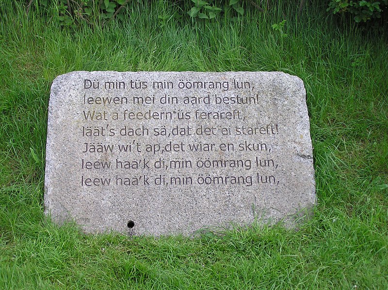
Original file (2,288 × 1,712 pixels, file size: 2.26 MB, MIME type: image/jpeg)

Summary

Description
Dansk: Mindesten i Öömrang, Tyskland
Deutsch: Öömrangdenkstein:4.Strophe der Amrumer Regionalhyme

weitere:
1. Stein 1.Strophe
2. Stein 2.Strophe

3. Stein 3.Strophe
English: Memorial stone in Öömrang on the island of Amrum in the German region of North Frisia
Date 13 February 2009 (original upload date)
Source Transferred from da.wikipedia - de:Bild:Öömrang denkstein P5252498jm.JPG
Author

de:Benutzer:Jom at de.wikipedia Original uploader was Angelboer at da.wikipedia

Later version(s) were uploaded by MGA73 at da.wikipedia.
Permission
(Reusing this file)
CC-BY-2.0.
OpenStreetMap
InfoField
Node 930051174
Object location54° 39′ 03.42″ N, 8° 21′ 24.91″ E Kartographer map based on OpenStreetMap.View this and other nearby images on: OpenStreetMapinfo

Licensing

w:en:Creative Commons
attribution
This file is licensed under the Creative Commons Attribution 2.0 Generic license.
You are free:
  • to share – to copy, distribute and transmit the work
  • to remix – to adapt the work
Under the following conditions:
  • attribution – You must give appropriate credit, provide a link to the license, and indicate if changes were made. You may do so in any reasonable manner, but not in any way that suggests the licensor endorses you or your use.

Original upload log

The original description page was here. All following user names refer to da.wikipedia.
  • 2009-02-13 11:25 MGA73 2288×1712× (2370560 bytes) Højere version fra dewiki
  • 2006-06-14 06:00 Angelboer 800×599× (155510 bytes) *fotograf: Joachim Müllerchen *fra tysk wiki: Bild:Öömrang denkstein P5252498jm.JPG

Captions

Add a one-line explanation of what this file represents

Items portrayed in this file

depicts

copyright status

copyrighted

copyright license

Creative Commons Attribution 2.0 Generic

captured with

Olympus C-750 Ultra Zoom

inception

13 February 2009

coordinates of depicted place

54°39'3.85"N, 8°21'24.08"E

exposure time

0.002 second

f-number

3.2

focal length

9 millimetre

ISO speed

100

media type

image/jpeg

instance of

photograph

checksum

b4113c97867fc3880f632d6d0966d4b7acebb59a

determination method or standard: SHA-1

data size

2,370,560 byte

height

1,712 pixel

width

2,288 pixel

File history

Click on a date/time to view the file as it appeared at that time.

Date/TimeThumbnailDimensionsUserComment
current20:03, 13 February 2009Thumbnail for version as of 20:03, 13 February 20092,288 × 1,712 (2.26 MB)MGA73bot {{BotMoveToCommons|da.wikipedia}} {{Information |Description={{da|*fotograf: Joachim Müllerchen *fra tysk wiki:}} |Source=Transferred from [http://da.wikipedia.org da.wikipedia] |Date=2009-02-13 (first version); 2006-06-14 (last version) |Author=Origi

The following page uses this file:

Global file usage

The following other wikis use this file:

Metadata