F. D. Roosevelt Airport
F. D. Roosevelt Airport | |||||||||||
|---|---|---|---|---|---|---|---|---|---|---|---|
 The airport seen from a distance with The Quill in the background | |||||||||||
| Summary | |||||||||||
| Airport type | Public | ||||||||||
| Owner | Island Government of Sint Eustatius | ||||||||||
| Operator | Island Government of Sint Eustatius | ||||||||||
| Serves | Oranjestad | ||||||||||
| Location | Sint Eustatius | ||||||||||
| Elevation AMSL | 129 ft / 39 m | ||||||||||
| Coordinates | 17°29′47″N 062°58′46″W / 17.49639°N 62.97944°W | ||||||||||
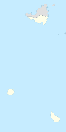
| Map | |||||||||||
 | |||||||||||
| Runways | |||||||||||
| |||||||||||
F. D. Roosevelt Airport (IATA: EUX, ICAO: TNCE) is the airport located on the Dutch Caribbean island of Sint Eustatius. It was opened as "Golden Rock Airport" in 1946 and renamed for Franklin Delano Roosevelt. As of 2012, the only commercial aircraft that serves the island is the DHC-6 Twin Otter (can operate chartered flights with Britten-Norman Islander and Cessna 208 Caravan), although the runway can accommodate larger turboprop aircraft and some smaller jets. As of 2023, the largest aircraft type to operate at the airport is the ATR 42.
President Roosevelt had Dutch ancestors and in 1939 presented Sint Eustatius with a plaque in recognition of the "First Salute," the first official salute of the flag of the newly declared independent United States in 1776. Members of the Roosevelt family lived on St. Eustatius in the 18th century and had possessions on the island.
Facilities
The airport is built to support small aircraft. A small single story terminal building processes passengers and baggage and also serves as the customs area.[3] A two-story tower is attached, but the airport has no control tower. There are no jetways or services, and a small apron allows for aircraft passengers to disembark.
Future development
The island is not a traditional Caribbean tourist destination, and so it does not have overcrowded beaches and blueprint resorts. The local government has, however, sought to increase tourism by attracting visitors to visit its dive sites, hike its dormant volcano The Quill and explore the remains of its colonial history and the restored historical city of Oranjestad. Part of this plan is a proposed 1,000-foot (300 m) extension of the runway, in order to accommodate even larger aircraft and additional destinations.
Airlines and destinations
| Airlines | Destinations |
|---|---|
| Coastal Air | Dominica–Canefield, Nevis, Saint Croix |
| EZAir | Bonaire, Aruba, Curacao |
| Trans Anguilla Airways | Anguilla, Nevis, Saint Kitts |
| Winair | Bonaire, Saba,[4] Sint Maarten |
Statistics
Access
Access to the airport is by private vehicle or taxi service from the surrounding areas of the island.[3] Main access to the airport is via Max T. Pandt Boulevard.
References
- ^ "Airport information for TNCE". World Aero Data. Archived from the original on 2019-03-05. Data current as of October 2006. Source: DAFIF.
- ^ Airport information for EUX at Great Circle Mapper. Source: DAFIF (effective October 2006).
- ^ a b "A-Z World Airports Online - BES Islands airports - St Eustatius - F D Roosevelt Airport (EUX/TNCE)". azworldairports.com. Retrieved 20 August 2016.
- ^ "Winair Adds St. Eustatius – Saba Sector Sep – Nov 2024". Aeroroutes. Retrieved 11 September 2024.
External links
![]() Media related to F.D. Roosevelt Airport at Wikimedia Commons
Media related to F.D. Roosevelt Airport at Wikimedia Commons

