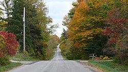
Bayham
Bayham | |
|---|---|
| Municipality of Bayham | |
 | |
| Motto: Opportunity is Yours | |
| Coordinates: 42°44′N 80°47′W / 42.733°N 80.783°W | |
| Country | |
| Province | |
| County | Elgin |
| Settled | 1800s |
| Incorporated | January 1, 1850 |
| Government | |
| • Mayor | Edward Ketchabaw |
| • Federal riding | Elgin—Middlesex—London |
| • Prov. riding | Elgin—Middlesex—London |
| Area | |
| • Land | 244.97 km2 (94.58 sq mi) |
| Population (2016)[1] | |
• Total | 7,396 |
| • Density | 30.2/km2 (78/sq mi) |
| Time zone | UTC-5 (EST) |
| • Summer (DST) | UTC-4 (EDT) |
| Postal Code | N0J |
| Area codes | 519 and 226 |
| Website | www |
Bayham (2011 Population: 6,989) is a municipality in the southeast corner of Elgin County, Ontario, Canada. It is south of the town of Tillsonburg and Oxford County.
History
Bayham was named in 1810 for Viscount Bayham Charles Pratt, a friend of land grant recipient Colonel Talbot. The township was incorporated on January 1, 1850. The villages of Port Burwell and Vienna were incorporated as separate municipalities and separated from the township in 1949 and 1853 respectively.
In 1998, Bayham was re-amalgamated with Port Burwell and Vienna and Eden to form an expanded Municipality of Bayham.
Communities
The municipality comprises the communities of Corinth, Eden, Froggetts Corners, North Hall, Port Burwell, Richmond, Springer's Hill, Straffordville, Vienna and Wadger.
Demographics
In the 2021 Census of Population conducted by Statistics Canada, Bayham had a population of 7,096 living in 2,264 of its 2,435 total private dwellings, a change of -4.1% from its 2016 population of 7,396. With a land area of 244.6 km2 (94.4 sq mi), it had a population density of 29.0/km2 (75.1/sq mi) in 2021.[4]
| 2021 | 2016 | 2011 | |
|---|---|---|---|
| Population | 7,096 (-4.1% from 2016) | 7,396 (+5.8% from 2011) | 6,989 (+3.9% from 2006) |
| Land area | 244.60 km2 (94.44 sq mi) | 244.97 km2 (94.58 sq mi) | 245.00 km2 (94.60 sq mi) |
| Population density | 29/km2 (75/sq mi) | 30.2/km2 (78/sq mi) | 28.5/km2 (74/sq mi) |
| Median age | 34.4 (M: 32.8, F: 35.6) | 34.3 (M: 34.0, F: 34.6) | 35.0 (M: 34.6, F: 35.4) |
| Private dwellings | 2,435 (total) 2,264 (occupied) | 2,557 (total) | 2,481 (total) |
| Median household income | $83,000 | $65,254 |
See also
References
- ^ a b c "Census Profile, 2016 Census: Bayham, Municipality". Statistics Canada. 8 February 2017. Retrieved June 12, 2019.
- ^ Statistics Canada: 1996, 2001, 2006 census
- ^ "Bayham census profile". 2011 Census of Population. Statistics Canada. 8 February 2012. Retrieved 2012-08-09.
- ^ "Population and dwelling counts: Canada, provinces and territories, census divisions and census subdivisions (municipalities), Ontario". Statistics Canada. February 9, 2022. Retrieved March 31, 2022.
- ^ "2021 Community Profiles". 2021 Canadian census. Statistics Canada. February 4, 2022. Retrieved 2023-10-19.
- ^ "2016 Community Profiles". 2016 Canadian census. Statistics Canada. August 12, 2021. Retrieved 2019-06-12.
- ^ "2011 Community Profiles". 2011 Canadian census. Statistics Canada. March 21, 2019. Retrieved 2012-08-09.
- ^ "2006 Community Profiles". 2006 Canadian census. Statistics Canada. August 20, 2019.
- ^ "2001 Community Profiles". 2001 Canadian census. Statistics Canada. July 18, 2021.

