Dnipriany
Dnipriany Дніпряни | |
|---|---|
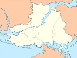
Location in Kherson Oblast | |
| Coordinates: 46°44′54″N 33°15′59″E / 46.74833°N 33.26639°E | |
| Country | |
| Oblast | Kherson Oblast |
| Raion | Kakhovka Raion |
| Hromada | Nova Kakhovka urban hromada |
| Population (2022) | |
• Total | |
| Time zone | UTC+2 (EET) |
| • Summer (DST) | UTC+3 (EEST) |
Dnipriany (Ukrainian: Дніпряни, Russian: Днепряны, romanized: Dnepryany), known as Brytany (Ukrainian: Британи) before 1946, is a rural settlement in Kakhovka Raion, Kherson Oblast, southern Ukraine. It is located on the left bank of the Dnieper, about 10 kilometres (6.2 mi) downstream of the city of Nova Kakhovka. Dnipriany belongs to Nova Kakhovka urban hromada, one of the hromadas of Ukraine.[1] It has a population of 3,930 (2022 estimate).[2]
History
Russian Empire
Dnipriany was founded in 1791 under the name Brytany on the lands of a military officer by fugitive serfs from other parts of the Russian Empire, such as Poltava Governorate, Kursk Governorate, and Oryol Governorate, among others. By 1822, 335 people lived in Brytany, which had an economy based around agriculture. By 1880, there were agricultural processing plants in the village.[3] In 1886, it was located in Kakhovka Volost, Dneprovsky Uyezd, Taurida Governorate, and had a church.[4]
In 1889, the village Osnovy (Ukrainian: Основи) was founded nearby by settlers from the village of Shabo (today in Odesa Oblast, Ukraine). The people of Osnovy planted large grape plantations and made wine, which was exported through the pier at Brytany. Many of the people of Brytany would also work on the grape fields. Also during the late 19th century, a steam mill was built in Brytany.[5]
Soviet Union

During World War II, Brytany was occupied by Nazi Germany between September 8, 1941 and November 1, 1943. In 1946, after the end of the war, Brytany was renamed to Dnipriany. In 1956, it received urban-type settlement status.[3] In 1957, the village Osnovy was merged into Dnipriany by an edict of the Kherson Oblast regional committee.[6] In 1965, by order of the Supreme Soviet of the Ukrainian Soviet Socialist Republic, Dnipriany—along with the surrounding village council—was subordinated to Nova Kakhovka Municipality.[7]
21st century
On 2 October 2018, Dnipriany was assigned to Nova Kakhovka urban hromada, one of the hromadas of Ukraine.[citation needed] Nova Kakhovka Municipality as an administrative unit was abolished on 18 July 2020 as part of the administrative reform of Ukraine, which reduced the number of raions of Kherson Oblast to five. The area of the former Nova Kakhovka Municipality was merged into Kakhovka Raion.[8][9]
During the Russian invasion of Ukraine that began in 2022, Dnipriany was captured and occupied by Russian forces. In June 2023, the Kakhovka Dam was blown up, flooding vast areas in Kherson Oblast, including Dnipriany. Footage showed that Dnipriany was either completely or almost completely underwater on 6 June 2023.[10][11]
Until 26 January 2024, Dnipriany was designated urban-type settlement. On this day, a new law entered into force which abolished this status, and Dnipriany became a rural settlement.[12]
Economy
Dnipriany is home to the Dnipriany River Port.
Transportation
The closest railway station, Elektromash, is located in Nova Kakhovka. It is on the railway connecting Mykolaiv via Snihurivka and Nova Kakhovka with Melitopol. There is infrequent passenger traffic.
The settlement has road access to Nova Kakhovka and further to Highway M14 connecting Kherson with Melitopol.
Demographics
|
|
In 2001, the settlement had a population of 4,712, most of whom were ethnic Ukrainians.[3]
References
- ^ "Новокаховская городская громада" (in Russian). Портал об'єднаних громад України.
- ^ a b Чисельність наявного населення України на 1 січня 2022 [Number of Present Population of Ukraine, as of January 1, 2022] (PDF) (in Ukrainian and English). Kyiv: State Statistics Service of Ukraine. Archived (PDF) from the original on 4 July 2022.
- ^ a b c d e Морлок, В. П. (2008-02-01). "Дніпряни". Encyclopedia of Modern Ukraine (in Ukrainian). Vol. 8. Інститут енциклопедичних досліджень НАН України. ISBN 978-966-02-2074-4.
- ^ komitet, Russia T͡Sentralʹnyĭ statisticheskīĭ (1886). Volosti i vazhni͡eĭshīi͡a selenīi͡a Evropeĭskoĭ Rossīi: Po dannym obsli͡edovanīi͡a, proizvedennago statisticheskimi uchrezhdenīi͡ami Ministerstva vnutrennikh di͡el, po poruchenīi͡u Statisticheskago sovi͡eta (in Russian). Tip. Ministerstva vnutrennikh di︠e︡l. p. 57.
- ^ a b "Дніпряни, Нова Каховка, Херсонська область". Історія міст і сіл Української РСР (in Ukrainian).
- ^ "Дніпряни, Нова Каховка, Херсонська область (продовження)". Історія міст і сіл Української РСР (in Ukrainian).
- ^ "Про внесення змін до Указу Президії Верховної Ради Української РСР від 4 січня 1965 року «Про внесення змін в адміністративне районування Української РСР»". Archived from the original on 1 July 2018. Retrieved 7 November 2016.
- ^ "Про утворення та ліквідацію районів. Постанова Верховної Ради України № 807-ІХ". Голос України (in Ukrainian). 2020-07-18. Retrieved 2020-10-03.
- ^ "Нові райони: карти + склад" (in Ukrainian). Міністерство розвитку громад та територій України.
- ^ "Satellite images show massive flooding of Ukraine's south". 2023-06-08. Retrieved 2023-11-26.
- ^ Hird, Karolina; Bailey, Riley; Stepanenko, Kateryna; Wolkov, Nicole; Barros, George; Kagan, Fredrick W. (6 June 2023). "Russian Offensive Campaign Assessment, June 6, 2023". Retrieved 26 June 2023.
- ^ "Что изменится в Украине с 1 января". glavnoe.in.ua (in Russian). 1 January 2024.
- ^ a b c d "Cities & towns of Ukraine". pop-stat.mashke.org. Retrieved 2023-11-26.
- ^ "Демоскоп Weekly - Приложение. Справочник статистических показателей". www.demoscope.ru. Retrieved 2023-11-26.


