Călărași
Călărași | |
|---|---|
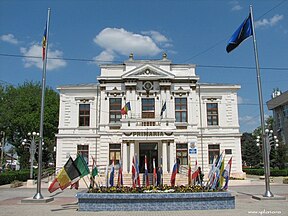
Old townhall Palace of the Prefecture | |
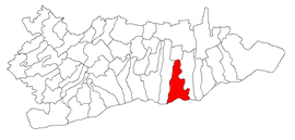
 Location within the county | |
| Coordinates: 44°12′N 27°20′E / 44.200°N 27.333°E | |
| Country | Romania |
| County | Călărași |
| Government | |
| • Mayor (2020–2024) | Marius-Grigore Dulce[1] (PSD) |
Area | 133.22 km2 (51.44 sq mi) |
| Elevation | 13 m (43 ft) |
| Population (2021-12-01)[2] | 58,211 |
| • Density | 440/km2 (1,100/sq mi) |
| Time zone | EET/EEST (UTC+2/+3) |
| Postal code | 910001–910165 |
| Vehicle reg. | CL |
| Website | www |
Călărași (Romanian pronunciation: [kələˈraʃʲ] ⓘ), the capital of Călărași County in the Muntenia region, is situated in south-east Romania, on the banks of the Danube's Borcea branch, at about 12 kilometres (7 miles) from the Bulgarian border and 125 kilometres (78 miles) from Bucharest. It is one of six Romanian county seats lying on the Danube river.
The city is an industrial centre for lumber and paper, food processing, glass manufacturing, textiles, medical equipment production, and heavy industry, the last one represented by the Călărași steel works. The city is known colloquially as "Capșa provinciei" (the Capșa from the provinces).[3]
History

The site of a medieval village, called Lichirești from the time of Michael the Brave.[dubious – discuss] Călărași appeared for the first time in 1700 on a map drawn by Constantin Cantacuzino. It got its name after it was made by the Wallachian princes, in the 17th century, a station of "mounted couriers' service" on the route from Bucharest to Constantinople. The service was operated by horseback riders (the călărași). It expanded into a small town, and in 1834 became the surrounding county's capital.
Transportation
Călărași is connected by National Roads DN3, DN21, DN31, and DN3B. Also A2 ("The Sun's Motorway") has 3 exits for Călărași, at Lehliu Gară (about 50 km (31 mi) NW), Dragalina (about 30 km (19 mi) N) and Fetești (about 40 km (25 mi) NE). The city lies on the seventh pan-European corridor of transport (the Danube river) and is next to the fourth pan-European transport corridor (Dresden–Constanța) at 26 km (16 mi). The Călărași train station serves the CFR Line 802. The nearest major cities are: Bucharest 120 km (75 mi), Constanța 148 km (92 mi), and Varna 155 km (96 mi).
Education

The city features seven middle schools and several high schools, including[4]
- Barbu Știrbei National College
- Mihai Eminescu Theoretical High School
- Ștefan Bănulescu Technical High School
- Danubius High School
- Sandu Aldea Agricultural College
- Călărași Economics College
Sports
The city is currently represented by Dunărea Călărași in the Romanian Liga III football league.
Natives
- Ștefan Bănică Sr. (1933–1995), actor, singer
- Daniel Bogdan (b. 1971), footballer
- Mircea Ciumara (1943–2012), politician
- Vladimir Constantinescu (1895–1965), general
- Maria Cuțarida-Crătunescu (1857–1919), first female doctor in Romania
- Daniel Florea (b. 1972), politician
- Petre V. Haneș (1879–1966), literary historian
- Dan Mateescu (1911–2008), engineer, titular member of the Romanian Academy
- Marius Mocanu (b. 1986), handballer
- Barbu Nemțeanu (1887–1919), poet
- Gabriel Popa (b. 1985), footballer
- Dragoș Protopopescu (1892–1948), writer, poet
- Gabriel Simion (b. 1998), footballer
International relations
Twin towns — Sister cities
Călărași is twinned with:
|
Climate
The climate is continental with a year average temperature of 11.3 °C (52 °F). The lowest temperature ever recorded in Călărași was −30.0 °C (−22 °F) on January 9, 1938, and the highest was 41.4 °C (107 °F) on August 10, 1957.
| Climate data for Călărași (1991–2020, extremes 1981-2020) | |||||||||||||
|---|---|---|---|---|---|---|---|---|---|---|---|---|---|
| Month | Jan | Feb | Mar | Apr | May | Jun | Jul | Aug | Sep | Oct | Nov | Dec | Year |
| Record high °C (°F) | 25.0 (77.0) |
27.9 (82.2) |
33.5 (92.3) |
37.5 (99.5) |
39.5 (103.1) |
42.3 (108.1) |
42.3 (108.1) |
41.1 (106.0) |
37.5 (99.5) |
35.4 (95.7) |
27.7 (81.9) |
20.7 (69.3) |
42.3 (108.1) |
| Mean daily maximum °C (°F) | 3.6 (38.5) |
6.8 (44.2) |
12.5 (54.5) |
18.9 (66.0) |
24.6 (76.3) |
28.8 (83.8) |
31.0 (87.8) |
31.1 (88.0) |
25.7 (78.3) |
18.8 (65.8) |
11.7 (53.1) |
5.3 (41.5) |
18.2 (64.8) |
| Daily mean °C (°F) | −0.4 (31.3) |
1.8 (35.2) |
6.5 (43.7) |
12.1 (53.8) |
17.7 (63.9) |
22 (72) |
24.1 (75.4) |
23.6 (74.5) |
18.4 (65.1) |
12.3 (54.1) |
6.7 (44.1) |
1.3 (34.3) |
12.2 (54.0) |
| Mean daily minimum °C (°F) | −3.7 (25.3) |
−2.1 (28.2) |
1.7 (35.1) |
6.0 (42.8) |
11.1 (52.0) |
15.6 (60.1) |
17.2 (63.0) |
16.6 (61.9) |
12.2 (54.0) |
7.3 (45.1) |
2.8 (37.0) |
−2.0 (28.4) |
6.9 (44.4) |
| Record low °C (°F) | −20.6 (−5.1) |
−17.5 (0.5) |
−4.2 (24.4) |
−0.2 (31.6) |
5.6 (42.1) |
8.5 (47.3) |
6.2 (43.2) |
2.0 (35.6) |
−7.3 (18.9) |
−15.2 (4.6) |
−19.6 (−3.3) |
−26.9 (−16.4) |
−26.9 (−16.4) |
| Average precipitation mm (inches) | 39.6 (1.56) |
27.5 (1.08) |
39.4 (1.55) |
40.9 (1.61) |
50.5 (1.99) |
65.7 (2.59) |
52.3 (2.06) |
41.8 (1.65) |
52.1 (2.05) |
49.0 (1.93) |
45.1 (1.78) |
45.3 (1.78) |
549.2 (21.62) |
| Average precipitation days (≥ 1.0 mm) | 6.8 | 4.8 | 5.8 | 6.6 | 7.5 | 7.4 | 6.2 | 4.2 | 4.8 | 5.2 | 5.5 | 6.9 | 71.7 |
| Mean monthly sunshine hours | 82.4 | 114.4 | 154.9 | 205.1 | 259.6 | 280.8 | 317.2 | 302.1 | 221.9 | 158.8 | 96.7 | 76.4 | 2,270.3 |
| Source: NOAA[6][7] | |||||||||||||
Population
| Year | Pop. | ±% |
|---|---|---|
| 1859 | 1,037 | — |
| 1900 | 11,024 | +963.1% |
| 1912 | 12,995 | +17.9% |
| 1930 | 18,053 | +38.9% |
| 1948 | 24,448 | +35.4% |
| 1956 | 25,555 | +4.5% |
| 1966 | 35,684 | +39.6% |
| 1977 | 49,727 | +39.4% |
| 1992 | 76,952 | +54.7% |
| 2002 | 70,039 | −9.0% |
| 2011 | 65,181 | −6.9% |
| 2021 | 58,211 | −10.7% |
| Source: Census data | ||
At the 2021 census, Călărași had a population 58,211. In 2011, it had a population of 65,181, with 95.05% of them declaring themselves as being Romanians and 3.59% Roma. The surrounding communes (Modelu, Ostrov, Roseți, Grădiștea, Cuza-Vodă, and Ștefan Vodă) together with Călărași number almost 100,000 inhabitants.
References
- ^ "Results of the 2020 local elections". Central Electoral Bureau. Retrieved 8 June 2021.
- ^ "Populaţia rezidentă după grupa de vârstă, pe județe și municipii, orașe, comune, la 1 decembrie 2021" (XLS). National Institute of Statistics.
- ^ (in Romanian) Laura Toma, "Amatorii de Călărași" Archived 2016-03-04 at the Wayback Machine, Jurnalul Național, July 27, 2005
- ^ (in Romanian) Schools at the Călărași County Schools Inspectorate site
- ^ Vacca, Maria Luisa. "Comune di Napoli -Gemellaggi" [Naples - Twin Towns]. Comune di Napoli (in Italian). Archived from the original on 2013-07-22. Retrieved 2013-08-08.
- ^ "World Meteorological Organization Climate Normals for 1991-2020 — Călărași". National Oceanic and Atmospheric Administration. Retrieved January 11, 2024.
- ^ "World Meteorological Organization Climate normals for 1981-2010: Calarasi(WMO number: 15460)" (XLS). ncei.noaa.gov. NOAA. Retrieved 12 February 2024.
External links
- Călăraşi, Romania at JewishGen
- Kalarash/Călărași (pp. 358–361) at Miriam Weiner's Routes to Roots Foundation.
Further reading
- Weiner, Miriam; Ukrainian State Archives (in cooperation with); Moldovan State Archives (in cooperation with) (1999). "Town Clips: Kalarash." Jewish Roots in Ukraine and Moldova: Pages from the Past and Archival Inventories . Secaucus, NJ: Miriam Weiner Routes to Roots Foundation. p. 362-363. ISBY 978-0-96-565081-6. OCLC 607423469.


