Bad Laasphe
Bad Laasphe | |
|---|---|
 | |
Location of Bad Laasphe within Siegen-Wittgenstein district  | |
| Coordinates: 50°55′49″N 08°25′00″E / 50.93028°N 8.41667°E | |
| Country | Germany |
| State | North Rhine-Westphalia |
| Admin. region | Arnsberg |
| District | Siegen-Wittgenstein |
| Subdivisions | 24 |
| Government | |
| • Mayor (2020–25) | Dirk Terlinden[1] |
| Area | |
• Total | 135.76 km2 (52.42 sq mi) |
| Highest elevation | 694 m (2,277 ft) |
| Lowest elevation | 300 m (1,000 ft) |
| Population (2023-12-31)[2] | |
• Total | 13,504 |
| • Density | 99/km2 (260/sq mi) |
| Time zone | UTC+01:00 (CET) |
| • Summer (DST) | UTC+02:00 (CEST) |
| Postal codes | 57334 |
| Dialling codes | 02752, 02753, 02754, 02774 |
| Vehicle registration | SI |
| Website | www |
Bad Laasphe (German: [baːt ˈlaːsfə] ) is a town in North Rhine-Westphalia, Germany, in the Siegen-Wittgenstein district.
Geography
Location
The town of Bad Laasphe lies in the upper Lahn Valley, near the stately home of Wittgenstein Castle (de) (nowadays a boarding school) in the former Wittgenstein district. The municipal area is located south of the main crest of the Rothaargebirge, and borders in the north on the towns of Bad Berleburg and Erndtebrück, in the east on the town of Biedenkopf in Hessen, in the southeast on Breidenbach, in the south on Dietzhölztal and in the west on the town of Netphen. Bad Laasphe lies about 30 km east of Siegen and 25 km northwest of Marburg.
The highest elevation in the municipal area rises to 694 m. It lies southwest of the main town at the outlying centre of Heiligenborn.
Constituent communities

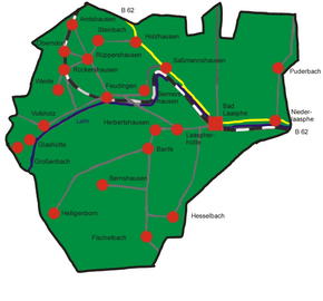
Each one of the following centres is part of the town of Bad Laasphe:
|
History
In 1888, the town of Laasphe lay in the Prussian administrative region of Arnsberg in Wittgenstein district and was connected to the Kreuzthal-Marburg line of the Prussian State Railway (Preußische Staatsbahn). In 1888 Laasphe had a junior teachers' college, a local court and knitwear and hosiery factories. In 1885, Laasphe had 2225 mostly Evangelical inhabitants. Schloss Wittgenstein owned two ironworks. (From Meyers Konversations-Lexikon)
Since 1960, Laasphe has been a Kneipp spa. On 1 January 1984 the town became a Kneipp curative spa for its mild climate, and since then has been called Bad Laasphe.
Government
The results of the local council elections in May 2014[3] were:
| Party | % | Seats |
|---|---|---|
| SPD | 40,5% | 13 |
| CDU | 39,0% | 12 |
| FDP | 11,7% | 4 |
| Alliance '90/The Greens | 8,8% | 3 |
Coat of arms
Bad Laasphe's civic coat of arms might heraldically be described thus: In sable a town wall with open gate tower argent flanked by two crenellated towers argent, between which an inescutcheon in argent two pallets sable.
A stamping of the town's seal from the 14th century has been preserved, which shows the same composition as the arms shown here. The inescutcheon (smaller shield within the main one) bears the same arms as the town's former overlords, the Counts of Wittgenstein. When the arms were revised in 1908, the town came up with another composition which looked the same, but the inescutcheon, owing to a misunderstanding, was rather different, being quartered with two opposite quarters showing in gules (red) a castle argent (silver), and in the two other quarters the Wittgenstein pallets. The castle charge was a modern addition and related to the Wittgensteins' overlordship in Homburg. The town archive suggested even then that the inescutcheon bear the old Wittgenstein arms as seen in the town's oldest known seal, but no decision was made about it at that time. Only in 1936 did the town finally decide to revert to the composition shown in the old seal. This was confirmed as the town's arms on 10 March 1937.
Twin towns
 Tamworth, Staffordshire, England, United Kingdom, since 10 October 1980
 Châteauneuf-sur-Loire, France, since 28 September 1991
Notable people

- Ludwig Crocius (1586–1655), preacher, professor at Bremen School Illustre
- Friedrich Kiel, (1821–1885), composer
- Wilhelm Pauck (1901–1981), Protestant church historian
- Rudolf Jung (1907–1973), writer and translator
- Fritz Heinrich, (1921–1959), German politician (SPD), Member of the Bundestag
- Otto Piene, (1928–2014), painter and artist
- Fritz Roth, born 1955, actor and musician
References
- ^ Wahlergebnisse in NRW Kommunalwahlen 2020, Land Nordrhein-Westfalen, accessed 30 June 2021.
- ^ "Bevölkerung der Gemeinden Nordrhein-Westfalens am 31. Dezember 2023 – Fortschreibung des Bevölkerungsstandes auf Basis des Zensus vom 9. Mai 2011" (in German). Landesbetrieb Information und Technik NRW. Retrieved 20 June 2024.
- ^ SPD wird stärkste Kraft im Rat von Bad Laasphe


