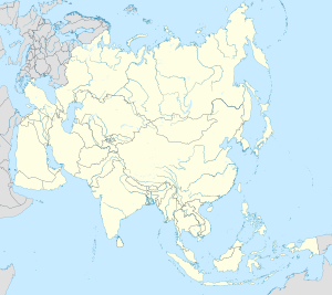
Atbasar
Atbasar Атбасар | |
|---|---|
 Late 19th century house in Atbasar | |
| Coordinates: 51°48′N 68°20′E / 51.800°N 68.333°E | |
| Country | |
| Region | Akmola Region |
| District | Atbasar District |
| Population (2012) | |
• Total | 29,984 |
| Time zone | UTC+6 (Omsk Time) |
| Area code | +7 71643 |
Atbasar (Kazakh: Атбасар, Atbasar) is a town in Atbasar District, Akmola Region of the northern Kazakhstan. It was founded in 1845. Atbasar is the 44th biggest city in Kazakhstan. Atbasar lies at an altitude of 282 meters above sea level.
Population: 30,436 (2009 Census results);[1]32,288 (1999 Census results).[1]
Geography
Atbasar lies by the Zhabay River, a tributary of the Ishim.[2]
Climate
Kazakhstan's lowest recorded temperature was at Atbasar, measured at −57 °C (−71 °F).[3]
Heavy rains in April 2017 caused a dam to rupture, leaving the whole town under water.[4]
| Climate data for Atbasar (1991–2020, extremes 1901–present) | |||||||||||||
|---|---|---|---|---|---|---|---|---|---|---|---|---|---|
| Month | Jan | Feb | Mar | Apr | May | Jun | Jul | Aug | Sep | Oct | Nov | Dec | Year |
| Record high °C (°F) | 6.1 (43.0) |
3.3 (37.9) |
17.4 (63.3) |
30.5 (86.9) |
36.3 (97.3) |
39.9 (103.8) |
41.6 (106.9) |
40.0 (104.0) |
37.2 (99.0) |
28.4 (83.1) |
15.9 (60.6) |
3.7 (38.7) |
41.6 (106.9) |
| Mean daily maximum °C (°F) | −12.5 (9.5) |
−11.0 (12.2) |
−3.5 (25.7) |
11.1 (52.0) |
21.0 (69.8) |
25.8 (78.4) |
26.7 (80.1) |
25.6 (78.1) |
19.1 (66.4) |
10.3 (50.5) |
−2.4 (27.7) |
−9.8 (14.4) |
8.4 (47.1) |
| Daily mean °C (°F) | −16.9 (1.6) |
−15.8 (3.6) |
−8.3 (17.1) |
4.9 (40.8) |
13.7 (56.7) |
18.8 (65.8) |
19.9 (67.8) |
18.3 (64.9) |
11.8 (53.2) |
4.1 (39.4) |
−6.6 (20.1) |
−14.0 (6.8) |
2.5 (36.5) |
| Mean daily minimum °C (°F) | −21.4 (−6.5) |
−20.6 (−5.1) |
−13.1 (8.4) |
−1.1 (30.0) |
6.0 (42.8) |
11.3 (52.3) |
13.0 (55.4) |
11.1 (52.0) |
5.0 (41.0) |
−1.2 (29.8) |
−10.4 (13.3) |
−18.4 (−1.1) |
−3.3 (26.1) |
| Record low °C (°F) | −57.6 (−71.7) |
−43.1 (−45.6) |
−39.1 (−38.4) |
−27.5 (−17.5) |
−11.0 (12.2) |
−4.1 (24.6) |
2.5 (36.5) |
−5.4 (22.3) |
−9.1 (15.6) |
−23.8 (−10.8) |
−36.4 (−33.5) |
−43.5 (−46.3) |
−57.6 (−71.7) |
| Average precipitation mm (inches) | 19 (0.7) |
17 (0.7) |
20 (0.8) |
20 (0.8) |
28 (1.1) |
41 (1.6) |
50 (2.0) |
30 (1.2) |
19 (0.7) |
24 (0.9) |
22 (0.9) |
24 (0.9) |
314 (12.4) |
| Average precipitation days (≥ 1.0 mm) | 6.0 | 4.9 | 5.1 | 4.7 | 6.0 | 5.7 | 7.3 | 5.4 | 4.3 | 5.5 | 5.6 | 6.6 | 67.1 |
| Mean monthly sunshine hours | 103 | 140 | 194 | 235 | 293 | 326 | 323 | 286 | 219 | 134 | 93 | 84 | 2,430 |
| Source 1: Pogoda.ru.net[5] | |||||||||||||
| Source 2: NOAA (sun 1961–1990)[6][7] | |||||||||||||
How to get to Atbasar
The capital, Astana is 3.5 hours away by train.[8] A narrow-gauge railway line running TU2 diesel locomotives provides local freight transport.[9]
Atbasar also has a small airport.
Environment
Concern has been raised by the United Nations Economic Commission for Europe about exposure of the city to airborne uranium ore dust produced during the transfer of the ore from between railway flatcars.[10]
References
- ^ a b "Население Республики Казахстан" [Population of the Republic of Kazakhstan] (in Russian). Департамент социальной и демографической статистики. Retrieved 8 December 2013.
- ^ "N-42 Topographic Chart (in Russian)". Retrieved 2 November 2024.
- ^ "Climate and weather of Kazakhstan". Advantour, Tashkent. Retrieved 10 December 2016.
- ^ "Flooding Sparks Complaints, Finger-Pointing". EurasiaNet.org. Retrieved 1 May 2017.
- ^ "Климат Атбасар" (in Russian). Weather and Climate (Погода и климат). Retrieved January 3, 2022.
- ^ "Atbasar Climate Normals 1961–1990". National Oceanic and Atmospheric Administration. Retrieved January 3, 2022.
- ^ "World Meteorological Organization Climate Normals for 1991–2020: Atbasar" (CSV). National Oceanic and Atmospheric Administration. Retrieved 2 August 2023.
- ^ "Train schedule 108 Київ-пасажирський-Астана". Tickets.ua. Retrieved 15 January 2017.
- ^ "TU2 diesel locomotive". Memim.com. Retrieved 15 January 2017.
- ^ "Committee on Environmental Policy - Environmental Performance Reviews - Kazakhstan" (PDF). United Nations Economic Commission for Europe. p. 82. Retrieved 15 January 2017.
External links
 Media related to Atbasar at Wikimedia Commons
- Panoramio — Photo of Панорама Атбасара


