Adabar Thana
Adabar আদাবর | |
|---|---|
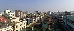
 Skyline of Adabar | |
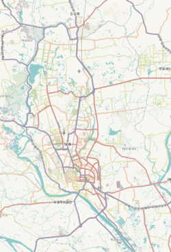
 Expandable map of vicinity of Adabar Thana | |
| Coordinates: 23°46′17″N 90°21′33″E / 23.77132866°N 90.35915521°E | |
| Country | |
| Division | Dhaka Division |
| District | Dhaka District |
| Area | |
• Total | 2.07 km2 (0.80 sq mi) |
| Elevation | 23 m (75 ft) |
| Population | |
• Total | 215,243 |
| • Density | 98,545/km2 (255,230/sq mi) |
| Time zone | UTC+6 (BST) |
| Postal code | 1207[3] |
| Area code | 02[4] |
Adabar Thana is an administrative and geographic unit of Dhaka North City Corporation under the jurisdiction of Dhaka District in Bangladesh. The area is located on the bank of Buriganga river and situated in the western part of Dhaka City. To the north, there is Darus Salam Thana, to the northern east, there is Sher-e-Bangla Nagar Thana, to the east and south, there is Mohammadpur Thana and to the west, there is Buriganga river and Savar Upazila. The Thana came into existence on the 27th June in 2007 by splitting up Mohammadpur Thana. The area has 798 acres of land, which is 3.23 square kilometers.
Geography
Located in between 23°45' and 23°46' north latitudes and in between 90°20' and 90°22' east longitudes, Adabar Thana is situated in the southwestern part of Dhaka City near the Buriganga River. The thana shares its borders mostly with Mohammadpur Thana and Darus Salam Thana. A small portion of the area near Shyamoli touches Sher-E-Bangla Nagar Thana on the northeast side. Savar Upazila and Keraniganj Upazila are just walking distances from the western side of the thana.[5]
The Thana area includes Mohammadia Housing Society, Pisciculture Housing Society, Nobodoy Housing Society, Abdul Rafiq Housing, Japan Garden City, Shekhertek, Monsurabad Housing, North Adabar, Baitul Aman Housing Society, Krishi Market, Shia Mosque, Dhaka Housing, Prominent Housing, Shyamoli Housing, Turag Housing, Akkas Housing, Beribadh Ibn Sina Housing, Ekota Housing, Sunibir Housing, Alif Housing, Mofiz Housing, Mehedibagh Housing, Unique Housing, Adarsha Chayanir, Mohammadpur, Mohammadpur Housing, Adbar. [6][7][8]
Demographics
According to the 2011 Census of Bangladesh, Adabar Thana had 47,642 households with average household size of 4.08 and a population of 203,989. Males constituted 53.61% (109,354) of the population while females 46.39% (94,635). Adabar had a literacy rate (age 7 and over) of 68.4%, compared to the national average of 51.8%, and a sex ratio of 116.There were 73 floating people in this jurisdiction. [10]
The religious breakdown was Muslim 98.10% (200,107), Hindu 1.61% (3,281), Christian 0.20% (404), Buddhist 0.08% (156), and others 0.01% (41). The ethnic minority people living there were 251 persons in total.
See also
References
- ^ "Geographic coordinates of Dhaka, Bangladesh". DATEANDTIME.INFO. Retrieved 7 July 2016.
- ^ National Report (PDF). Population and Housing Census 2022. Vol. 1. Dhaka: Bangladesh Bureau of Statistics. November 2023. p. 386. ISBN 978-9844752016.
- ^ "Bangladesh Postal Code". Dhaka: Bangladesh Postal Department under the Department of Posts and Telecommunications of the Ministry of Posts, Telecommunications and Information Technology of the People's Republic of Bangladesh. 19 October 2024.
- ^ "Bangladesh Area Code". China: Chahaoba.com. 18 October 2024.
- ^ "Adabar Thana - Banglapedia". en.banglapedia.org. Retrieved 2022-01-19.
- ^ "Adabar Thana - Anchal 5 - Ward 30". en.dncc.gov.bd.
- ^ "Adabar Thana". en.thebangladesh.net.
- ^ "Adabar Thana". en.thebangladesh.net.
- ^ "Bangladesh Population and Housing Census 2011 Zila Report – Dhaka" (PDF). bbs.gov.bd. Bangladesh Bureau of Statistics.
- ^ "Community Tables: Dhaka district" (PDF). bbs.gov.bd. 2011.


