Ableman's Gorge State Natural Area
| Ableman's Gorge State Natural Area | |
|---|---|
IUCN category V (protected landscape/seascape) | |
 Ableman's Gorge in 2009 | |
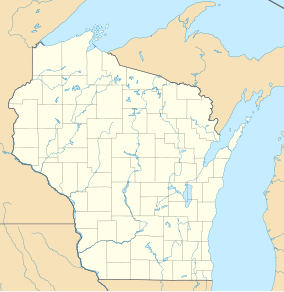
| Location | Sauk County, Wisconsin |
| Nearest city | Rock Springs, Wisconsin |
| Coordinates | 43°29′18″N 89°55′17″W / 43.48833°N 89.92139°W / 43.48833; -89.92139 |
| Area | 127 acres (51 ha) |
| Established | 1969 |
| Governing body | Wisconsin Department of Natural Resources and the University of Wisconsin |
Ableman's Gorge is a 127 acres (51 ha) Wisconsin State Natural Area located near Rock Springs, Wisconsin.[1] This 200 to 400-foot wide and 200-foot high gorge is cut by about 1 mile (1.6 km) of the Baraboo River in an "L" shape.[2][1][3] The Natural Area is named after Stephen Van Rensselaer Ableman, who settled Rock Springs in 1851 and named the community after the gorge area.[4]
Formation
The cliffs are composed of Baraboo Quartzite below Cambrian sandstone and conglomerate.[1] The gorge formed along a layer of ancient sea sediment that hardened into sandstone then metamorphized into harder quartzite rock before being lifted into a vertical layer.[3] The area was later submerged under the sea again, which led to another sandstone layer capping the quartzite.[3] The unique geological features of this gorge make it one of a few places where this type of rock can clearly be seen in the Midwestern United States.[1] The gorge has a cooler climate than the surrounding areas, resulting in vegetation commonly found in northern Wisconsin.[1] It was designated to the State Natural Area program in 1969.[1]
Use
The gorge was used by University of Wisconsin-Madison geology students for research.[3] Students and visitors had difficult-level hiking to reach the gorge.[3] After it was named a State Natural Area, it was owned by the Wisconsin Department of Natural Resources (WDNR).[3] Local residents petitioned the WDNR for permission to build a trail on an abandoned rail line in 2005.[3] The trail was built and had opened by 2014.[3] The easy-level trail to reach the gorge and a half mile (1 km) difficult-level trail along the edge.[2] The trail begins at a parking lot on Wisconsin Highway 136 near an artesian well.[3] The Van Hise Rock is located within this gorge and is a prominent feature.[3]
References
- ^ a b c d e f "Ableman's Gorge State Natural Area - Wisconsin DNR". dnr.wi.gov. Retrieved December 29, 2021.
- ^ a b DiRienzo, Daniella (April 17, 2020). "Walk Through 126 Acres Of Rock Formations At Wisconsin's Ableman's Gorge State Natural Area". OnlyInYourState. Retrieved January 2, 2022.
- ^ a b c d e f g h i j Lewis, Chelsey (January 7, 2016). "Ableman's Gorge is a window to Baraboo area's geological past". Milwaukee Journal Sentinel. Retrieved January 2, 2022.
- ^ Lamoreaux, Kim (May 26, 2014). "Rocky hike through Ableman's Gorge". Sauk Prairie Eagle. Retrieved January 2, 2022.
External links
- U.S. Geological Survey Map at the U.S. Geological Survey Map Website. Retrieved February 6, 2023.


