Pisgah National Forest
| Pisgah National Forest | |
|---|---|
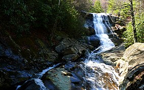
 Upper Creek Falls near the community of Linville in Pisgah National Forest | |
| Location | North Carolina, United States |
| Nearest city | Asheville, NC |
| Coordinates | 35°21′36″N 82°47′35″W / 35.36°N 82.793°W |
| Area | 512,758 acres (2,075.06 km2)[1] |
| Established | October 17, 1916[2] |
| Governing body | U.S. Forest Service |
| Website | Pisgah National Forest |
Pisgah National Forest is a National Forest in the Appalachian Mountains of western North Carolina. It is administered by the United States Forest Service, part of the United States Department of Agriculture. The Pisgah National Forest is completely contained within the state of North Carolina. The forest is managed together with the other three North Carolina National Forests (Croatan, Nantahala, and Uwharrie) from common headquarters in Asheville, North Carolina. There are local ranger district offices located in Pisgah Forest, Mars Hill, and Nebo.
Name
Pisgah (פִּסְגָּה) is a Biblical Hebrew word with several meanings: it can be used to describe someone’s best achievement; another meaning is the highest point of a mountain, “summit”. Some translators of the Bible book of Deuteronomy translated the word as a name of a mountain in general, usually referring to Mount Nebo.
History


The Pisgah National Forest was established in 1916, one of the first national forests in the eastern United States. The new preserve included approximately 86,700 acres (35,100 ha) that had been part of the Biltmore Estate, but were sold to the federal government in 1914 by Edith Vanderbilt. Some of the forest tracts were among the first purchases by the Forest Service under the Weeks Act of 1911. While national forests had already been created in the western United States, the Weeks Act provided the authority required to create national forests in the east as well.[3] Although tracts in the future Pisgah National Forest were among the first purchased under the Weeks Act, the very first to receive formal approval was the 31,000-acre (130 km2) Gennett Purchase in northern Georgia.[4] On March 25, 1921 Boone National Forest was added to Pisgah, and on July 10, 1936, most of Unaka National Forest was added. In 1954 the Pisgah National Forest was administratively combined with the Croatan and Nantahala national forests, collectively known as the National Forests of North Carolina.[5]
American forestry has roots in what is now the Pisgah National Forest. The Cradle of Forestry, (Biltmore Forest School), located in the southern part of the forest, was the site of the first school of forestry in the United States. It operated during the late 19th and early 20th centuries. The school was opened and operated at the direction of George Washington Vanderbilt II, builder of the Biltmore Estate in Asheville. The Forestry Education offered at Biltmore was taught by Carl Schenk. A native German, Schenk was referred to Vanderbilt when Gifford Pinchot resigned to operate the newly formed Division of Forestry. The Cradle of Forestry and the Biltmore Estate played a major role in the birth of the U.S. Forest Service. Today these lands are part of an educational and recreational area in Pisgah National Forest.[6]
Located on the forest property is the Bent Creek Campus of the Appalachian Forest Experiment Station, listed on the National Register of Historic Places in 1993.[7]
Administration
The Pisgah National Forest is divided into 3 Ranger Districts: the Grandfather, Appalachian, and Pisgah districts. The Grandfather and Appalachian Ranger Districts lie in the northern mountains of North Carolina and include areas such as the Linville Gorge Wilderness, Wilson Creek, the watersheds of the Toe and Cane rivers, Roan Mountain, Mount Mitchell, Craggy Gardens, and the Big Ivy/Coleman Boundary area. The Grandfather Ranger District office is located in Nebo. The Appalachian Ranger District stretches along the Tennessee border from the Great Smoky Mountains National Park north to Hot Springs, with the district office located in Mars Hill.[citation needed] The Appalachian Trail passes through this district, as well as the Cherokee National Forest in Tennessee. The Pisgah Ranger District lies mostly south of Asheville, in parts of Henderson, Transylvania and Haywood counties, with the district office located in Pisgah Forest.[8]
Geography

The Pisgah National Forest covers 512,758 acres (801 sq mi; 2,075 km2)[9] of mountainous terrain in the southern Appalachian Mountains, including parts of the Blue Ridge Mountains and Great Balsam Mountains. Elevations reach over 6,000 feet (1,800 m) and include some of the highest mountains in the eastern United States. Summit elevations include Black Balsam Knob at 6,214 feet (1,894 m), Mount Hardy at 6,110 feet (1,860 m), Tennant Mountain at 6,056 feet (1,846 m), and Cold Mountain at 6,030 feet (1,840 m).[10][11] Mount Mitchell, in Mount Mitchell State Park, is the highest mountain east of the Mississippi River and lies just outside the boundary of Pisgah National Forest.
The forest also includes tracts surrounding the city of Asheville, the city of Brevard and land in the French Broad River Valley. Recreation includes activities such as hiking, backpacking, and mountain biking. The land and its resources are also used for hunting, wildlife management, and timber harvesting, as well as the North Carolina Arboretum. The forest lies in parts of 12 counties in western North Carolina. In descending order they are Transylvania, McDowell, Haywood, Madison, Caldwell, Burke, Yancey, Buncombe, Avery, Mitchell, Henderson, and Watauga counties.
Forests and old growth
Some 46,600 acres (189 km2) of old-growth forests have been identified in the Pisgah National Forest, with 10,000 acres (4,000 ha) in Linville Gorge.[12]
Rivers and trails
Bent Creek, Mills River, and Davidson River - three major streams and tributaries of the French Broad River - are located in the Pisgah Ranger District, which lies on either side of the Blue Ridge Parkway south of Asheville, along the Pisgah Ridge and Balsam Mountains. Three long-distance recreational trails - the Mountains-to-Sea Trail, the Shut-In Trail, and the Art Loeb Trail travel through this district. Also included in the Pisgah Ranger District are the Shining Rock and Middle Prong Wildernesses. The Blue Ridge Parkway transects this National Forest, and many National Forest and Parkway trails intersect.[11]
Recreation
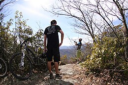
Pisgah National Forest is a popular place for many activities, such as hiking, backpacking, road biking, mountain biking, fishing, and rock climbing. Popular mountain biking trails include Sycamore Cove Trail, and Black Mountain Loop. Farlow Gap is an expert-level trail, and considered "one of the toughest mountain bike trails in Pisgah National Forest."[13]
Wilderness areas
There are three officially designated wilderness areas lying within Pisgah National Forest that are part of the National Wilderness Preservation System.
Gallery
- A waterfall which can be reached from Daniel Ridge Trail.
- View from Black Mountain Trail, with icicles in the foreground.
- Creek running across Farlow Gap trail.
- Sign at Farlow Gap trailhead (starting point of downhill bike trail).
See also
- List of national forests of the United States
- Cherokee National Forest, the corresponding USNF across the border in Tennessee
- DuPont State Forest (also popular in western North Carolina for hiking and mountain biking)
- List of mountains in North Carolina
- Appalachian temperate rainforest
- Killing of Judy Smith
References
- ^ "Land Areas of the National Forest System" (PDF). U.S. Forest Service. January 2012. Retrieved June 26, 2012.
- ^ "The National Forests of the United States" (PDF). ForestHistory.org. Retrieved July 26, 2012.
- ^ Page, Walter Hines; Page, Arthur Wilson (July 1914). "The March of Events: Pisgah A National Forest". The World's Work: A History of Our Time. XLIV (2): 260. Retrieved 2009-08-04.
The sale of the late George W. Vanderbilt's Pisgah Forest ... to the Government calls attention to the establishment of National Forests in the East which has been proceeding so quietly that few people realized that it was going on at all.
- ^ Davis, Donald Edwards (2000). Where There Are Mountains: An Environmental History of the Southern Appalachians. The University of Georgia Press. pp. 172–173. ISBN 0-8203-2494-9.
- ^ The National Forests of the United States, Forest History Society.
- ^ "Cradle of Forestry: History". cradleofforestry.com. Retrieved 29 July 2011.
- ^ "National Register Information System". National Register of Historic Places. National Park Service. July 9, 2010.
- ^ "Pisgah Ranger District". National Forests in North Carolina.
- ^ Forest facts 2007 Archived 2009-01-15 at the Wayback Machine, National Forest Service.
- ^ "Balsam Cone, North Carolina". Peakbagger.com. Retrieved 2007-07-09.
- ^ a b Trail Guide, South Pisgah Ranger District Including Bent Creek, 5th edition, Pisgah Map Company, 2014. ISBN 978-0-9770915-6-0.
- ^ Mary Byrd Davis (23 January 2008). "Old Growth in the East: A Survey. North Carolina" (PDF). Archived from the original (PDF) on February 17, 2012.
- ^ "Best trail guide for MTB in Pisgah Forest, let us be your guide Visit Brevard NC". brevardnc.com.
External links
- Pisgah National Forest
- Images from The Dawn of Private Forestry in America, Covering the Years 1895 to 1914, Forest History Society Library and Archives


