Massay
Massay | |
|---|---|
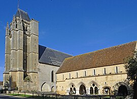
 The Abbey of Saint-Martin | |
| Coordinates: 47°09′17″N 1°59′36″E / 47.1547°N 1.9933°E | |
| Country | France |
| Region | Centre-Val de Loire |
| Department | Cher |
| Arrondissement | Vierzon |
| Canton | Mehun-sur-Yèvre |
| Intercommunality | CC Vierzon-Sologne-Berry |
| Government | |
| • Mayor (2020–2026) | Dominique Lévêque[1] |
Area 1 | 47.94 km2 (18.51 sq mi) |
| Population (2022)[2] | 1,347 |
| • Density | 28/km2 (73/sq mi) |
| Time zone | UTC+01:00 (CET) |
| • Summer (DST) | UTC+02:00 (CEST) |
| INSEE/Postal code | 18140 /18120 |
| Elevation | 99–164 m (325–538 ft) (avg. 123 m or 404 ft) |
| 1 French Land Register data, which excludes lakes, ponds, glaciers > 1 km2 (0.386 sq mi or 247 acres) and river estuaries. | |
Massay (French pronunciation: [masɛ]) is a commune in the Cher department in the Centre-Val de Loire region of France.
Geography
An area of farming and forestry, comprising the village and several hamlets, the commune is situated by the banks of the river Garreau some 8 miles (13 km) south of Vierzon, at the junction of the A20 and the D75 roads.
Transport
From Monday to Saturday there are a few buses to and from Vierzon.[3]
Population
| Year | Pop. | ±% |
|---|---|---|
| 1962 | 1,258 | — |
| 1968 | 1,324 | +5.2% |
| 1975 | 1,251 | −5.5% |
| 1982 | 1,339 | +7.0% |
| 1990 | 1,354 | +1.1% |
| 1999 | 1,335 | −1.4% |
| 2008 | 1,418 | +6.2% |
Sights
- The church of St. Paxent, dating from the twelfth century.
- The thirteenth-century abbey buildings (Salle capitulaire). See Simon-Jérôme Bourlet de Vauxcelles, abbot of Massay
- The twelfth-century chapel of Saint-Loup.
See also
References
- ^ "Répertoire national des élus: les maires". data.gouv.fr, Plateforme ouverte des données publiques françaises (in French). 2 December 2020.
- ^ "Populations de référence 2022" (in French). The National Institute of Statistics and Economic Studies. 19 December 2024.
- ^ http://www.lignes18.fr/PDF/fiches-horaires/235.pdf [bare URL PDF]


