Loreto Municipality, Baja California Sur
Loreto | |
|---|---|
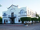
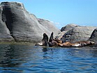
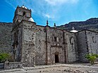
Top: Panoramic view of Sierra de la Giganta from Loreto Bay; Middle: Loreto, Coronado Island ;Bottom: Mission San Francisco Javier of Viggé-Biuandó, Mission Our Lady of Loreto Conchó | |
 Location of Loreto in Baja California Sur. | |
| Country | Mexico |
| State | Baja California Sur |
| Municipal seat and largest city | Loreto |
| Government | |
| • Mayor | Paola Margarita Cota Davis (PAN) |
| Area | |
• Total | 4,418.98 km2 (1,706.18 sq mi) |
| Population (2020) | |
• Total | 18,052 |
| • Density | 4.08/km2 (10.6/sq mi) |
| • Seat | 16,311 |
| Time zone | UTC−7 (Pacific (US Mountain)) |
| • Summer (DST) | UTC−6 (Pacific) |
Loreto (Spanish pronunciation: [loˈɾeto]) is a municipality in the Mexican state of Baja California Sur. It was created in 1992 from the partition of the neighboring Comondú Municipality. The municipal seat is in the town of Loreto, which was the former capital of Las Californias during Spanish colonial times.
The 2020 census reported a population of 18,052, about 94% of whom lived in the town of Loreto. The municipality has an area of 4,311 km2 (1,664 sq mi).
Demographics
As 2020, the city of Loreto with a population of 16,311 concentrates 94% of the municipal population. There are other 136 small communities, which the largest are Ligüí (248 hab.), Ensenada Blanca (227 hab.), Puerto Agua Verde (210 hab.), San Javier (155 hab.) and Nopoló (103 hab.).[1]
| Year | Pop. | ±% |
|---|---|---|
| 1995 | 9,986 | — |
| 2000 | 11,812 | +18.3% |
| 2005 | 11,839 | +0.2% |
| 2010 | 16,738 | +41.4% |
| 2015 | 18,912 | +13.0% |
| 2020 | 18,052 | −4.5% |
| [1] | ||
Sister cities
 Ventura, California (United States)[2]
See also
Alfredo Garcia Green, first municipal president of Loreto.
References
- ^ a b "CENSO Loreto 2020" (PDF).
- ^ Staff (March 30, 2015) "Ventura, Loreto discuss new sister city program during binational visit" Ventura County Star (subscription may be required for this article.)
External links
- Official Ayuntamiento de Loreto website (Municipality of Loreto)—(in Spanish)
- Enciclopedia de los Municipios de México: Baja California Sur—(in Spanish)
26°00′46″N 111°20′36″W / 26.01278°N 111.34333°W


