Lake Langano
| Lake Langano | |
|---|---|
 | |
 | |
| Coordinates | 7°36′N 38°43′E / 7.600°N 38.717°E |
| Basin countries | Ethiopia |
| Max. length | 18 km (11 mi) |
| Max. width | 16 km (9.9 mi) |
| Surface area | 230 km2 (89 sq mi) |
| Max. depth | 46 m (151 ft) |
| Surface elevation | 1,585 m (5,200 ft) |
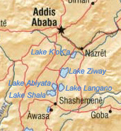
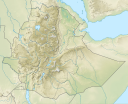
Lake Langano (Oromo: Hora Langaanoo, Amharic: ላንጋኖ ሐይቅ) is a lake in the Oromia Region of Ethiopia, exactly 200 kilometers by road south of the capital, Addis Ababa, on the border between the East Shewa Zone and Arsi Zones.[1] It is located to the east of Lake Abijatta in the Main Ethiopian Rift at an elevation of 1,585 meters.
Overview


According to figures published by the Central Statistical Agency, Lake Langano is 18 kilometers long and 16 km wide, with a surface area of 230 square kilometers and a maximum depth of 46 meters.[2] The lake's catchment area is 1,600 square kilometers in size, and is drained by the Hora Kallo river which empties into the adjacent Lake Abijatta.[3]
As it is free of Bilharzia (schistosomiasis), unlike all other freshwater lakes in Ethiopia, Lake Langano is popular with tourists and city-dwellers. The lake is brown in colour and at first sight one may think that the lake is not clean. However this is not the case, the reason for the colour is due to the richness of minerals including high sulphur levels which have led many to believe that the lake water has healing properties. There are a number of resorts around the lake and water sports are popular. There is a variety of wildlife around the lake, which include hippos (rare), monkeys, baboons, warthogs, and a huge variety of birds. The area around the lake is largely deforested, however, and a large number of herders live around the area.
Two earthquakes had their epicenter near this lake, the first in 1906 (a magnitude 6.8 on the Richter scale), and the second in 1985 (magnitude 6.2).[4] After the earthquake of 1906 there formed a 25–30 m tall geyser on Edo Laki Island on the northern part of the lake. The geyser disappeared circa 1966 – 1970, leaving a hot spring.
Climate
| Climate data for Lake Langano, elevation 1,600 m (5,200 ft), (1971–2000) | |||||||||||||
|---|---|---|---|---|---|---|---|---|---|---|---|---|---|
| Month | Jan | Feb | Mar | Apr | May | Jun | Jul | Aug | Sep | Oct | Nov | Dec | Year |
| Mean daily maximum °C (°F) | 26.4 (79.5) |
27.3 (81.1) |
28.5 (83.3) |
28.7 (83.7) |
27.2 (81.0) |
26.6 (79.9) |
24.6 (76.3) |
25.7 (78.3) |
26.0 (78.8) |
26.5 (79.7) |
26.3 (79.3) |
25.9 (78.6) |
26.6 (80.0) |
| Mean daily minimum °C (°F) | 13.6 (56.5) |
12.5 (54.5) |
13.1 (55.6) |
14.8 (58.6) |
15.1 (59.2) |
14.8 (58.6) |
14.5 (58.1) |
14.5 (58.1) |
14.2 (57.6) |
12.6 (54.7) |
11.2 (52.2) |
10.7 (51.3) |
13.5 (56.3) |
| Average precipitation mm (inches) | 25.0 (0.98) |
12.0 (0.47) |
35.0 (1.38) |
26.0 (1.02) |
53.0 (2.09) |
87.0 (3.43) |
113.0 (4.45) |
75.0 (2.95) |
58.0 (2.28) |
13.0 (0.51) |
8.0 (0.31) |
5.0 (0.20) |
510 (20.07) |
| Average relative humidity (%) | 50 | 48 | 50 | 58 | 62 | 64 | 68 | 67 | 68 | 65 | 60 | 54 | 60 |
| Source: FAO[5] | |||||||||||||
See also
Notes
- ^ Neumann, "From the Somali Coast through Southern Ethiopia to the Sudan", Geographical Journal, 20 (October 1902), pp. 373–398
- ^ CSA 2005 National Statistics Archived 2008-07-31 at the Wayback Machine, Table A.2
- ^ Robert Mepham, R. H. Hughes, and J. S. Hughes, A directory of African wetlands, (Cambridge: IUCN, UNEP and WCMC, 1992), p. 159
- ^ "Earthquake Risks in Addis Ababa and other Major Ethiopian Cities – Will the Country be Caught Off-guarded?" Archived 2010-02-25 at the Wayback Machine by Dr. Samuel Kinde, published March 2002 (accessed 4 June 2008)
- ^ "CLIMWAT climatic database". Food and Agriculture Organization of United Nations. Retrieved 23 June 2024.

