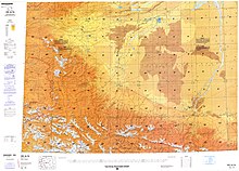
Kezi River
| Kezi River Kirzl River Kirzlesu River | |
|---|---|
 | |
| Native name | |
| Location | |
| Country | People's Republic of China |
| Physical characteristics | |
| Length | 900 kilometers (within China) |
The Kezi River (Chinese: 克孜河), also marked as Kirzl River (克孜勒河) and Kirzlesu River (克孜勒苏河) on the map of People's Republic of China, is a river in Xinjiang Uygur Autonomous Region[4] of China, located in Kizilsu Kyrgyz Autonomous Prefecture.[5]


Kezi River originates from the Gora Kurumdy (Kurumdy I Summit) in Kyrgyzstan-Tajikistan border and enters Wuqia County in Xinjiang through the border at Simukhana Pass (斯木哈纳山口), which is the boundary between the Tianshan and Kunlun Mountains.[6] The river flows 900 kilometers within China,[7] with a drainage area of 15,100 square kilometers.
Kezi River is the largest river in the Kashgar water system.[8] In China, the river flows from west to east through Wuqia County, Kizilsu Kyrgyz Autonomous Prefecture, Shufu County, Shule County, Kashgar City, Jiashi City, and Bachu County in Kashgar Prefecture,[9] and finally meets the Yarkant River and joins the Tarim River basin.[10]
The Kashi segment (Xinjiang) of Kezi River was badly polluted.[11] In 2016, the control unit in the Kashgar Prefecture of the Kezi River was upgraded from worse than Grade V to Grade V.[12]
References
- ^ "Changing characteristics of land use/cover and landscape pattern from 1990 to 2010 in the Kaxgar River basin, Xinjiang" (PDF). National Natural Science Foundation of China. 2014-12-13.
- ^ "Schematic diagram of the earthquake zone in Bachu, Jiashi, Xinjiang". Xinhua News Agency. 2003-02-24. Archived from the original on June 27, 2003.
- ^ "Kizilsu Kyrgyz Autonomous Prefecture of Xinjiang". State Ethnic Affairs Commission. 2004-07-13.
- ^ "Soil and Water Loss Situation and Countermeasures in Downstream Area of Kezi River in Kaxgar River Basin of Xinjiang Wei Autonomous Region". August 13, 2004. S2CID 132615390.
{{cite journal}}: Cite journal requires|journal=(help) - ^ "The song of happiness sings on the Pamir Mountains". Xinhua News Agency. Mar 5, 2006. Archived from the original on 2020-10-02.
- ^ Karakoram: Physical Geography of the Kunlun Mountains Region. China Science Publishing & Media. 1999. ISBN 978-7-03-006933-7.
- ^ "Kashgar pomegranate". Ministry of Commerce. Retrieved Oct 2, 2020.
- ^ "100,000 artificially propagated fish fry released into the Kezi River". Sina News. Oct 23, 2018.
- ^ Encyclopedia of China. Encyclopedia of China Publishing House. 1999. ISBN 9787500062127.
- ^ Guan Shouxin; Liang Junyan; Zhang Wenya (2001). History of Kashgar Scenery. Yunnan People's Publishing House. ISBN 978-7-222-03202-6.
- ^ "Report on the State of the Environment in China 2013" (PDF). Ministry of Ecology and Environment. 2016-06-21.
- ^ "The 13th Five-Year Plan for the Protection of Ecological Environment" (PDF). Ministry of Ecology and Environment. 2017-06-23.
