Kansanga
Kansanga is a neighborhood in Kampala, the capital and largest city of Uganda.[1]
Location
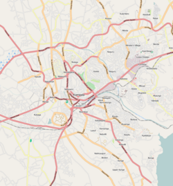
Kansanga is bordered by Kabalagala and Kisugu to the north, Muyenga to the north-east, Kiwafu to the east, Bbunga to the south-east, Konge to the south, Lukuli to the south-west, Kibuye to the west, and Nsambya to the north-west.[1] The road distance between Kampala's central business district and Kansanga is approximately 7 kilometres (4 mi).[2] The coordinates of Kansanga are 0°17'14.0"N, 32°36'28.0"E (Latitude:0.287225; Longitude:32.607778).[3]
Overview
During the 1950s and 1960s, Kansanga was primarily a middle-class residential neighborhood. During the 1990s, the neighborhood transformed into an upscale residential area and began to accommodate corporate entities like Kampala International University and the International University of East Africa. The area is cosmopolitan, with Internet cafes, residential apartments, upscale residential estates, and, as one proceeds north along the Ggaba Road, Kansanga merges into Kabalagala, with its restaurants, bars, and nightclubs.[4]
Points of interest
The points of interest within or near Kansanga include:[1][3] (a) the Main Campus of Kampala International University, a private university[5] (b) Kansanga Miracle Center, a place of worship, affiliated with the Pentecostal Movement[6] (c) Our Lady of Mount Carmel Catholic Church (d) Kivebulaaya Protestant Church (e) Kansanga Islamic Mosque (f) Rainbow International School and (g) the main campus of International University of East Africa, another private university.[7]
See also
References
- ^ a b c "Map Showing Kansanga's Location And Boundaries" (Map). Google Maps. Retrieved 2 August 2021.
- ^ "Road Distance Between Nakasero, Kampala Central Division And Kansanga, Makindye Division, Kampala, Uganda" (Map). Google Maps. Retrieved 2 August 2021.
- ^ a b "Location of Kansanga, Makindye Division, Kampala, Uganda" (Map). Google Maps. Retrieved 2 August 2021.
- ^ Baranga, Samson (25 April 2016). "Uganda: When Open-Air Club Arrived in Kansanga". The Observer (Uganda) via AllAfrica.com. Kampala. Retrieved 26 April 2016.
- ^ 4Icu.Org (August 2021). "Kampala International University: University Overview". 4Icu.Org. Sydney, New South Wales, Australia. Retrieved 2 August 2021.
{{cite web}}: CS1 maint: numeric names: authors list (link) - ^ "Location of Kansanga Miracle Centre, Kansanga, Kampala, Uganda" (Map). Google Maps. Retrieved 2 August 2021.
- ^ "Location of International University of East Africa, Kansanga, Kampala, Uganda" (Map). Google Maps. Retrieved 2 August 2021.


