
File:RoanokeRiverWatershed.png

Size of this preview: 681 × 600 pixels. Other resolutions: 272 × 240 pixels | 545 × 480 pixels | 765 × 674 pixels.
Original file (765 × 674 pixels, file size: 48 KB, MIME type: image/png)
Summary
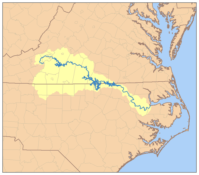
| Description | This is a map of the Roanoke River watershed. I, Pfly, made it, based on USGS data. |
| Date | |
| Source | Own work |
| Author | Pfly |
| Permission (Reusing this file) |
I, the copyright holder of this work, hereby publish it under the following license: This file is licensed under the Creative Commons Attribution-Share Alike 2.5 Generic license.
|
File history
Click on a date/time to view the file as it appeared at that time.
| Date/Time | Thumbnail | Dimensions | User | Comment | |
|---|---|---|---|---|---|
| current | 08:15, 5 January 2007 | | 765 × 674 (48 KB) | Pfly | {{Information |Description=This is a map of the Cumberland River watershed. I, Pfly, made it, based on USGS data. |Source=Own work. |Date=January 4, 2007 |Author=Pfly |Permission= |other_versions= }} |
File usage
The following 2 pages use this file:
Global file usage
The following other wikis use this file:
- Usage on azb.wikipedia.org
- Usage on bg.wikipedia.org
- Usage on cs.wikipedia.org
- Usage on da.wikipedia.org
- Usage on de.wikipedia.org
- Usage on es.wikipedia.org
- Usage on fr.wikipedia.org
- Usage on ky.wikipedia.org
- Usage on nl.wikipedia.org
- Usage on no.wikipedia.org
- Usage on pl.wikipedia.org
- Usage on pms.wikipedia.org
- Usage on pt.wikipedia.org
- Usage on ru.wikipedia.org
- Usage on uk.wikipedia.org
- Usage on www.wikidata.org
- Usage on xmf.wikipedia.org
- Usage on zh.wikipedia.org