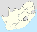
File:Map of South Africa with provincial borders.svg

Size of this PNG preview of this SVG file: 684 × 599 pixels. Other resolutions: 274 × 240 pixels | 548 × 480 pixels | 876 × 768 pixels | 1,168 × 1,024 pixels | 2,337 × 2,048 pixels | 809 × 709 pixels.
Original file (SVG file, nominally 809 × 709 pixels, file size: 462 KB)
File history
Click on a date/time to view the file as it appeared at that time.
| Date/Time | Thumbnail | Dimensions | User | Comment | |
|---|---|---|---|---|---|
| current | 20:44, 22 April 2011 |  | 809 × 709 (462 KB) | Htonl | tweak |
| 20:21, 22 April 2011 |  | 809 × 709 (462 KB) | Htonl | size tweak | |
| 22:52, 29 November 2010 |  | 757 × 660 (337 KB) | Htonl | style | |
| 18:48, 6 October 2010 |  | 1,071 × 934 (399 KB) | Htonl | tweak | |
| 18:39, 6 October 2010 |  | 1,071 × 934 (399 KB) | Htonl | styling | |
| 13:34, 5 October 2010 |  | 1,071 × 934 (278 KB) | Htonl | tweak | |
| 06:14, 5 October 2010 |  | 1,071 × 934 (438 KB) | Htonl | {{Information |Description={{en|1=Blank map of South Africa, divided into provinces. Provincial boundaries as of 2009, including the border changes by the 12th, 13th and 16th constitutional amendments. Projection: Lambert Conformal Conic with standard par |
File usage
The following 47 pages use this file:
- Alan Winde
- Bushy Maape
- Demographics of South Africa
- Districts of South Africa
- Helen Zille
- ISO 3166-2:ZA
- Lazarus Mokgosi
- List of South African provinces by GDP
- List of South African provinces by Human Development Index
- List of South African provinces by area
- List of South African provinces by fertility rate
- List of South African provinces by gross domestic product per capita
- List of South African provinces by highest point
- List of South African provinces by life expectancy
- List of South African provinces by population
- List of South African provinces by population density
- List of South African provinces by poverty rate
- List of South African provincial capitals
- List of administrators of former South African provinces
- List of municipalities in South Africa
- Mandla Ndlovu
- Maqueen Letsoha-Mathae
- Nomusa Dube-Ncube
- Noxolo Kiviet
- Oscar Mabuyane
- Panyaza Lesufi
- Phophi Ramathuba
- Premier (South Africa)
- Premier of Gauteng
- Premier of KwaZulu-Natal
- Premier of Limpopo
- Premier of Mpumalanga
- Premier of North West
- Premier of the Eastern Cape
- Premier of the Free State
- Premier of the Northern Cape
- Premier of the Western Cape
- Provinces of South Africa
- Provincial legislature (South Africa)
- Sisi Ntombela
- Stan Mathabatha
- Vehicle registration plates of South Africa
- Zamani Saul
- User:Shakescene/S. Africa
- Template:Labelled Map of South Africa Provinces
- Template:Lists of the provinces of South Africa
- Template:South Africa premiers
Global file usage
The following other wikis use this file:
- Usage on af.wikipedia.org
- Usage on ast.wikipedia.org
- Usage on es.wikipedia.org
- Usage on eu.wikipedia.org
- Usage on fa.wikipedia.org
- Usage on ka.wikipedia.org
- Usage on la.wikipedia.org
- Usage on ml.wikipedia.org
- Usage on mr.wikipedia.org
- Usage on pa.wikipedia.org
- Usage on pt.wikipedia.org
- Usage on ru.wikipedia.org
- Usage on simple.wikipedia.org
- Usage on sr.wikipedia.org
- Usage on sw.wikipedia.org
- Usage on ta.wikipedia.org
- Usage on tn.wikipedia.org
- Usage on tr.wikipedia.org
- Usage on uk.wikipedia.org
- Usage on ur.wikipedia.org
View more global usage of this file.

