
File:Map.Daian-Town.Mie.PNG
Map.Daian-Town.Mie.PNG (206 × 277 pixels, file size: 6 KB, MIME type: image/png)
Summary
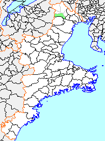
| Description | English: Map of Daian, Mie, Japan. |
||
| Date | |||
| Source |
Originally from ja:File:Map.Daian-Town.Mie.PNG |
||
| Author | Knua | ||
| Permission (Reusing this file) |
|
Licensing

|
Permission is granted to copy, distribute and/or modify this document under the terms of the GNU Free Documentation License, Version 1.2 or any later version published by the Free Software Foundation; with no Invariant Sections, no Front-Cover Texts, and no Back-Cover Texts. A copy of the license is included in the section entitled GNU Free Documentation License. |
- You are free:
- to share – to copy, distribute and transmit the work
- to remix – to adapt the work
- Under the following conditions:
- attribution – You must give appropriate credit, provide a link to the license, and indicate if changes were made. You may do so in any reasonable manner, but not in any way that suggests the licensor endorses you or your use.
- share alike – If you remix, transform, or build upon the material, you must distribute your contributions under the same or compatible license as the original.
Original upload log
| This file was moved from Japanese Wikipedia.
See below for original file information. | ||||||||||||||||||||||||||||
| ||||||||||||||||||||||||||||
|
| ||||||||||||||||||||||||||||
File history
Click on a date/time to view the file as it appeared at that time.
| Date/Time | Thumbnail | Dimensions | User | Comment | |
|---|---|---|---|---|---|
| current | 05:01, 15 November 2009 | | 206 × 277 (6 KB) | Knua | == Summary == {{Information |Description={{Ja|三重県に以前存在したja:大安町の位置画像。<br />2003年12月1日にja:北勢町、ja:員弁町、ja:藤原町 (三重県)と合併し、ja:いなべ市を新設� |
File usage
The following page uses this file:
Global file usage
The following other wikis use this file: