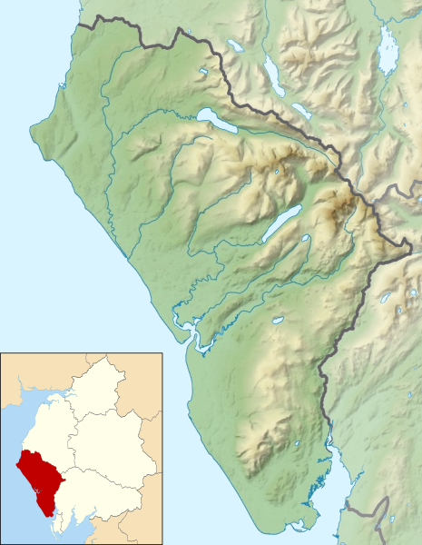
File:Location relief map Borough of Copeland.svg

Size of this PNG preview of this SVG file: 465 × 600 pixels. Other resolutions: 186 × 240 pixels | 372 × 480 pixels | 596 × 768 pixels | 794 × 1,024 pixels | 1,588 × 2,048 pixels | 1,044 × 1,346 pixels.
Original file (SVG file, nominally 1,044 × 1,346 pixels, file size: 651 KB)
File history
Click on a date/time to view the file as it appeared at that time.
| Date/Time | Thumbnail | Dimensions | User | Comment | |
|---|---|---|---|---|---|
| current | 13:00, 29 January 2021 |  | 1,044 × 1,346 (651 KB) | Dr Greg | Uploaded a work by * Cumbria UK relief location map.jpg: Nilfanion, created using Ordnance Survey data * Copeland UK ward map 2010 (blank).svg: Nilfanion, created using Ordnance Survey data * derivative work: Dr Greg from {{Derived from|Cumbria UK relief location map.jpg|Copeland UK ward map 2010 (blank).svg|display=50}} with UploadWizard |
File usage
The following 54 pages use this file:
- Black Combe
- Blake Fell
- Blea Tarn (Eskdale)
- Bowfell
- Brandreth
- Buckbarrow
- Burnbank Fell
- Burnmoor Tarn
- Caw Fell
- Cogra Moss
- Cold Pike
- Crag Fell
- Crinkle Crags
- Devoke Water
- Ennerdale Water
- Esk Pike
- Foxes Tarn
- Gavel Fell
- Great Borne
- Great End
- Great Gable
- Green Crag
- Green Gable
- Grike (Lake District)
- Hard Knott
- Harter Fell (Eskdale)
- Haycock (Lake District)
- Haystacks (Lake District)
- High Crag
- High Stile
- Illgill Head
- Innominate Tarn
- Kirk Fell
- Lank Rigg
- Lingmell
- Middle Fell
- Pike o' Blisco
- Pillar (Lake District)
- Ravenglass and Eskdale Railway
- Red Pike (Buttermere)
- Red Pike (Wasdale)
- Scafell
- Scafell Pike
- Scoat Fell
- Seatallan
- Slight Side
- St Bees Head
- Starling Dodd
- Steeple (Lake District)
- Wast Water
- Whin Rigg
- Yewbarrow
- Module:Location map/data/United Kingdom Copeland
- Module:Location map/data/United Kingdom Copeland/doc
Global file usage
The following other wikis use this file:
- Usage on si.wikipedia.org
- Usage on uz.wikipedia.org


