
File:Georgia 30.svg

Size of this PNG preview of this SVG file: 600 × 600 pixels. Other resolutions: 240 × 240 pixels | 480 × 480 pixels | 768 × 768 pixels | 1,024 × 1,024 pixels | 2,048 × 2,048 pixels.
Original file (SVG file, nominally 600 × 600 pixels, file size: 6 KB)
Summary
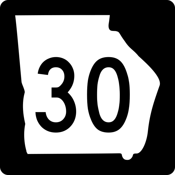
| Description | Georgia state route marker. Signs use FHWA type D or type C font. |
| Date | |
| Source | http://www.dot.ga.gov/PartnerSmart/DesignManuals/smguide/GDOT%20SIGNING%20AND%20MARKING%20DESIGN%20GUIDELINES.pdf and approximated from photos |
| Author | Fredddie, originally created by Pedriana |
Licensing
This file is in the public domain because it is prescribed by the Georgia Supplement to the Manual on Uniform Traffic Control Devices, sign number M1-5. The Georgia Supplement states on page 1-3 that "[MUTCD 2009 edition is the] latest edition adopted by GDOT. This document shall govern those aspects of the application of all signs, signals, and pavement markings". The federal MUTCD states specifically on page I-1 that:
No provisions of the supplement supersede this provision of the MUTCD. |
File history
Click on a date/time to view the file as it appeared at that time.
| Date/Time | Thumbnail | Dimensions | User | Comment | |
|---|---|---|---|---|---|
| current | 15:32, 3 June 2010 | | 600 × 600 (6 KB) | Fredddie | |
| 19:56, 18 May 2006 |  | 500 × 500 (10 KB) | Pedriana~commonswiki | changed font from Series D to Series C to reflect actual use in the field | |
| 15:25, 16 April 2006 |  | 500 × 500 (10 KB) | Pedriana~commonswiki | Georgia State Route 30 shield, 24 inches square. Based on [http://www.dot.state.ga.us/operations/traffic-safety-design/Documents/PDF/3.%20Non-Interstate%20Signing%20and%20Marking%20Design%20Guidelines.pdf GDOT's Non-Interstate Signing and Marking Design G |
File usage
The following 93 pages use this file:
- Alapaha River
- Bryan County, Georgia
- Business routes of Interstate 75
- Chatham County, Georgia
- Columbus–Auburn–Opelika combined statistical area
- Cordele, Georgia
- Crisp County, Georgia
- Dodge County, Georgia
- Effingham County, Georgia
- Evans County, Georgia
- Georgia State Route 11
- Georgia State Route 112
- Georgia State Route 117
- Georgia State Route 118
- Georgia State Route 119
- Georgia State Route 121
- Georgia State Route 126
- Georgia State Route 129
- Georgia State Route 130
- Georgia State Route 135
- Georgia State Route 147
- Georgia State Route 149
- Georgia State Route 15
- Georgia State Route 153
- Georgia State Route 159
- Georgia State Route 165
- Georgia State Route 169
- Georgia State Route 17
- Georgia State Route 19
- Georgia State Route 195
- Georgia State Route 204
- Georgia State Route 21
- Georgia State Route 215
- Georgia State Route 23
- Georgia State Route 233
- Georgia State Route 25
- Georgia State Route 26
- Georgia State Route 27
- Georgia State Route 29
- Georgia State Route 292
- Georgia State Route 3
- Georgia State Route 30
- Georgia State Route 300
- Georgia State Route 31
- Georgia State Route 377
- Georgia State Route 4
- Georgia State Route 41
- Georgia State Route 49
- Georgia State Route 56
- Georgia State Route 57
- Georgia State Route 67
- Georgia State Route 7
- Georgia State Route 73
- Georgia State Route 86
- Georgia State Route 87
- Georgia State Route 90
- Interstate 16
- Interstate 75 in Georgia
- Interstate 95 in Georgia
- Jimmy DeLoach Parkway
- List of former state routes in Georgia (1–199)
- List of highways numbered 30
- List of state routes in Georgia
- Marion County, Georgia
- Montgomery County, Georgia
- Mount Vernon, Georgia
- Savannah River Parkway
- Sumter County, Georgia
- Tattnall County, Georgia
- Telfair County, Georgia
- Toombs County, Georgia
- U.S. Route 129 in Georgia
- U.S. Route 19 in Georgia
- U.S. Route 1 in Georgia
- U.S. Route 221 in Georgia
- U.S. Route 23 in Georgia
- U.S. Route 25 in Georgia
- U.S. Route 280
- U.S. Route 301 in Georgia
- U.S. Route 319
- U.S. Route 41 in Georgia
- U.S. Route 441 in Georgia
- U.S. Route 80 in Georgia
- Waycross Air Line Railroad
- Wheeler County, Georgia
- Wilcox County, Georgia
- User:Chris 886
- User:GeorgiaStateRoute702
- User:Morriswa/Clinched highways/State highways
- User:Morriswa/Clinched highways/U.S. highways
- User talk:JohnnyReb1977
- Wikipedia:WikiProject U.S. Roads/Redirects/Georgia
- Template:Fitzgerald Subdivision
Global file usage
The following other wikis use this file:
- Usage on es.wikipedia.org
- Usage on fa.wikipedia.org
- Usage on fr.wikipedia.org
- Usage on gl.wikipedia.org
- Usage on ja.wikipedia.org
- Usage on nl.wikipedia.org
- Usage on pt.wikipedia.org
- Usage on simple.wikipedia.org
- Usage on vi.wikipedia.org
- Usage on zh-min-nan.wikipedia.org