
File:20130805 Barra Strait and Grand Narrows Bridges.jpg

Size of this preview: 800 × 533 pixels. Other resolutions: 320 × 213 pixels | 640 × 427 pixels | 1,024 × 683 pixels | 1,280 × 853 pixels | 2,560 × 1,707 pixels | 3,888 × 2,592 pixels.
Original file (3,888 × 2,592 pixels, file size: 4.42 MB, MIME type: image/jpeg)
Summary
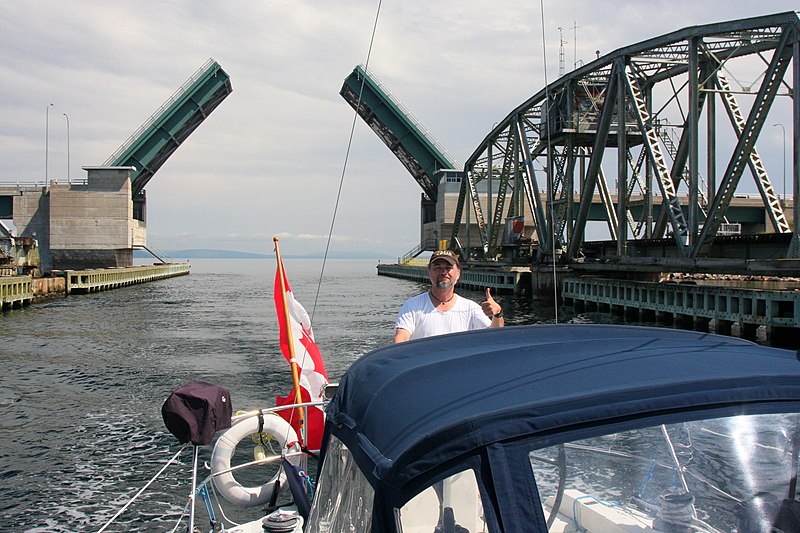
| Description | English: The Barra Strait Bridge is a Canadian road bridge, and the Grand Narrows Bridge is a Canadian railway bridge, both side by side, crossing between Victoria County, Nova Scotia, and Cape Breton County. At 516.33 m (1,694 ft), Grand Narrows is the longest railroad bridge in the province. The rail bridge incorporates a swing span, and the road bridge a double leaf bascule, both inline at their eastern end to permit the continued passage of marine traffic through the strait. |
| Date | |
| Source | Own work |
| Author | Ken Heaton |
| Camera location | | View this and other nearby images on: OpenStreetMap |
|---|
Licensing
I, the copyright holder of this work, hereby publish it under the following license:
This file is licensed under the Creative Commons Attribution-Share Alike 4.0 International license.
- You are free:
- to share – to copy, distribute and transmit the work
- to remix – to adapt the work
- Under the following conditions:
- attribution – You must give appropriate credit, provide a link to the license, and indicate if changes were made. You may do so in any reasonable manner, but not in any way that suggests the licensor endorses you or your use.
- share alike – If you remix, transform, or build upon the material, you must distribute your contributions under the same or compatible license as the original.
File history
Click on a date/time to view the file as it appeared at that time.
| Date/Time | Thumbnail | Dimensions | User | Comment | |
|---|---|---|---|---|---|
| current | 02:54, 16 July 2020 | | 3,888 × 2,592 (4.42 MB) | Ken Heaton | Uploaded own work with UploadWizard |
File usage
The following page uses this file: