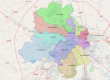
West Delhi district
West Delhi | |
|---|---|
| Coordinates: 28°39′39″N 77°06′03″E / 28.6608°N 77.1008°E | |
| Country | |
| State | Delhi |
| Headquarters | Rajouri Garden |
| Government | |
| • Body | Municipal Corporation of Delhi |
| • Member of Parliament | Kamaljeet Sehrawat |
| Area | |
• Total | 129 km2 (50 sq mi) |
| Elevation | 219 m (719 ft) |
| Population (2011) | |
• Total | 2,543,243 |
| • Density | 20,000/km2 (51,000/sq mi) |
| Languages | |
| • Official | Punjabi, Hindi |
| Time zone | UTC+5:30 (IST) |
| PIN | 1100xx[1] |
| Lok Sabha constituency | West Delhi |
| Website | dcwestrev |
West Delhi is one of the 11 administrative districts of the National Capital Territory of Delhi in India. Administratively, the district is divided into three subdivisions, Patel Nagar, Rajouri Garden and Punjabi Bagh.

West Delhi is bound by the districts of North West Delhi to the north, North Delhi and Central Delhi to the east, South West Delhi to the south, and Jhajjar District of Haryana state to the west. Major residential and commercial areas of Delhi like Janakpuri, Uttam Nagar and Tilak Nagar are located in West Delhi.
West Delhi has an area of 129 km2, with a population density of nearly 14,000 persons per km2. The population of 2,543,243 consists of 1,356,240 males and 1,187,003 females. Children between 0–6 years are 203,528 consisting of 109,526 boys and 94,002 girls. The literacy rate is above 70% at a total of 1,301,252 of which 739,572 are males and 561,680 females.[2]
Demographics
According to the 2011 census West Delhi has a population of 2,543,243,[3] roughly equal to the nation of Kuwait[4] or the US state of Nevada.[5] This gives it a ranking of 169th in India (out of a total of 640).[3] The district has a population density of 19,625 inhabitants per square kilometre (50,830/sq mi) .[3] Its population growth rate over the decade 2001-2011 was 18.91%.[3] West Delhi has a sex ratio of 876 females for every 1000 males,[3] and a literacy rate of 87.12%. 2,536,823 (99.75%) of the population lives in urban areas. Scheduled Castes make up 14.80% of the population.[3]
At the time of the 2011 census, 75.46% of the population spoke Hindi, 14.52% Punjabi, 1.66% Bhojpuri 1.32% Urdu and 1.06% Rajasthani as their first language.[7]
See also
- Districts of Delhi
- Bali Nagar
- Meera Bagh
- Najafgarh
- Indira Gandhi International Airport
- Ashok Nagar (Delhi)
- Tilak Nagar
- Janakpuri
- Vikaspuri
- Paschim Vihar
- Punjabi Bagh
- NANGLOI
- Rajouri Garden
- Mayapuri
- Chander Vihar
- Patel Nagar
- Dwarka
- Dashrath puri
- South Delhi
- Hari Nagar
- Subhash Nagar
- Uttam Nagar
- Shadipur Depot (Baljit Nagar, Kathputli Colony)
- Naraina Ind. Area
- Kirti Nagar
- Saraswati Garden
- Mansarover Garden
References
- ^ (West Delhi)
- ^ (Source : Census Of India 2001)
- ^ a b c d e f "District Census Handbook: NCT Delhi" (PDF). censusindia.gov.in. Registrar General and Census Commissioner of India. 2011.
- ^ US Directorate of Intelligence. "Country Comparison:Population". Archived from the original on 13 June 2007. Retrieved 1 October 2011.
Kuwait 2,595,62
- ^ "2010 Resident Population Data". U. S. Census Bureau. Retrieved 30 September 2011.
Nevada 2,700,551
- ^ "Table C-01 Population by Religion: NCT Delhi". censusindia.gov.in. Registrar General and Census Commissioner of India. 2011.
- ^ a b "Table C-16 Population by Mother Tongue: NCT Delhi". www.censusindia.gov.in. Registrar General and Census Commissioner of India.
External links
- West Delhi District – official website

