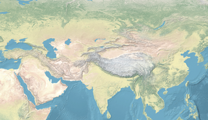
Template:South Asia in 800 CE
The example shown below is for the following, structurally similar, template: {{Continental Asia in 200 BCE}}.
Usage
{{Continental Asia in 200 BCE}}{{Continental Asia in 200 BCE|Parameter 1|Parameter 2|Parameter 3|Parameter 4|Parameter 5}}
Other templates of the same family (Continental Asia in 200 BCE, Continental Asia in 400 CE, Continental Asia in 1000 CE, South Asia in 600 CE etc...) follow the same format:
Parameters
Use with the following format in Wikipedia articles (all parameters are optional):
|1=: defines the position of the map on a page:|1=center,|1=left,|1=right|2=defines an alternative caption for the map, for example:|2=Asian polities in 500 BCE|3=defines additional objects to place on the map, for example:- A text with hyperlink:
{{Annotation|227|50|<span class="mw-no-invert" style="color:#4F311CFF">''City of Heaven''</span>|text-aligns=center|font-weights=bold|font-styles=normal|font-sizes=6|colors=#000000}} - A rectangle:
{{Annotation|175|134|[[File:Long Rectangle (plain).png|40px]]}} - A date mask:
{{Annotation|0|0|[[File:Continental Asia date mask.png|300px]]}} - An object defined through geographic coordinates
{{location map~|Continental Asia|lat=37.164722|N|long=69.408611|E|label=|position=|label_size=|mark=Basic red dot.png|marksize=4}}
- A text with hyperlink:
|4=defines an alternative background map, which has to have the same size as the original.|5=if set to|5=none, will remove the border of the map, for use in infoboxes for example.
Example
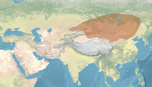
The basic map would simply require the code {{Continental Asia in 200 BCE}}, but the code for the same map with an alignement to the right, with a different caption, with an added rectangle for "YUEZHI" and a geo-located dot for the city of Ai-Khanoum, with a specially-made map overlay showing Xiongnu territory (this map), and without a border, looks like:
{{Continental Asia in 200 BCE
|right
|The [[Yuezhi]], with [[Xiongnu]] territory and main polities of Asia in 200 BCE
|{{Annotation|185|70|[[File:Long Rectangle (plain).png|35px]]}} {{location map~ |Continental Asia |lat=37.164722|N |long=69.408611|E |label=|position=|label_size=|mark=Basic red dot.png|marksize=4}}
|Map of the Xiongnu, circa 150 BCE.png
|none
}}
References
- ^ Schwartzberg, Joseph E. (1978). A Historical atlas of South Asia. Chicago: University of Chicago Press. p. 145, map XIV.1 (e). ISBN 0226742210.
- ^ O'Brien, Patrick K.; et al., eds. (2007) [2002]. Concise Atlas of World History (Revised ed.). Oxford University Press. p. 51. ISBN 978-0-19-521921-0.
- ^ Fauve, Jeroen (2021). The European Handbook of Central Asian Studies. Ibidem Press. p. 403. ISBN 978-3-8382-1518-1.
- ^ Haywood, John (1997). Atlas of World History. New York: Barnes & Noble Books. p. Map 24. ISBN 978-0-7607-0687-9.
- ^ Török, Tibor (July 2023). "Integrating Linguistic, Archaeological and Genetic Perspectives Unfold the Origin of Ugrians". Genes. 14 (7): Figure 1. doi:10.3390/genes14071345. ISSN 2073-4425. PMC 10379071. PMID 37510249.


