Těškov
Těškov | |
|---|---|
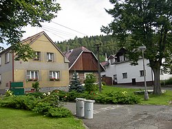
 Centre of Těškov | |
| Coordinates: 49°48′8″N 13°41′53″E / 49.80222°N 13.69806°E | |
| Country | |
| Region | Plzeň |
| District | Rokycany |
| First mentioned | 1343 |
| Area | |
• Total | 14.17 km2 (5.47 sq mi) |
| Elevation | 500 m (1,600 ft) |
| Population (2024-01-01)[1] | |
• Total | 320 |
| • Density | 23/km2 (58/sq mi) |
| Time zone | UTC+1 (CET) |
| • Summer (DST) | UTC+2 (CEST) |
| Postal code | 337 01 |
| Website | www |
Těškov is a municipality and village in Rokycany District in the Plzeň Region of the Czech Republic. It has about 300 inhabitants.
Geography
Těškov is located about 10 kilometres (6 mi) northeast of Rokycany and 22 km (14 mi) northeast of Plzeň. It lies in the Křivoklát Highlands. The highest point is the Hrad hill at 680 m (2,230 ft) above sea level.
History
The first written mention of Těškov is from 1343.[2]
Demographics
|
|
| ||||||||||||||||||||||||||||||||||||||||||||||||||||||
| Source: Censuses[3][4] | ||||||||||||||||||||||||||||||||||||||||||||||||||||||||
Transport
There are no railways or major roads passing through the municipality. The D5 motorway from Prague to Plzeň runs along the southern municipal border just outside the municipality.
Sights
The main landmark of Těškov is a well-preserved timbered polygonal chapel. It dates from the turn of the 18th and 19th centuries.[5]
References
- ^ "Population of Municipalities – 1 January 2024". Czech Statistical Office. 2024-05-17.
- ^ "Homepage" (in Czech). Obec Těškov. Retrieved 2022-09-28.
- ^ "Historický lexikon obcí České republiky 1869–2011" (in Czech). Czech Statistical Office. 2015-12-21.
- ^ "Population Census 2021: Population by sex". Public Database. Czech Statistical Office. 2021-03-27.
- ^ "Kaple s pamětním křížem" (in Czech). National Heritage Institute. Retrieved 2024-03-28.


