Sunzha
Sunzha Сунжа | |
|---|---|
| Other transcription(s) | |
| • Ingush | Шолжа-Пхье |
 | |
| Coordinates: 43°19′N 45°04′E / 43.317°N 45.067°E | |
| Country | Russia |
| Federal subject | Ingushetia |
| Founded | 1845 |
| Town status since | 2016[1] |
| Elevation | 320 m (1,050 ft) |
| Population | |
• Total | 61,598 |
| • Capital of | Sunzhensky District |
| Time zone | UTC+3 (MSK |
| Postal code(s)[4] | 386200-386204 |
| OKTMO ID | 26720000001 |
| Website | www |
Sunzha (Russian: Сунжа, romanized: Sunzha; Ingush: Шолжа-Пхье, romanized: Šolža-Pꜧe[5]) is a town and the administrative center of the Sunzhensky District of the Republic of Ingushetia, Russia.[6] Before 2016 it was called Ordzhonikidzevskaya,[a] after Soviet political leader Grigoriy Ordzhonikidze.
Population: 61,598 (2010 Census);[2] 65,112 (2002 Census);[10] 17,318 (1989 Soviet census).[11] As of the 2010 Census, it was the most populous rural locality in Russia.[2]
Geography


Sunzha is located in the valley of the river Sunzha, 22 km (14 mi) northeast from Nazran, and 47 km (29 mi) west from Grozny. Historically, the town was laid on the northern bank of the river, however, currently both banks are inhabited.
Sunzhensky ridge is situated to the north of the town. To the west, Sunzha borders Troitskya, on the east Sernovosky of the Sunzhensky District of Chechnya. 5 km (3.1 mi) to the south lies Nesterovskaya.
The train station Sleptsovkaya of the North Caucasian railway is the last stop on the trail. The railway connection between Sunzha and Grozny existed before the military conflict in Chechnya, however, in the 1990s the railways had been damaged and consequently destroyed.
Climate
Sunzha has a humid continental climate (Köppen climate classification: Dfa).
| Climate data for Sunzha, elevation: 320 m or 1,050 ft, 1961–1990 normals | |||||||||||||
|---|---|---|---|---|---|---|---|---|---|---|---|---|---|
| Month | Jan | Feb | Mar | Apr | May | Jun | Jul | Aug | Sep | Oct | Nov | Dec | Year |
| Mean daily maximum °C (°F) | 0.9 (33.6) |
2.1 (35.8) |
8.0 (46.4) |
17.1 (62.8) |
22.5 (72.5) |
26.3 (79.3) |
29.0 (84.2) |
28.2 (82.8) |
23.5 (74.3) |
15.9 (60.6) |
9.1 (48.4) |
3.6 (38.5) |
15.5 (59.9) |
| Daily mean °C (°F) | −3.2 (26.2) |
−2.0 (28.4) |
3.5 (38.3) |
11.2 (52.2) |
16.6 (61.9) |
20.4 (68.7) |
23.1 (73.6) |
22.3 (72.1) |
17.7 (63.9) |
10.6 (51.1) |
5.0 (41.0) |
−0.2 (31.6) |
10.4 (50.8) |
| Mean daily minimum °C (°F) | −7.3 (18.9) |
−6.1 (21.0) |
−1.1 (30.0) |
5.2 (41.4) |
10.7 (51.3) |
14.5 (58.1) |
17.2 (63.0) |
16.3 (61.3) |
11.9 (53.4) |
5.3 (41.5) |
0.8 (33.4) |
−4.0 (24.8) |
5.3 (41.5) |
| Average precipitation mm (inches) | 20 (0.8) |
22 (0.9) |
27 (1.1) |
39 (1.5) |
75 (3.0) |
83 (3.3) |
68 (2.7) |
56 (2.2) |
42 (1.7) |
29 (1.1) |
26 (1.0) |
23 (0.9) |
510 (20.2) |
| Average precipitation days | 6 | 6 | 6 | 6 | 9 | 10 | 7 | 6 | 6 | 6 | 6 | 6 | 80 |
| Source: WMO[12] | |||||||||||||
History
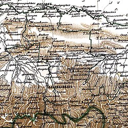
The establishment of the early settlement is associated with the Ingush highlanders moving from the Assinkoe gorge to the plains. In 18th century Ingush highlanders established settlements in the modern Sunzhensky district of Ingushetia. According to the maps of 1834, several Ingush settlements are known to the area, including Kurei-Yurt which was lying on the modern boundaries of the town of Sunzha. According to the rapport by the Vladikavkaz commandant the population of village Kurai-Yurt was 585 people, which was considered to be a relatively large settlement. The other sources acknowledge the village under the name of Korei-Yurd, such as on the "Map of left flank of the Caucausian line" in 1840.
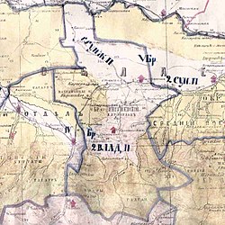
The founder of the village was Kuri, the son of Ali Ingush: Iаьлий КIури), from the Leimi village of the mountainous Dzheirakhski district of Ingushetia. In the late 20s of the XIX, he moved from his native Leimi and established Kuri-Yurt which existed until 1845, where it was destroyed during the Russian colonization, which established Sunzha line of cossacks settlements on the sights of villages of the indigenous population. During the Russian Empire, the town was the administrative capital of the Sunzhensky Otdel of the Terek Oblast.
In 1845, during the Caucasian war, stanitsa Sunzhenskay has been established as a part of Sunzha cossack line. The stanitsas were inhabited by settlers from already existing cossack settlements in the Caucasus, as well as Don cossacks.
Notable people
- Zarifa Sautieva, activist[13]
- Movsar Evloev, mixed martial artist
Notes
References
- ^ Распоряжение Правительства Российской Федерации от 03.02.2016 г. № 138-р. Сайт Правительства Российской Федерации (3 февраля 2016)
- ^ a b c Russian Federal State Statistics Service (2011). Всероссийская перепись населения 2010 года. Том 1 [2010 All-Russian Population Census, vol. 1]. Всероссийская перепись населения 2010 года [2010 All-Russia Population Census] (in Russian). Federal State Statistics Service.
- ^ "Об исчислении времени". Официальный интернет-портал правовой информации (in Russian). 3 June 2011. Retrieved 19 January 2019.
- ^ Почта России. Информационно-вычислительный центр ОАСУ РПО. (Russian Post). Поиск объектов почтовой связи (Postal Objects Search) (in Russian)
- ^ Кодзоев 2021, p. 560.
- ^ "В Ингушетии появился новый город - Сунжа".
- ^ Оздоев 1980, p. 831.
- ^ Сулейманов 1985, p. 23.
- ^ БIархой, Коазой & Хайренаькъан 2016, p. 25.
- ^ Federal State Statistics Service (21 May 2004). Численность населения России, субъектов Российской Федерации в составе федеральных округов, районов, городских поселений, сельских населённых пунктов – районных центров и сельских населённых пунктов с населением 3 тысячи и более человек [Population of Russia, Its Federal Districts, Federal Subjects, Districts, Urban Localities, Rural Localities—Administrative Centers, and Rural Localities with Population of Over 3,000] (XLS). Всероссийская перепись населения 2002 года [All-Russia Population Census of 2002] (in Russian).
- ^ Всесоюзная перепись населения 1989 г. Численность наличного населения союзных и автономных республик, автономных областей и округов, краёв, областей, районов, городских поселений и сёл-райцентров [All Union Population Census of 1989: Present Population of Union and Autonomous Republics, Autonomous Oblasts and Okrugs, Krais, Oblasts, Districts, Urban Settlements, and Villages Serving as District Administrative Centers]. Всесоюзная перепись населения 1989 года [All-Union Population Census of 1989] (in Russian). Институт демографии Национального исследовательского университета: Высшая школа экономики [Institute of Demography at the National Research University: Higher School of Economics]. 1989 – via Demoscope Weekly.
- ^ "World Weather Information Service - Ordzhonikedzevskaja". World Meteorological Organisation. Retrieved 14 May 2019.
- ^ Катаева, Марина (2020-02-12). ""Надеюсь, не закончу как Мандельштам". Как Зарифа Саутиева стала самой известной женщиной Ингушетии". BBC News Русская служба (in Russian). Retrieved 2020-04-16.
Bibliography
- БIархой, Нина; Коазой, Нурдин; Хайренаькъан, БайIаьла (2016). ГIалгIай-Эрсий Терминий Дошлорг (in Ingush and Russian). Магас. pp. 1–288.
{{cite book}}: CS1 maint: location missing publisher (link) - Оzdoyev, I. A. (1980). Оzdoyevа, F. G.; Kurkiyev, А. S. (eds.). Русско-ингушский словарь: 40 000 слов [Russian-Ingush Dictionary: 40,000 words] (in Ingush and Russian). Мoscow: Russian language. pp. 1–832.
- Сулейманов, А. С. (1985). Ирисханов, И. А. (ed.). Часть IV [Part 4]. Топонимия Чечено-Ингушетии: в IV частях (1976-1985 гг.) (in Russian). Грозный: Чечено-Ингушское Книжное Изд-во. pp. 1–222.


