
Zangilan: Difference between revisions
Content deleted Content added
ImprovedWikiImprovment (talk | contribs) m Grammar |
Archives908 (talk | contribs) No edit summary |
||
| Line 54: | Line 54: | ||
[[Category:Populated places in Zangilan District]] |
[[Category:Populated places in Zangilan District]] |
||
{{NagornoKarabakh-geo-stub}} |
|||
{{Zangilan-geo-stub}} |
{{Zangilan-geo-stub}} |
||
Revision as of 17:06, 28 August 2020
39°03′56″N 46°41′49″E / 39.06556°N 46.69694°E
Zəngilan Kovsakan | |
|---|---|
 Kovsakan nature | |
 Zəngilan Kovsakan | |
| Coordinates: 39°03′56″N 46°41′49″E / 39.06556°N 46.69694°E | |
| Country | Azerbaijan (de facto - Nagorno Karabakh Republic) |
| District Province | Zangilan Qarabag Region |
| Population (2015) | |
• Total | 500 [1] |
| Time zone | UTC+4 (UTC) |
Zangilan (Template:Lang-hy) is a town that is de jure located in the Zangilan Rayon of Azerbaijan. Since the Nagorno-Karabakh War it has been administered as part of Kashatagh Region by the de facto independent Republic of Artsakh.
Since the outbreak of the Syrian Civil War, a growing number of Armenian refugees from Syria have chosen to settle in this town, many of them farmers.[2][3][4]
Gallery
 Voghji River in Zəngilan
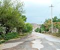 A street in Zəngilan
 Khudapherin Reservoir in Zəngilan
 A khachkar in Zəngilan


References
- Zangilan at GEOnet Names Server
- World Gazetteer: Azerbaijan – World-Gazetteer.com
| Capital city | ||
|---|---|---|
| Provinces | ||
| Provincial capitals | ||
| Other urban communities |
| |
