
Skåneleden
| Skåneleden | |
|---|---|
 Shelter along the trail, lake Grundsjön | |
| Length | 1,700 km (1,100 mi) |
| Location | Skåne, Sweden |
| Established | 1978 |
| Use | Hiking |
| Difficulty | Varied |
| Waymark | Orange square |
| Sights | Dalby Söderskog, Hovdala Castle, Kullaberg, Sofiero Palace, Söderåsen, Stenshuvud, Vattenriket |
| Maintained by | Municipalities of Skåne County |
| Website | skaneleden |
The Skåneleden trail is a long-distance walking trail that stretches all over the countryside of Skåne, in southern Sweden. The trail spans over 1,700 kilometres (1,100 mi) and is divided into seven sub-trails, with a total of 147 sections.[1][2] The trail can easily be recognized by the orange trail marks along the footpath. The trail runs from the west to east and from north to south and passes through a highly diversified landscape such as rocky coastlines, undulating ridges, deep forests and white sandy beaches. Parts of the trail are accessible by wheelchair.[3]
The trail features around 90 permanent shelters at designated campsites. The trail is also part of the 6,000 kilometres (3,700 mi) long North Sea Trail, which passes through Sweden, Norway, Denmark, Germany, the Netherlands and the United Kingdom. It connects to the neighbouring trails of Blekingeleden to the east, sharing some sections with it and Hallandsleden to the north, meeting at Koarp in Hallandsås.[4][5]

As of 2023, visitor counters along the trail recorded between 5 and 300 hikers per day on most sections, and up to 5,000 daily visitors in popular locations such as Stenshuvud and Ales Stenar.[6] The official Skåneleden website received over 500,000 people in 2024,[7] and 1,830 maps of the Skåneleden trail were sold in 2021.[6]
The management of Skåneleden is overseen by the Scanian Landscape Foundation (Stiftelsen Skånska Landskap) on behalf of Region Skåne. Since 2011, Region Skåne has served as the main authority responsible for the trail’s development and promotion, while the foundation handles its administration and coordinates maintenance efforts with 31 municipalities. Each municipality is responsible for maintaining its section of the trail and managing relations with landowners, sometimes carrying out the work directly and sometimes delegating it to other organizations. The trail passes through both public and privately owned land, with over 1,000 landowners granting access through formal agreements with local municipalities.[8][9]
History
The planning of Skåneleden began in 1973 as an initiative by Friluftsfrämjandet in collaboration with the County Administrative Board of Kristianstad County and various outdoor recreation organizations. Early discussions focused on identifying suitable routes that would integrate the trail into the landscape. By 1976, a project group was formed, including representatives from the County Labor Board, the Nature Conservation Unit of the County Administrative Board, and the Forest Management Board, along with landowner associations, outdoor organizations, and municipalities.[10]
The section between Sölvesborg and Glimåkra in SL1 Kust till kust (Coast to coast) was the first inaugurated in 1978, with Sölvesborg Municipality assuming responsibility for its management.[9][10] Over time, individual municipalities continued developing the network, leading to the creation of an extensive regional trail system.[10]
In 1990, the Fritidsområden i Skåne Foundation was appointed as the main managing body, ensuring a more structured approach to municipal coordination.[10] Since 2011, Region Skåne has served as the main authority overseeing the development of the trail, integrating its management into broader regional planning efforts.[8][10]
In the 2020s, Skåneleden continued to expand its network of paths, inaugurating SL6 Vattenriket (Water Kingdom) in May 2024 and SL7 Sydkust (South Coast) in October 2024.[2][11]
Sub-trails
SL1 Kust till kust (Coast to coast)

The Kust till kust, or Coast to coast, trail extends 370 kilometres (230 mi) across 31 sections, running through the north of Scania, from Sölvesborg in the east to Ängelholm in the west. The eastern part of the trail passes through quiet woodlands and tranquil lakes, while the western sections feature more dramatic coastal cliffs.[12]
As the northernmost sub-trail, SL1 partially passes through the neighboring counties of Blekinge and Halland. In sections 13 and 14, going between Bjärabygget and Brammarp, the trail goes through Hallandsås, a hilly area, featuring Halland's highest point at 226 metres (741 ft) above sea level.[13][14] Sections 3 and 5 are partly in Blekinge, but section 3A is almost entirely in the neighbouring county.[15][16][17] Lastly, sections 1 to 3A are considered to be a part of both Skåneleden and Blekingeleden.[4]
| Section | Length | Difficulty |
|---|---|---|
| 1. Sölvesborg - Grundsjön | 14 km (8.7 mi) | Red |
| 2. Näsum - Näsums bokskogar | 3 km (1.9 mi) | Blue |
| 2. Grundsjön - Östafors | 16 km (9.9 mi) | Blue |
| 3. Östafors - Bökestad | 9 km (5.6 mi) | Blue |
| 3A. Bökestad - Olofström | 12 km (7.5 mi) | Red |
| 3A. Olofström - Halens camping | 1 km (0.62 mi) | Green |
| 4. Bökestad - Brotorpet | 13 km (8.1 mi) | Red |
| 5. Brotorpet - Vesslarp | 13 km (8.1 mi) | Blue |
| 6. Vesslarp - Glimåkra | 19 km (12 mi) | Blue |
| 6. Glimåkra - Trollabadet | 1.8 km (1.1 mi) | Green |
| 7. Glimåkra - Osby | 18 km (11 mi) | Blue |
| 8. Osby - Verum | 24 km (15 mi) | Blue |
| 9. Verum - Vittsjö | 12 km (7.5 mi) | Blue |
| 10. Vittsjö - Hårsjö | 8 km (5.0 mi) | Blue |
| 11. Hårsjö - Lärkesholm | 20 km (12 mi) | Blue |
| 12. Lärkesholm - Bjärabygget | 13 km (8.1 mi) | Red |
| 12A. Lärkesholm - Grytåsa | 17 km (11 mi) | Blue |
| 13. Bjärabygget - Koarp | 17 km (11 mi) | Red |
| 14. Koarp - Brammarp | 17 km (11 mi) | Red |
| 15. Brammarp - Båstad | 12 km (7.5 mi) | Red |
| 15. Båstad | 1.9 km (1.2 mi) | Blue |
| 16. Båstad - Hovs Hallar | 16 km (9.9 mi) | Red |
| 16. Båstad - Skummeslöv | 2 km (1.2 mi) | Green |
| 16. Båstad train station | 2.6 km (1.6 mi) | Green |
| 17. Hovs Hallar - Torekov | 8 km (5.0 mi) | Blue |
| 18. Torekov - Vejbystrand | 20 km (12 mi) | Blue |
| 19. Vejbystrand - Hålehall | 11 km (6.8 mi) | Red |
| 20. Hålehall - Örlid | 9 km (5.6 mi) | Blue |
| 21. Ängelsbäcksstrand - Båstad | 14 km (8.7 mi) | Red |
| 22. Vejbystrand - Ängelholm/Utvälinge | 16 km (9.9 mi) | Blue |
| 23. Ängelholm - Utvälinge | 7.5 km (4.7 mi) | Green |
Difficulty:
| ||
| Source: Skåneleden[12] | ||
SL2 Nord till syd (North to south)

The Nord till syd, or North to south, trail stretches 325 kilometres (202 mi) over 33 sections, from Hårsjö (west of Vittsjö) in the north to Trelleborg on the southern coast. The trail leads through dense woodlands, savanna-like open landscapes, and historic estates with diverse flora.[18] The trail features several circular paths through nature reserves such as Skrylle, Fulltofta and Hovdala.[19][20][21]
| Section | Length | Difficulty |
|---|---|---|
| 1. Hårsjö - Olastorp | 7 km (4.3 mi) | Blue |
| 2. Olastorp - Vedema | 13 km (8.1 mi) | Red |
| 3. Vedema - Hässleholm | 22 km (14 mi) | Red |
| 4. Hässleholm - Göingeåsen | 12.5 km (7.8 mi) | Red |
| 4A. Göingeåsen - Hovdala | 11 km (6.8 mi) | Red |
| 4B. Hovdala - Skyrup | 20 km (12 mi) | Red |
| 4C. Skyrup - Hässleholm | 16 km (9.9 mi) | Blue |
| 5. Göingeåsen - Lillsjödal | 12 km (7.5 mi) | Red |
| 6. Lillsjödal - Frostavallen | 21 km (13 mi) | Blue |
| 6. Lillsjödal - Maglebjär/Tjörnarp | 3 km (1.9 mi) | Blue |
| 6. Lillsjödal - Maglebjär/Sösdala | 3 km (1.9 mi) | Blue |
| 7. Frostavallen - Höör | 7 km (4.3 mi) | Blue |
| 8. Höör - Bjeveröd | 11 km (6.8 mi) | Red |
| 9. Bjeveröd - Hörby Ringsjöstrand | 17 km (11 mi) | Red |
| 9A. Fulltofta circular path | 10 km (6.2 mi) | Blue |
| 10. Hörby Ringsjöstrand - Rövarekulan | 13 km (8.1 mi) | Red |
| 11. Rövarekulan - Höghult | 9 km (5.6 mi) | Red |
| 12. Höghult - Krankesjön | 11 km (6.8 mi) | Red |
| 13. Krankesjön - Väderkullen | 14 km (8.7 mi) | Blue |
| 13A. Skrylleslingan | 15 km (9.3 mi) | Red |
| 14. Väderkullen - Häckeberga | 8 km (5.0 mi) | Red |
| 14. Väderkullen - Häckeberga/Veberöd | 3 km (1.9 mi) | Blue |
| 15. Häckeberga - Sturup | 11 km (6.8 mi) | Blue |
| 15. Häckeberga - Sturup/Genarp | 2 km (1.2 mi) | Blue |
| 15A. Sturup - Dörröd | 14 km (8.7 mi) | Blue |
| 16. Sturup - Eksholmssjön | 7 km (4.3 mi) | Green |
| 16. Sturup - Eksholmssjön/Airport | 2 km (1.2 mi) | Green |
| 17. Eksholmssjön - Torup | 9 km (5.6 mi) | Blue |
| 18. Torup - Malmö Bulltofta | 14 km (8.7 mi) | Green |
| 19. Dörröd - Blentarp | 12 km (7.5 mi) | Blue |
| 20. Blentarp - Snogeholm | 12 km (7.5 mi) | Blue |
| 21. Torup - Fru Alstad | 18 km (11 mi) | Blue |
| 22. Fru Alstad - Trelleborg | 13 km (8.1 mi) | Green |
Difficulty:
| ||
| Source: Skåneleden[18] | ||
SL3 Ås till ås (Ridge to ridge)

The Ås till ås, or Ridge to ridge, trail spans 162 kilometres (101 mi) across 16 sections, linking Åstorp in the northwest, at the base of the Söderåsen ridge, to the Brösarp hills in Österlen, to the southeast. This subtrail passes through Söderåsen National Park, the largest national park in Skåne, known for its dramatic ravines.[22]
| Section | Length | Difficulty |
|---|---|---|
| 1. Åstorp - Hålebäck | 10 km (6.2 mi) | Blue |
| 2. Hålebäck - Krika skog | 11 km (6.8 mi) | Red |
| 3. Krika skog - Klåveröd | 14 km (8.7 mi) | Blue |
| 4. Klåveröd - Söderåsen | 6 km (3.7 mi) | Red |
| 5. Söderåsen - Jällabjär | 11 km (6.8 mi) | Red |
| 6. Jällabjär - Södra Hultarp | 11 km (6.8 mi) | Red |
| 7. Södra Hultarp - Frostavallen | 12 km (7.5 mi) | Red |
| 8. Frostavallen - Höör | 7 km (4.3 mi) | Blue |
| 9. Höör - Bjeveröd | 11 km (6.8 mi) | Red |
| 9. Onsvala spring (campsite) | 1 km (0.62 mi) | Green |
| 10. Bjeveröd - Ekeröd | 12 km (7.5 mi) | Red |
| 11. Ekeröd - Timan | 13 km (8.1 mi) | Blue |
| 12. Timan - Rebbetuaröd | 21 km (13 mi) | Blue |
| 13. Rebbetuaröd - Agusa | 7 km (4.3 mi) | Blue |
| 14. Agusa - Brösarp | 15.6 km (9.7 mi) | Red |
| 14. Brösarp bus station | 0.3 km (0.19 mi) | Green |
Difficulty:
| ||
| Source: Skåneleden[22] | ||
SL4 Österlen

The Österlen trail, named after the region it traverses, covers 188 kilometres (117 mi) across 15 sections, forming a circular route in southeastern Skåne. It starts and ends in Ystad, passing through Simrishamn, Stenshuvud National Park, Kivik, the Brösarp hills and Hallamölla waterfall. The landscape is characterized by long sandy beaches, picturesque fishing villages, and humid beech woodlands.[23]
| Section | Length | Difficulty |
|---|---|---|
| 1. Ystad - Nybrostrand | 8.1 km (5.0 mi) | Green |
| 2. Nybrostrand - Löderup's beach | 18 km (11 mi) | Red |
| 3. Löderup's beach - Borrby's beach | 11 km (6.8 mi) | Blue |
| 4. Borrby's beach - Simrishamn | 20 km (12 mi) | Blue |
| 5. Simrishamn - Kivik | 20 km (12 mi) | Blue |
| 6. Kivik - Brösarp | 11.2 km (7.0 mi) | Blue |
| 7. Brösarp - Andrarums alum mill | 12.9 km (8.0 mi) | Blue |
| 7. Brösarp bus station | 0.3 km (0.19 mi) | Green |
| 7A. Verkasjön - Agusa | 9 km (5.6 mi) | Red |
| 7B. Agusa - Brösarp | 14 km (8.7 mi) | Red |
| 8. Verkasjön - Heinge | 8 km (5.0 mi) | Red |
| 9. Heinge - Lövestad's ridges | 6 km (3.7 mi) | Red |
| 10. Lövestad's ridges - Vitabäck | 14 km (8.7 mi) | Blue |
| 11. Vitabäck - Snogeholm | 10 km (6.2 mi) | Blue |
| 12. Snogeholm - Ystad | 24 km (15 mi) | Green |
Difficulty:
| ||
| Source: Skåneleden[23] | ||
SL5 Öresund

The Öresund trail, named after the Öresund strait, covers 214 kilometres (133 mi) across 33 sections, following the Scanian west coast between Utvälinge and the Falsterbonäset Peninsula. It includes two circular paths, one around the Falsterbonäset Peninsula and another around the island Ven. The trail offers expansive sea views and traverses several nature reserves.[24]
| Section | Length | Difficulty |
|---|---|---|
| 1. Utvälinge - Jonstorp | 11 km (6.8 mi) | Blue |
| 2. Jonstorp - Arild | 9 km (5.6 mi) | Blue |
| 3. Arild - Mölle | 16 km (9.9 mi) | Red |
| 3A. Mölle - Himmelstorp | 3 km (1.9 mi) | Blue |
| 4A. Kullarulla (Wheelchair accessible alternative to 4.) | 10.5 km (6.5 mi) | Green |
| 4. Mölle - Höganäs | 12 km (7.5 mi) | Green |
| 5. Höganäs - Domsten | 11 km (6.8 mi) | Green |
| 6. Domsten - Helsingborg | 14 km (8.7 mi) | Red |
| 6. Domsten - Helsingborg/Sofiero | 1.4 km (0.87 mi) | Green |
| 7. Helsingborg - Rydebäck | 16 km (9.9 mi) | Green |
| 8. Rydebäck - Landskrona | 13 km (8.1 mi) | Red |
| 8. Rydebäck - Landskrona/Glumslöv | 4 km (2.5 mi) | Green |
| 9. Ven circular path | 12 km (7.5 mi) | Blue |
| 10. Landskrona - Järavallen | 14 km (8.7 mi) | Blue |
| 9. Landskrona - Tide windbreaker | 1.6 km (0.99 mi) | Green |
| 10. Landskrona - Järavallen/Landskrona station | 1 km (0.62 mi) | Green |
| 11. Järavallen - Löddeköpinge | 21 km (13 mi) | Blue |
| 10. Löddeköpinge | 2 km (1.2 mi) | Green |
| 11. Löddeköpinge - Bjärred | 8 km (5.0 mi) | Green |
| 13. Bjärred - Lomma | 6 km (3.7 mi) | Green |
| 13. Lomma - Spillepeng | 5 km (3.1 mi) | Green |
| 14. Spillepeng - Bulltofta | 6.5 km (4.0 mi) | Green |
| 14. Arlöv/Burlöv station | 1.4 km (0.87 mi) | Green |
| 14A. Bulltofta | 1.2 km (0.75 mi) | Green |
| 15. Bulltofta - Malmö C | 6.4 km (4.0 mi) | Green |
| 16. Spillepeng - Malmö C | 6.3 km (3.9 mi) | Green |
| 17. Malmö C - Limhamn | 9.2 km (5.7 mi) | Green |
| 18. Limhamn - Klagshamn | 13.3 km (8.3 mi) | Green |
| 19. Klagshamn - Falsterbo Canal | 21 km (13 mi) | Green |
| 19. Foteviken | 0.5 km (0.31 mi) | Green |
| 20. Falsterbo Canal - Skanör | 16.2 km (10.1 mi) | Blue |
| 21. Skanör harbour - Falsterbo | 9.1 km (5.7 mi) | Blue |
| 22. Falsterbo - Falsterbo Canal | 8.2 km (5.1 mi) | Green |
Difficulty:
| ||
| Source: Skåneleden[24] | ||
SL6 Vattenriket (Water Kingdom)

The Vattenriket, or Water Kingdom, trail extends 190 kilometres (120 mi) over 14 sections, running from Simontorp or Breanäs in northeastern Skåne to Brösarp in Österlen.[25] The trail passes through Kristianstad Vattenriket, a UNESCO-designated biosphere reserve known for its wetlands and rich birdlife.[26] The landscape transitions from lush inland greenery to a more exposed coastal terrain, with several small villages along the way.[25] This subtrail incorporated the already existing hiking path Degebergaleden, passing through Forsakar nature reserve.[27]
| Section | Length | Difficulty |
|---|---|---|
| 1. Brösarp - Maglehem | 10 km (6.2 mi) | Blue |
| 2. Maglehem - Nyehusen | 16 km (9.9 mi) | Blue |
| 2A. Maglehem - Degeberga | 18 km (11 mi) | Blue |
| 3. Nyehusen - Åhus | 16 km (9.9 mi) | Blue |
| 4. Åhus - Kristianstad | 23 km (14 mi) | Green |
| 4A. Åhus circular path | 17 km (11 mi) | Green |
| 5. Kristianstad - Norra Lingenäset | 12 km (7.5 mi) | Green |
| 6. Norra Lingenäset - Österslöv | 12 km (7.5 mi) | Green |
| 7. Österslöv - Arkelstorp | 9 km (5.6 mi) | Green |
| 8. Arkelstorp - Immeln | 10 km (6.2 mi) | Green |
| 8A. Arkelstorp - Lerjevallen | 8 km (5.0 mi) | Blue |
| 9. Immeln - Sibbhult | 14 km (8.7 mi) | Blue |
| 10. Sibbhult - Simontorp | 12 km (7.5 mi) | Blue |
| 10A. Sibbhult - Breanäs | 17 km (11 mi) | Blue |
Difficulty:
| ||
| Source: Skåneleden[25] | ||
SL7 Sydkust (South coast)

The Sydkust or South coast trail runs 65 kilometres (40 mi) over 5 sections, along the southern coastline of Scania, from Skåre to Ystad, passing through Smygehuk, Sweden's southernmost point. The route provides hikers with easy access to coastal scenery and sandy beaches and is accessible in its entirety by bus.[28][29]
| Section | Length | Difficulty |
|---|---|---|
| 1. Ystad - Mossbystrand | 12.4 km (7.7 mi) | Green |
| 2. Mossbystrand - Bingsmarken | 11.7 km (7.3 mi) | Blue |
| 3. Bingsmarken - Smygehamn | 13.8 km (8.6 mi) | Blue |
| 4. Smygehamn - Trelleborg | 17.1 km (10.6 mi) | Blue |
| 1. Skåre - Trelleborg | 10 km (6.2 mi) | Green |
Difficulty:
| ||
| Source: Skåneleden[28] | ||
Gallery
 Hammars backar hill
 Older sign posts
 Marker
 Signage between sections
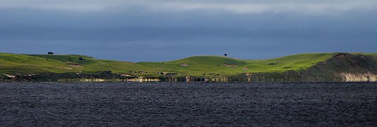 Hammars backar hills, seen from Ystad
 Between Helsingborg and Rydebäck


External links
References
- ^ "Skåneleden". Skåneleden. Retrieved 2025-02-11.
- ^ a b "Skåneleden inviger nya delleden SL7 Sydkust". Skåneleden. Retrieved 2025-02-11.
- ^ "Hiking on wheels in Skåne". Skåneleden. Retrieved 2019-08-05.
- ^ a b "Blekingeleden". Blekingeleden (in Swedish). Retrieved 2025-02-12.
- ^ "Welcome to the Hallandsleden trail". Hallandsleden. Retrieved 2025-02-12.
- ^ a b Holmberg, Ida (2023). "Hitta ut till Skåneleden: att underlätta för naturovana personer att ta sig ut i naturen med hjälp av en vandringsled". SLU, Dept. of Landscape Architecture, Planning and Management (in Swedish): 28, 29.
- ^ "Ökat intresse för Skåneleden under 2024". Skåneleden. Retrieved 2025-02-11.
- ^ a b "Vårt uppdrag: Friluftsliv och natur för alla - Stiftelsen Skånska Landskap". skanskalandskap.se (in Swedish). Retrieved 2025-02-11.
- ^ a b "About Skåneleden". Skåneleden. Retrieved 2025-02-11.
- ^ a b c d e Jensen, Viktor Erik (2015). "Leden rätt genom Skåne : varierad landskapsupplevelse på Skåneleden?". SLU, Dept. of Landscape Architecture, Planning and Management (in Swedish): 1.
- ^ "Nu invigs SL6 Vattenriket". Skåneleden. Retrieved 2024-05-29.
- ^ a b "SL1 Kust till kust". Skåneleden. Retrieved 2025-02-11.
- ^ "13 Bjärabygget - Koarp". Skåneleden. Retrieved 2025-02-12.
- ^ "14 Koarp - Brammarp". Skåneleden. Retrieved 2025-02-12.
- ^ "3A Boafall - Olofström". Skåneleden. Retrieved 2025-02-12.
- ^ "3 Östafors - Bökestad". Skåneleden. Retrieved 2025-02-12.
- ^ "5 Brotorpet - Vesslarp". Skåneleden. Retrieved 2025-02-12.
- ^ a b "SL2 Nord till syd". Skåneleden. Retrieved 2025-02-11.
- ^ "13 A Skrylleslingan". Skåneleden. Retrieved 2025-02-11.
- ^ "9A Fulltofta runt". Skåneleden. Retrieved 2025-02-11.
- ^ "4 rundslingor för en dagsvandring". Skåneleden. Retrieved 2025-02-11.
- ^ a b "SL3 Ås till ås". Skåneleden. Retrieved 2025-02-11.
- ^ a b "SL4 Österlen". Skåneleden. Retrieved 2025-02-11.
- ^ a b "SL5 Öresund". Skåneleden. Retrieved 2025-02-11.
- ^ a b c "SL6 Vattenriket". Skåneleden. Retrieved 2025-02-11.
- ^ "Kristianstads Vattenrike « Svenska Unescorådet". unesco.se (in Swedish). Retrieved 2025-02-11.
- ^ "Degebergaleden blir Skåneleden". www.kristianstad.se (in Swedish). 2024-05-07. Retrieved 2024-05-29.
- ^ a b Cite error: The named reference
SL7was invoked but never defined (see the help page). - ^ "SL7 Sydkust". Skåneleden. Retrieved 2025-02-11.