Orion, Queensland
| Orion Queensland | |||||||||||||||
|---|---|---|---|---|---|---|---|---|---|---|---|---|---|---|---|
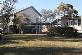
 Orion State School, 2023 | |||||||||||||||
| Coordinates | 24°12′31″S 148°21′47″E / 24.2086°S 148.3630°E | ||||||||||||||
| Population | 87 (2021 census)[1] | ||||||||||||||
| • Density | 0.1135/km2 (0.2939/sq mi) | ||||||||||||||
| Postcode(s) | 4722 | ||||||||||||||
| Area | 766.8 km2 (296.1 sq mi) | ||||||||||||||
| Time zone | AEST (UTC+10:00) | ||||||||||||||
| Location |
| ||||||||||||||
| LGA(s) | Central Highlands Region | ||||||||||||||
| State electorate(s) | Gregory | ||||||||||||||
| Federal division(s) | Flynn | ||||||||||||||
| |||||||||||||||
Orion is a rural locality in the Central Highlands Region, Queensland, Australia.[2] In the 2021 census, Orion had a population of 87 people.[1]
Geography
The Comet River forms the south-eastern boundary of the locality.[3]
The Dawson Highway enters the locality from the south (Albinia), passes through the south-west of the locality, and exits to the west (Cairdbeign).[3] The Blackwater railway line enters the locality from the south-east (Lowesby), passes briefly through the south-east of the locality before exiting to the south (Albinia).[3]
The eastern and central parts of the locality are about 200 metres about sea level, while the western part of the locality is more mountainous, rising to unnamed peaks of 600 metres.[3] There are two named peaks in the locality:
- Mount Sirius (24°13′57″S 148°12′45″E / 24.2326°S 148.2126°E) 532 metres (1,745 ft)[4][5]
- Terrace Hill (24°12′39″S 148°15′59″E / 24.2108°S 148.2665°E) 467 metres (1,532 ft)[4][6]
The Cairdbeign State Forest is in the west of the locality.[3] Predominant land uses elsewhere in the locality are grazing on native vegetation, mostly in the west and east, and the growing of grain, mostly in the north and south.[3][7]
History
Orion State School opened on 28 January 1964.[8] The school celebrated its 50th anniversary in 2014.[9]
Demographics
In the 2016 census, Orion had a population of 87 people.[10]
In the 2021 census, Orion had a population of 87 people, as in 2016.[1]
Education
Orion State School is a government primary (Prep-6) school for boys and girls at 1002 Ten Chain Road (24°13′49″S 148°24′39″E / 24.2303°S 148.4107°E).[11][12] In 2016, the school had an enrolment of 16 students with 1 teacher and 4 non-teaching staff (2 full-time equivalent).[7] In 2018, the school had an enrolment of 11 students with 2 teachers (1 full-time equivalent) and 5 non-teaching staff (2 full-time equivalent).[13] In 2022, enrolment had fallen to 3 students.[14]
There are no secondary schools in Orion. The nearest secondary school is Springsure State School (to Year 10) in neighbouring Springsure to the north-west; however, due to distances, some parts of the locality would be too distant for daily travel. There are no schools providing secondary education to Year 12 nearby. Other options are distance education and boarding school.[15]
Amenities
Orion Community Hall is at 1002 Orion Ten Chain Road, immediately south of the school.(24°13′53″S 148°24′38″E / 24.23137°S 148.41060°E)[16]
References
- ^ a b c Australian Bureau of Statistics (28 June 2022). "Orion (SAL)". 2021 Census QuickStats. Retrieved 28 February 2023.
- ^ "Orion – locality in Central Highlands Region (entry 46971)". Queensland Place Names. Queensland Government. Retrieved 6 November 2017.
- ^ a b c d e f "Queensland Globe". State of Queensland. Retrieved 26 December 2023.
- ^ a b "Mountain peaks and capes - Queensland". Queensland Open Data. Queensland Government. 12 November 2020. Archived from the original on 25 November 2020. Retrieved 25 November 2020.
- ^ "Mount Sirius – mountain in Central Highlands Region (entry 30916)". Queensland Place Names. Queensland Government. Retrieved 25 November 2020.
- ^ "Terrace Hill – mountain in Central Highlands Region (entry 33737)". Queensland Place Names. Queensland Government. Retrieved 25 November 2020.
- ^ a b "2016 Annual Report" (PDF). Orion State School. Archived from the original (PDF) on 17 November 2017. Retrieved 17 November 2017.
- ^ Queensland Family History Society (2010), Queensland schools past and present (Version 1.01 ed.), Queensland Family History Society, ISBN 978-1-921171-26-0
- ^ "Our school". Orion State School. 17 January 2020. Archived from the original on 10 November 2023. Retrieved 25 December 2023.
- ^ Australian Bureau of Statistics (27 June 2017). "Orion (SSC)". 2016 Census QuickStats. Retrieved 20 October 2018.
- ^ "State and non-state school details". Queensland Government. 9 July 2018. Archived from the original on 21 November 2018. Retrieved 21 November 2018.
- ^ "Orion State School". Orion State School. 29 November 2020. Archived from the original on 1 April 2020. Retrieved 25 December 2023.
- ^ "ACARA School Profile 2018". Australian Curriculum, Assessment and Reporting Authority. Archived from the original on 27 August 2020. Retrieved 28 January 2020.
- ^ "School annual report 2022" (PDF). Orion State School. p. 2. Archived (PDF) from the original on 10 November 2023. Retrieved 26 December 2023.
- ^ "Layers: Locality; Schools and school catchments". Queensland Globe. Queensland Government. Archived from the original on 19 December 2017. Retrieved 26 December 2023.
- ^ "Orion Community Hall" (Map). Google Maps. Retrieved 26 December 2023.

