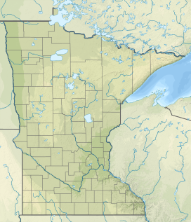
Misquah Hills High Point
| Misquah Hills High Point | |
|---|---|
| Highest point | |
| Elevation | 2,260 ft (690 m) |
| Prominence | 380 ft (120 m) |
| Coordinates | 47°58′30″N 90°31′11″W / 47.97500°N 90.51972°W |
| Geography | |
| Location | Cook County, Minnesota, U.S. |
The Misquah Hills High Point, or Point 2260 is the unnamed high point of the Misquah Hills and the third highest point in the state of Minnesota.[1] It has 420 feet of clean prominence from its parent, Eagle Mountain, from which it is 5.68 miles isolated.[2]
Point 2230 (at 2230 feet) was considered to be the highest point in the Misquah Hills, and indeed in the state of Minnesota, until the region was resurveyed in 1961.[3] This survey not only established that Eagle Mountain was significantly higher than the Misquah Hills, but found additional points higher than Point 2230 within the Misquah Hills themselves. Thus the high point of the Misquah Hills was established as point 2260 (at 2260 feet), located on the east edge of Winchell Lake.[4]
Climate
| Climate data for Misquah Hills High Point 47.9825 N, 90.4482 W, Elevation: 1,969 ft (600 m) (1991–2020 normals) | |||||||||||||
|---|---|---|---|---|---|---|---|---|---|---|---|---|---|
| Month | Jan | Feb | Mar | Apr | May | Jun | Jul | Aug | Sep | Oct | Nov | Dec | Year |
| Mean daily maximum °F (°C) | 12.6 (−10.8) |
19.0 (−7.2) |
32.1 (0.1) |
44.1 (6.7) |
59.9 (15.5) |
70.1 (21.2) |
75.3 (24.1) |
74.4 (23.6) |
64.0 (17.8) |
46.3 (7.9) |
31.7 (−0.2) |
18.9 (−7.3) |
45.7 (7.6) |
| Daily mean °F (°C) | 2.7 (−16.3) |
7.7 (−13.5) |
20.0 (−6.7) |
33.9 (1.1) |
49.3 (9.6) |
59.6 (15.3) |
64.9 (18.3) |
63.1 (17.3) |
54.1 (12.3) |
38.9 (3.8) |
23.9 (−4.5) |
10.3 (−12.1) |
35.7 (2.1) |
| Mean daily minimum °F (°C) | −7.2 (−21.8) |
−3.7 (−19.8) |
8.0 (−13.3) |
23.7 (−4.6) |
38.7 (3.7) |
49.0 (9.4) |
54.5 (12.5) |
51.8 (11.0) |
44.2 (6.8) |
31.5 (−0.3) |
16.1 (−8.8) |
1.7 (−16.8) |
25.7 (−3.5) |
| Average precipitation inches (mm) | 1.41 (36) |
1.15 (29) |
1.34 (34) |
2.30 (58) |
3.22 (82) |
4.11 (104) |
4.07 (103) |
3.18 (81) |
3.48 (88) |
3.22 (82) |
2.22 (56) |
1.84 (47) |
31.54 (800) |
| Source: PRISM Climate Group[5] | |||||||||||||
References
- ^ MN Peak Stats, [1] Accessed January 13, 2013.
- ^ Misquah Hills High Point, Accessed January 13, 2013.
- ^ Summit plaque, Eagle Mountain, Minnesota Historical Society, 1967.
- ^ Minnesota's Mineral Resources[permanent dead link] p. 230. Accessed January 13, 2013.
- ^ "PRISM Climate Group, Oregon State University". PRISM Climate Group, Oregon State University. Retrieved October 30, 2023.
To find the table data on the PRISM website, start by clicking Coordinates (under Location); copy Latitude and Longitude figures from top of table; click Zoom to location; click Precipitation, Minimum temp, Mean temp, Maximum temp; click 30-year normals, 1991-2020; click 800m; click Retrieve Time Series button.

