Mancherial
Mancherial | |
|---|---|
City | |
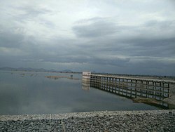
 Yellampalli project located in Ramagundam Rural but borders Mulkalla village | |
| Coordinates: 18°52′17.0″N 79°26′39.5″E / 18.871389°N 79.444306°E | |
| Country | |
| State | Telangana |
| District | Mancherial |
| Government | |
| • Type | Municipal Council Mancherial |
| • Body | Mancherial Municipality |
| • MLA | Sri Kokkirala Premsagar Rao |
| Area | |
• Total | 90 km2 (30 sq mi) |
| • Rank | 14th (Telangana) |
| Elevation | 173 m (568 ft) |
| Population (2018)[1] | |
• Total | 110,000 |
| • Density | 1,200/km2 (3,200/sq mi) |
| Languages | |
| • Official Language | Telugu,Urdu |
| Time zone | UTC+5:30 (IST) |
| PIN | 504208 |
| Vehicle registration | TG-19 |
| Assembly constituency | Mancherial |
| Lok Sabha constituency | Peddapalli |
| Major highways | Rajiv Rahadari NH 63 NH 363 |
| Website | mancherialmunicipality |
Mancherial is a city and headquarters of the Mancherial district of the Indian state of Telangana. It is both the district and administrative headquarters of Mancherial mandal in the Mancherial revenue division.[2] It is located on the north banks of the Godavari River.[3][4] It is located about 244 kilometres (152 mi) from the state capital, Hyderabad, 84 kilometres (52 mi) from Karimnagar, 138 kilometres (86 mi) from Nirmal and 155 kilometres (96 mi) from Adilabad.
History
Historically, it was part of Adilabad District, but now it is a separate district by itself. It was, until as recently as less than a hundred years ago, rich in forest resources and many small scale & large scale industries but was of little economic and political importance.[5] Gonds mainly depended on farming for their livelihoods.[6] After the Singareni Collieries Company coal mines were established in the region, it became industrialised. During the 1970s, an Industrial training institute was opened there.[7]
Demographics
| Year | Pop. | ±% |
|---|---|---|
| 1951 | 8,997 | — |
| 1961 | 13,822 | +53.6% |
| 1971 | 19,808 | +43.3% |
| 1981 | 32,478 | +64.0% |
| 1991 | 52,657 | +62.1% |
| 2001 | 70,381 | +33.7% |
| 2011 | 89,935 | +27.8% |
| Source: [8] | ||
As of the 2011 census of India, Mancherial has a population of 89,935. Males constitute 51% of the total population and females 49%. Mancherial has an average literacy rate of 75.71%, higher than the national average: male literacy is 83.16%, and female literacy is 67.92%. In Mancherial, 8% of the population is under 6 years of age.
The majority of people in the area practice Hinduism, followed by Islam and Christianity. Telugu is the most widely spoken language.
Education
List of colleges in Mancherial:
- Government Medical College, Mancherial
- Government ITI college, Mancherial
- Government Degree college, Mancherial
- Government Junior college, Mancherial
Tourism
- Gandhari khilla, a hill fort
Transport
Mancherial is well connected with all types of transport facilities, the major ones are Road and Rail.
Road
Telangana State Road Transport CorporationTSRTC has its bus depot in Mancherial connecting transportation facility to the citizens to every village and city of Mancherial district. A new National highway is being constructed from Mancherial to Chandrapur. Also another new National highway is sanctioned from Jaipur Mandal to Warangal via Manthani and Bhupalpally. This Highway is named as Green Industrial corridor by NHAI.
The following are the major roads passing through the city:

- Rajiv Rahadari
- National Highway 63 - Jagdalpur to yedashi via renapur latur bodhan nizamabad passes through Mancherial.
- National Highway 363
Rail

Mancherial railway station is the busiest station in Kazipet–Balharshah section Secunderabad railway division, after it is one among the five 'A' category stations of SC division.
Mancherial is located on the longest railway line, which is called the Grand Trunk line (New Delhi–Chennai). It is well connected by rail from various towns/cities in India. It comes under South Central Railways. With the completion of the Kazipet–Balharshah link in 1929, Chennai was directly linked to Delhi.[9]
It has 3 platforms. It is a good potential station to stop due its population as well as proximity to other major towns like Mandamarri (14 km), Luxettipet (26 km), Ramakrishnapur (8 km), Chennur (40 km), Jaipur Power Plant (17 km).
Air
The closest airport is Hyderabad International Airport.
References
- ^ "About Mancherial". Mancherial municipality.
- ^ "The official website of Mancherial District". Retrieved 16 August 2018.
- ^ "Adilabad District Mandals" (PDF). Census of India. p. 98. Retrieved 28 January 2016.
- ^ "District Census Handbook – Adilabad" (PDF). Census of India. pp. 13–14, 44. Retrieved 22 September 2015.
- ^ Furer-Haimendorf, Christoph Von (1982). Tribes of India: The Struggle for Survival. University of California Press. pp. 51, 52. ISBN 9780520043152.
- ^ Furer-Haimendorf, Christoph Von (1982). Tribes of India: The Struggle for Survival. University of California Press. pp. 99, 100, 101. ISBN 9780520043152.
- ^ F?rer-Haimendorf, Christoph Von (1982). Tribes of India: The Struggle for Survival. University of California Press. p. 139. ISBN 9780520043152.
- ^ "Page Redirection". data.gov.in. 21 January 2022.
- ^ "IR History: Early Days – III". Chronology of railways in India, Part 3 (1900–1947). Retrieved 26 November 2013.


