Isla de Jueyes
 Isla de Jueyes, taken looking SE from the Observation Tower at La Guancha, in Barrio Playa, Ponce, PR | |
| Geography | |
|---|---|
| Location | Ponce, Puerto Rico |
| Coordinates | 17°57′33″N 66°35′23″W / 17.95917°N 66.58972°W |
| Area | 0.01 km2 (0.0039 sq mi) |
| Administration | |
| Commonwealth | Puerto Rico |
| Municipality | Ponce |
| Barrio | Vayas |
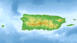
Isla de Jueyes are a group of three small uninhabited islands off the southern coast of Puerto Rico. Together with Caja de Muertos, Gatas, Morrillito, Ratones, Cardona, and Isla del Frío, Isla de Jueyes is one of seven islands ascribed to the municipality of Ponce.[1][2][3][4] At an area of just 2.89 cuerdas, they are also the smallest of these seven islands. Like Isla del Frío, the islands are considered part of barrio Vayas.[5]
Location
The islands, sometimes considered keys (or, cays), or islets,[6] because of their size, are located 0.12 mi (0.19 km) south of the Puerto Rican mainland and is closest to Barrio Vayas[7][8] ward of the Ponce, Puerto Rico, municipality.
They are oriented in a southwest-to-northeast axis and are separated from each other by approximately 120 feet (37 meters).[9] The northernmost, and the one closest to the Puerto Rico mainland shore, sits at a distance of approximately 600 feet (180 meters), of 0.12 mi (0.19 km), southwest from the mainland Puerto Rican shore in the area of Caleta de Cabullones (Cabullon Point), with the furthestmost extending 0.43 mi (0.69 km) from the mainland.[10][11][12] The closest populated point on the mainland is Hacienda Villa Esperanza, also known as Quinta Esperanza, located in barrio Vayas. The islands have an area of just 0.0019 sq mi (0.0049 km2) (2.89 cuerdas)[13] (one cuerda equals 0.97 acres[14]).
Their coordinates are: latitude 17.9592° and longitude -66.5897° (latitude 17°57'33"N and longitude 66°35'23"W).[15][16]
Geography and climate
The islands vary in size from 130 ft × 130 ft (40 m × 40 m), the smallest, to 200 ft × 260 ft (61 m × 79 m), the largest, and are located 660 feet (200 meters) off the coast of mainland Puerto Rico.[17] The climate is dry and the island supports dry forest. They consists mostly of brush.[18] Though not officially a nature reserve, the island is administered by the Puerto Rico Department of Natural and Environmental Resources. Its length is 0.31 miles (0.5 kilometers) northeast and southwest.[19]
See also
References
- ^ Geographic Names Information System. U.S. Department of the Interior. U.S. Geological Survey. Retrieved 10 June 2011.
- ^ Neysa Rodriguez Deynes. Brevario Sobre la Historia de Ponce. Second Edition. Government of the Autonomous Municipality of Ponce. 2002. Page 9. Printed by Impress Quality Printing, Bayamon, Puerto Rico.
- ^ CityMelt. Retrieved 10 June 2011.
- ^ Map of Ponce Municipio, Puerto Rico. United States Geological Survey. Home Town Locator. Retrieved 10 June 2011.
- ^ Puerto Rico 2000: Population and Housing Unit Counts. U.S. Census Bureau. Publication Number PHC-3-53. Published November 2003. Page F-17. Retrieved 22 September 2011.
- ^ West Indies Pilot, Volume 1. United States Hydrographic Office. Page 593. Fourth Edition: 1922. Retrieved 10 June 2011.
- ^ General Purpose Population Data, Census 2000. Unidad de Sistemas de Información Geográfica, Área de Tecnología de Información Gubernamental, Oficina de Gerencia y Presupuesto. Gobierno de Puerto Rico. Archived 2010-08-12 at the Wayback Machine Retrieved 10 June 2011.
- ^ US Census. 1930 Federal Census Team Transcription. Retrieved 10 June 2011.
- ^ Maptest. Archived 2010-02-18 at the Wayback Machine Government of the Commonwealth of Puerto Rico. General Purpose Population Data, Census 2000. Unidad de Sistemas de Información Geográfica, Área de Tecnología de Información Gubernamental, Oficina de Gerencia y Presupuesto. Gobierno de Puerto Rico. Retrieved February 24, 2010.
- ^ West Indies Pilot, Volume 1. United States Hydrographic Office. Page 593. Fourth Edition: 1922. Retrieved 10 June 2011.
- ^ GNIS.USGS Retrieved 10 June 2011.
- ^ West Indies Pilot, Volume 1. United States Hydrographic Office. Page 592. Fourth Edition: 1922. Retrieved 10 June 2011.
- ^ Neysa Rodriguez Deynes. Brevario Sobre la Historia de Ponce. Second Edition. Government of the Autonomous Municipality of Ponce. 2002. Page 9. Printed by Impress Quality Printing, Bayamon, Puerto Rico.
- ^ UnitConversion.org Retrieved 10 June 2011.
- ^ Geographic Names Information System. USGS. Retrieved 10 June 2011.
- ^ Isla de Jueyes. Puerto Rico Home Town Locator. Retrieved 10 June 2011.
- ^ Booklet Chart: Isla Petrona to Isla Caja de Muertos. Archived 28 April 2011 at the Wayback Machine 25685 - NOAA - National Oceanic and Atmospheric Administration. Retrieved 10 June 2011.
- ^ West Indies Pilot, Volume 1. United States Hydrographic Office. Page 592. Fourth Edition: 1922. Retrieved 10 June 2011.
- ^ West Indies Pilot, Volume 1. United States Hydrographic Office. Page 592. Fourth Edition: 1922.Retrieved 10 June 2011.


