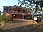
Guirim
Guirim | |
|---|---|
Village | |
 | |
| Coordinates: 15°35′N 73°48′E / 15.58°N 73.80°E | |
| Country | |
| State | Goa |
| District | North Goa |
| Elevation | 7 m (23 ft) |
| Population (2001) | |
• Total | 6,371 |
| Languages | |
| • Official | Konkani |
| Time zone | UTC+5:30 (IST) |
| Vehicle registration | GA |
| Website | villagepanchayatguirim |
Guirim is a census town in North Goa in the Indian state of Goa. For administrative purposes, however, it is considered to be a village, and has a village panchayat, which is the local administration of a village in parts of India. Guirim is located on the outskirts of the North Goa main commercial city of Mapusa (also spelt as Mapsa or Mapuca). It is the last village along the Panjim-Mapusa highway that one encounters prior to reaching Mapusa.
Area and population
Guirim has an area of 4.03 square kilometres, and a total of 1,178 households.[1] Its population totals 5.036 (according to the 2011 official Census) which comprises 2,502 males and 2,534 females.[1] Its under-six population in 2011 was a total of 493 children, comprising 258 boys and 235 girls.[1]
About the village

The village is also known as Girvoddea in the local Konkani language. Gurim has been home to the prominent St. Anthony's High School, run by the Goa Capuchin Friars and is located on a hillock that overlooks the agrarian village whose geography is dominated by paddy fields.
The village cemetery has, prominently written on its entrance, the text in Konkani which is meant to be a reminder of our own limited nature, Aiz Mhaka, Falea Tuka, which means, "Today it's my turn. Tomorrow yours."
School
St Anthony's at Guirum, the prominent local school, is run in the English-medium.[2] It was earlier a boys-only school though now is a mixed school catering to both boys and girls.
The school was conceived by the Capuchins in 1936 and became a reality in 1941.[2] This Catholic religious order was planning to build their residence at Peddem, on the other side of Mapusa, when Fr. Hippolito da Luna (1909-1942), director of the Collegio de Santo Antonio boarding school offered to hand over to them the school, boarding, Chapel and adjoining property on the hill to the Capuchins.[2]
The Capuchins took over the school in May 1942.[2] It was set up with the aim of offering the youth of Goa sound and quality and all-round education through literary, moral, religious, emotional and physical education.[2] This school is open to all. Its motto in Latin is Ad Ardua (towards higher, greater achievements).[2] Every year 45 students get scholarships and 90 freeships are given for hardworking students.[2]
This has been one of the prominent schools in Bardez, with a particularly strong reputation for its prowess in sports, particularly football and hockey around the second half of the 20th century.
Geography


Guirim is located at 15°33′48″N 73°48′55″E / 15.563419°N 73.815237°E .[3] It has an average elevation of 7 metres (23 feet).
Demographics
As of 2001 India census,[4] Guirim had a population of 6371. Males constitute 51% of the population and females 49%. Guirim has an average literacy rate of 70%, higher than the national average of 59.5%: male literacy is 75%, and female literacy is 65%. In Guirim, 12% of the population is under 6 years of age.
Recent developments
During the heavy monsoons of June 2020, some fields of Guirim were reported flooded.[5] A flyover on the road highway cutting through Guirim was inaugurated in July 2020.[6] Citizens, green campaigners, youth and local farmers sought to resuscitate coconut trees near the Guirim underpass in 2020.[7][8][9] In February 2020, an issue broke out over the illegal mud-filling of Guirim lands and fields.[10]
Gallery
- Life in Guirim
- St Antonio Chapel
- Village Panchayat
- Guirim Cross
- Village Cemetery
References
- ^ a b c Census of India, 2011 Goa: Series 31, Part XIIB: District Census Handbook, North Goa. Village and Townwise Primary Census Abstracts. Directorate of Census Operations, Goa. 2014. p. 102.
- ^ a b c d e f g "St. Anthony's High School, Monte de Guirim". Goa Capuchins. Retrieved 14 November 2020.
- ^ Falling Rain Genomics, Inc - Guirim
- ^ "Census of India 2001: Data from the 2001 Census, including cities, villages and towns (Provisional)". Census Commission of India. Archived from the original on 16 June 2004. Retrieved 1 November 2008.
- ^ "Guirim fields flooded". oHeraldo. Retrieved 14 November 2020.
- ^ "Guirim flyover open from today". The Times of India. 16 July 2020. Retrieved 14 November 2020.
- ^ "A Green initiative to save Guirim's iconic coconut trees". oHeraldo. Retrieved 14 November 2020.
- ^ Sayed, Nida (13 September 2020). "Farmers, citizens to put green back in Guirim coconut trees". The Times of India. Retrieved 14 November 2020.
- ^ "Phase 2 of Guirim palms revival today in Goa". The Times of India. 20 September 2020. Retrieved 14 November 2020.
- ^ "Uproar over illegal filling of Guirim comunidade fields". The Times of India. 24 February 2020. Retrieved 14 November 2020.


