Geylang East
Geylang East | |
|---|---|
Subzone of Geylang Planning Area | |
| Other transcription(s) | |
| • Traditional Chinese | 芽籠東 |
| • Simplified Chinese | 芽笼东 |
| • Malay | Geylang Timur |
| • Tamil | கேலாங் கிழக்கு |
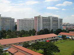
 An older HDB neighbourhood at Eunos. | |
 | |
| Coordinates: 1°19′11.01″N 103°54′11.19″E / 1.3197250°N 103.9031083°E | |
| Country | |
| Region | Central Region |
| Planning Area | Geylang |
| Area | |
• Total | 2.58 km2 (1.00 sq mi) |
| Population (2015)[1] | |
• Total | 33,380 |
| • Density | 13,000/km2 (34,000/sq mi) |
Geylang East, as a planning subzone, covers what is more commonly known as Eunos. This is located in Geylang zone in the Central Region of Singapore. The vicinity is served by both Paya Lebar and Eunos MRT stations. This area is distinct from the Geylang East Central and estate, which is adjacent to and west of Eunos.
"Eunos" is also the name given to a street called Jalan Eunos which spans the area.[2]
Etymology and History
| Eunos | |||||||
|---|---|---|---|---|---|---|---|
| Chinese name | |||||||
| Traditional Chinese | 友諾士 | ||||||
| Simplified Chinese | 友诺士 | ||||||
| |||||||
| Malay name | |||||||
| Malay | Eunos | ||||||
| Tamil name | |||||||
| Tamil | யூனுஸ் | ||||||
The settlement was originally named Kampong Melayu, a large Malay village that used to include Kampong Ubi and Kaki Bukit areas. It was later renamed Eunos in honour of its founder, Mohamed Eunos bin Abdullah.
Eunos was the Chairman and co-founder of the Singapore Malay Union and the first Malay representative of the Legislative Council, the then governing body of Singapore. In 1927, he appealed to the government and was granted $700,000 that the Singapore Malay Union used for the purchase of 670 hectares of land, which later became known as Kampong Melayu.[3] This land was used to provide a home for Malays who were affected by the building of Singapore’s first airport at Kallang.[4]
References
- ^ a b City Population - statistics, maps and charts | Geylang East
- ^ "Jalan Eunos". National Library Board. 24 January 2005. Retrieved 31 March 2016.
- ^ "Mohamed Eunos bin Abdullah". National Library Board. 3 May 2010. Retrieved 31 March 2016.
- ^ Memory, Singapore. "A community leader who saw himself as a servant, Mohamed Eunos bin Abdullah (born 1876 died 1933)". Singapore Memory. Retrieved 2022-04-03.

