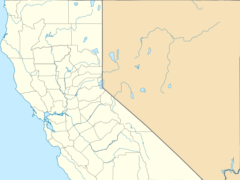
File:USA California Northern location map.svg

Size of this PNG preview of this SVG file: 800 × 600 pixels. Other resolutions: 320 × 240 pixels | 640 × 480 pixels | 1,024 × 767 pixels | 1,280 × 959 pixels | 2,560 × 1,919 pixels | 978 × 733 pixels.
Original file (SVG file, nominally 978 × 733 pixels, file size: 430 KB)
File history
Click on a date/time to view the file as it appeared at that time.
| Date/Time | Thumbnail | Dimensions | User | Comment | |
|---|---|---|---|---|---|
| current | 06:27, 8 March 2015 |  | 978 × 733 (430 KB) | Banaticus | {{Information |Description ={{en|1=Equirectangular projection, N/S. Geographic limits of the map: * N: 41.998403° N * S: 35.789821° N * W: 124.410508° W * E: 114.0506° W}} |Source =File:USA California location map.svg |Author... |
File usage
The following 80 pages use this file:
- 1984 Summer Olympics torch relay
- 2002 Winter Olympics torch relay
- Acampo, California
- Arena Union Elementary School District
- August Complex fire
- Balboa Terrace, San Francisco
- Bank of Italy (Tracy, California)
- Bank of Tracy
- Bear Creek Redwoods Open Space Preserve
- Benbow, California
- Benjamin Holt House
- Boles Fire
- Boulevard Park, Sacramento, California
- Building 101 (San Francisco)
- Bully Fire
- CZU Lightning Complex fires
- Caldor Fire
- Carmel Arts and Crafts Club
- Carr Fire
- Casa del Rey Hotel
- Childs Meadows, California
- Chips Fire
- Contra Costa Centre, California
- Cranston–Geary House
- Dharma Realm Buddhist University
- El Dorado Elementary School
- Empire Fire
- Fawn Fire
- Fernside, Alameda, California
- Fox California Theater
- Frog Fire
- Glass Fire
- Happy Camp Complex Fire
- Harmony Grove Church
- Helena Fire
- Jones Fire (1999)
- Lime Fire
- List of college athletic programs in California
- Locke's Meat Market
- Locke House and Barn
- Loma Fire
- McKinley Park, Sacramento
- Military Vehicle Technology Foundation
- Mission Fire
- Moonlight Fire
- Moses Rodgers House
- Mount Vision Fire
- Mud Fire
- Parker 2 Fire
- Peninsula Athletic League
- Placerville, California
- Ponderosa Fire (2017)
- Railroad Fire
- Rattlesnake Fire
- Red Bank Fire
- San Joaquin County Historical Society and Museum
- Sargent, California
- Snell Valley
- Soberanes Fire
- Stinson Beach, California
- Tassajara Fire
- Tracy City Hall and Jail
- Trailhead Fire
- Trinidad, California
- Walker Fire (2019)
- Washburn Fire
- Webber Lake Hotel
- Weller House (Fort Bragg, California)
- Wragg Fire
- Wrights, California
- Young Fire
- Yuba City, California
- Talk:Fernside, Alameda, California
- User:Banaticus/BSA, Western Region, Area 3, Council locations
- User:Penitentes/Fawn Fire
- User:Penitentes/Mosquito Fire
- Wikipedia:Graphics Lab/Map workshop/Archive/Jun 2019
- Template:Infobox protected area/testcases
- Module:Location map/data/USA California Northern
- Module:Location map/data/USA California Northern/doc
Global file usage
The following other wikis use this file:
- Usage on ar.wikipedia.org
- Usage on azb.wikipedia.org
- Usage on fa.wikipedia.org
- Usage on fr.wikipedia.org
- Usage on hi.wikipedia.org
- Usage on ja.wikipedia.org
- Usage on ml.wikipedia.org
- Usage on ru.wikipedia.org
- Usage on simple.wikipedia.org
- Usage on si.wikipedia.org
- Usage on ta.wikipedia.org
- Usage on ur.wikipedia.org
- Usage on uz.wikipedia.org
