
File:The Castle Armoury - geograph.org.uk - 1690254.jpg
Size of this preview: 800 × 600 pixels. Other resolutions: 320 × 240 pixels | 640 × 480 pixels | 1,024 × 768 pixels.
Original file (1,024 × 768 pixels, file size: 203 KB, MIME type: image/jpeg)
Summary
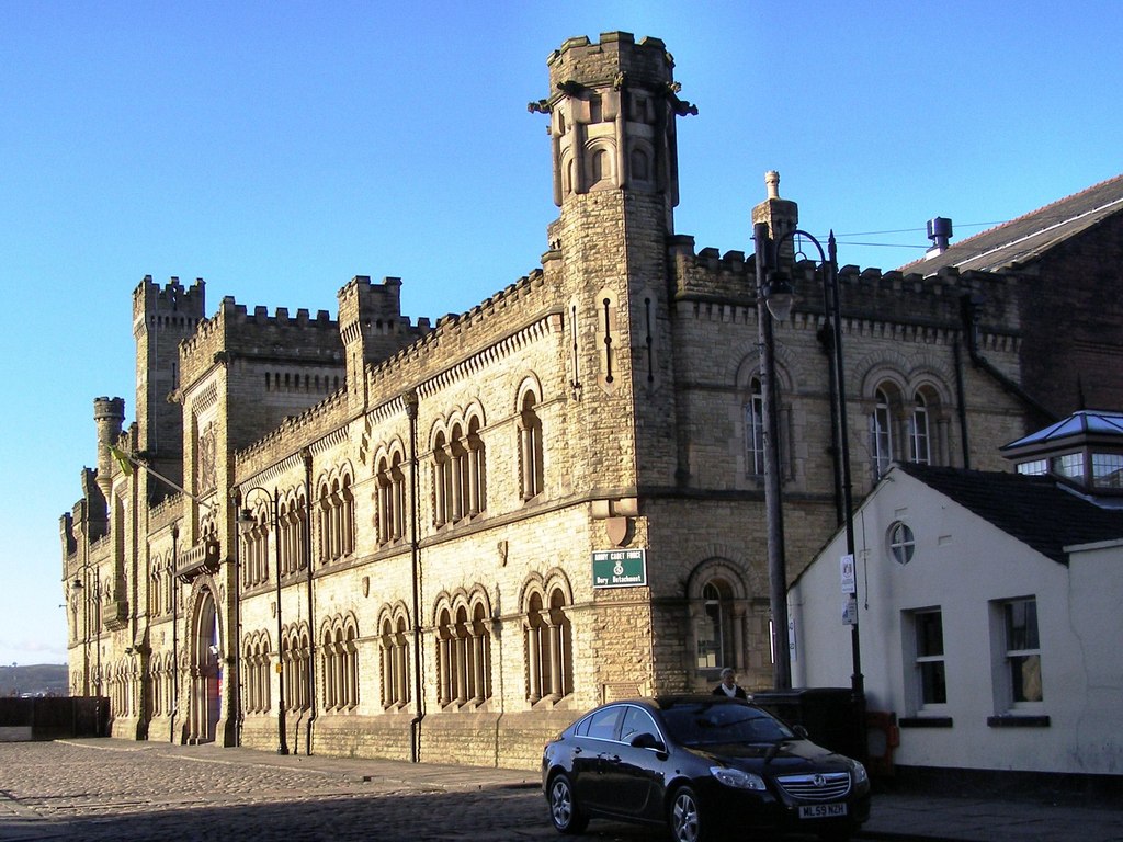
| Description | English: The Castle Armoury The drill hall for the 8th Lancashire (Bury) Rifle Volunteer Corps (the Castle Armoury) was built on the historical site of Bury Castle in 1868. To reflect the 'castle' its facade has a fortified style with features such as castellations, turrets, towers and arrow slits.
Bury |
| Date | |
| Source | From geograph.org.uk |
| Author | David Dixon |
| Attribution (required by the license) | David Dixon / The Castle Armoury / |
| Camera location | | View this and other nearby images on: OpenStreetMap |
|---|
_heading:315.00&language=en)
| Object location | | View this and other nearby images on: OpenStreetMap |
|---|
_heading:315.00&language=en)
Licensing

|
This image was taken from the Geograph project collection. See this photograph's page on the Geograph website for the photographer's contact details. The copyright on this image is owned by David Dixon and is licensed for reuse under the Creative Commons Attribution-ShareAlike 2.0 license. |
This file is licensed under the Creative Commons Attribution-Share Alike 2.0 Generic license.
Attribution: David Dixon
- You are free:
- to share – to copy, distribute and transmit the work
- to remix – to adapt the work
- Under the following conditions:
- attribution – You must give appropriate credit, provide a link to the license, and indicate if changes were made. You may do so in any reasonable manner, but not in any way that suggests the licensor endorses you or your use.
- share alike – If you remix, transform, or build upon the material, you must distribute your contributions under the same or compatible license as the original.
File history
Click on a date/time to view the file as it appeared at that time.
| Date/Time | Thumbnail | Dimensions | User | Comment | |
|---|---|---|---|---|---|
| current | 03:20, 5 March 2011 | | 1,024 × 768 (203 KB) | GeographBot | == {{int:filedesc}} == {{Information |description={{en|1=The Castle Armoury The drill hall for the 8th Lancashire (Bury) Rifle Volunteer Corps (the Castle Armoury) was built on the historical site of Bury Castle in 1868. To reflect the 'castle' its facade |
File usage
The following 3 pages use this file:
Global file usage
The following other wikis use this file:
- Usage on www.wikidata.org