
File:Plaque at Playing Place - geograph.org.uk - 1058923.jpg
No higher resolution available.
Plaque_at_Playing_Place_-_geograph.org.uk_-_1058923.jpg (640 × 427 pixels, file size: 142 KB, MIME type: image/jpeg)
Summary
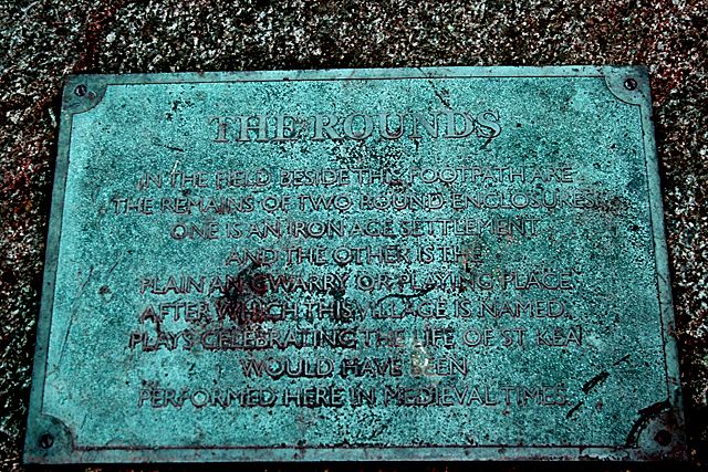
| Description | English: Plaque at Playing Place THE ROUNDS
IN THE FIELD BESIDE THIS FOOTPATH ARE THE REMAINS OF TWO ROUND ENCLOSURES ONE IS AN IRONAGE SETTLEMENT AND THE OTHER IS THE PLAIN-AN-GWARRY OR PLAYING PLACE AFTER WHICH THIS VILLAGE IS NAMED PLAYS CELEBRATING THE LIFE OF ST KEA WOULD HAVE BEEN PERFORMED HERE IN MEDIEVAL TIMES |
| Date | |
| Source | From geograph.org.uk |
| Author | Fred James |
| Attribution (required by the license) | Fred James / Plaque at Playing Place / |
| Camera location | | View this and other nearby images on: OpenStreetMap |
|---|
_heading:67.00&language=en)
| Object location | | View this and other nearby images on: OpenStreetMap |
|---|
_heading:67.00&language=en)
Licensing

|
This image was taken from the Geograph project collection. See this photograph's page on the Geograph website for the photographer's contact details. The copyright on this image is owned by Fred James and is licensed for reuse under the Creative Commons Attribution-ShareAlike 2.0 license. |
This file is licensed under the Creative Commons Attribution-Share Alike 2.0 Generic license.
Attribution: Fred James
- You are free:
- to share – to copy, distribute and transmit the work
- to remix – to adapt the work
- Under the following conditions:
- attribution – You must give appropriate credit, provide a link to the license, and indicate if changes were made. You may do so in any reasonable manner, but not in any way that suggests the licensor endorses you or your use.
- share alike – If you remix, transform, or build upon the material, you must distribute your contributions under the same or compatible license as the original.
File history
Click on a date/time to view the file as it appeared at that time.
| Date/Time | Thumbnail | Dimensions | User | Comment | |
|---|---|---|---|---|---|
| current | 01:27, 24 February 2011 | | 640 × 427 (142 KB) | GeographBot | == {{int:filedesc}} == {{Information |description={{en|1=Plaque at Playing Place THE ROUNDS IN THE FIELD BESIDE THIS FOOTPATH ARE THE REMAINS OF TWO ROUND ENCLOSURES ONE IS AN IRONAGE SETTLEMENT AND THE OTHER IS THE PLAIN-AN-GWARRY OR PLAYING PLACE AFTE |
File usage
The following 4 pages use this file:
Global file usage
The following other wikis use this file:
- Usage on la.wikipedia.org