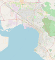
File:Map of Thessaloniki - Whole.png

Size of this preview: 543 × 599 pixels. Other resolutions: 217 × 240 pixels | 435 × 480 pixels | 696 × 768 pixels | 928 × 1,024 pixels | 1,855 × 2,048 pixels | 6,756 × 7,458 pixels.
Original file (6,756 × 7,458 pixels, file size: 21.37 MB, MIME type: image/png)
File history
Click on a date/time to view the file as it appeared at that time.
| Date/Time | Thumbnail | Dimensions | User | Comment | |
|---|---|---|---|---|---|
| current | 19:35, 25 August 2018 |  | 6,756 × 7,458 (21.37 MB) | Sarah fides | Manually added metro stops |
| 18:43, 25 August 2018 |  | 6,756 × 7,458 (21.35 MB) | Sarah fides | User created page with UploadWizard |
File usage
The following 10 pages use this file:
- Aristotelous Square
- Eleftherias Square
- Holocaust Museum of Greece
- Monastir Synagogue (Thessaloniki)
- Siege of Thessalonica (254)
- Thessaloniki Olympic Museum
- Thessaloniki Science Center and Technology Museum
- Thessaloniki railway station
- Module:Location map/data/Greece Thessaloniki
- Module:Location map/data/Greece Thessaloniki/doc
Global file usage
The following other wikis use this file:
- Usage on fy.wikipedia.org
- Usage on hr.wikipedia.org
- Usage on nl.wikipedia.org
- Sjabloon:Infobox metrostation Thessaloniki
- Néos Sidirodromikós Stathmós
- Nea Elvetia
- Mikra
- Sjabloon:Positiekaart Thessaloniki
- Voulgari
- 25 Martiou
- Analipseos
- Fleming (metrostation)
- Evklidi
- Papafi
- Dimokratias
- Venizelou
- Agias Sofias
- Sintrivani
- Panepistimio
- Nea Krini
- Aretsou
- Kalamaria (metrostation)
- Nomarchia
- Usage on pl.wikipedia.org
- Moduł:Mapa/dane/Saloniki
- Superleague Ellada (2022/2023)
- Superleague Ellada (2023/2024)
- Superleague Ellada (2021/2022)
- Superleague Ellada (2020/2021)
- Superleague Ellada (2015/2016)
- Superleague Ellada (2016/2017)
- Superleague Ellada (2018/2019)
- Superleague Ellada (2019/2020)
- Superleague Ellada (2024/2025)
- Usage on si.wikipedia.org
- Usage on uz.wikipedia.org

