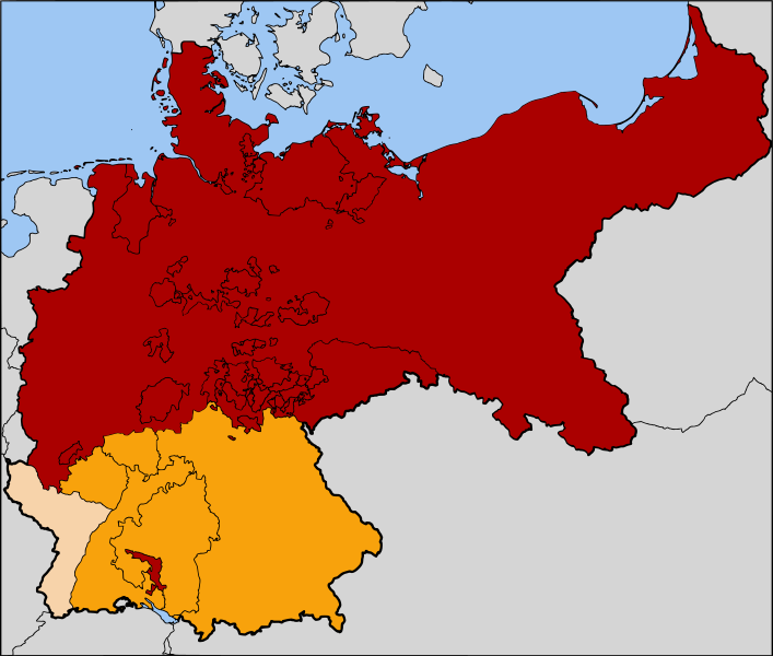
File:Map-NDB.svg

Size of this PNG preview of this SVG file: 707 × 600 pixels. Other resolutions: 283 × 240 pixels | 566 × 480 pixels | 905 × 768 pixels | 1,207 × 1,024 pixels | 2,414 × 2,048 pixels | 2,621 × 2,224 pixels.
Original file (SVG file, nominally 2,621 × 2,224 pixels, file size: 713 KB)
File history
Click on a date/time to view the file as it appeared at that time.
| Date/Time | Thumbnail | Dimensions | User | Comment | |
|---|---|---|---|---|---|
| current | 06:11, 25 July 2007 |  | 2,621 × 2,224 (713 KB) | 52 Pickup | now with Alsace-Lorraine coloured in |
| 07:37, 24 July 2007 |  | 2,621 × 2,224 (713 KB) | 52 Pickup | oops, wrong version | |
| 07:36, 24 July 2007 |  | 2,621 × 2,224 (713 KB) | 52 Pickup | {{Information| |Description= The North German Confederation / Norddeutscher Bund (1867-1871) in red. The states that would join the confederation to form the German Empire |
File usage
The following 8 pages use this file:
Global file usage
The following other wikis use this file:
- Usage on ar.wikipedia.org
- Usage on ast.wikipedia.org
- Usage on azb.wikipedia.org
- Usage on az.wikipedia.org
- Usage on be.wikipedia.org
- Usage on ca.wikipedia.org
- Usage on cs.wikipedia.org
- Usage on da.wikipedia.org
- Usage on de.wikipedia.org
- Usage on es.wikipedia.org
- Usage on et.wikipedia.org
- Usage on fa.wikipedia.org
- Usage on gl.wikipedia.org
- Usage on hu.wikipedia.org
- Usage on hy.wikipedia.org
- Usage on it.wikipedia.org
- Usage on ja.wikipedia.org
- Usage on ka.wikipedia.org
- Usage on ko.wikipedia.org
- Usage on lv.wikipedia.org
- Usage on mk.wikipedia.org
- Usage on ms.wikipedia.org
- Usage on pl.wikipedia.org
View more global usage of this file.
