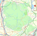
File:Location map United Kingdom Forest of Bowland.svg

Size of this PNG preview of this SVG file: 614 × 600 pixels. Other resolutions: 246 × 240 pixels | 491 × 480 pixels | 786 × 768 pixels | 1,048 × 1,024 pixels | 2,097 × 2,048 pixels | 946 × 924 pixels.
Original file (SVG file, nominally 946 × 924 pixels, file size: 6.09 MB)
File history
Click on a date/time to view the file as it appeared at that time.
| Date/Time | Thumbnail | Dimensions | User | Comment | |
|---|---|---|---|---|---|
| current | 13:08, 7 July 2018 |  | 946 × 924 (6.09 MB) | Dr Greg | User created page with UploadWizard |
File usage
The following 52 pages use this file:
- Abbeystead
- Aighton, Bailey and Chaigley
- Barley, Lancashire
- Barley-with-Wheatley Booth
- Bashall Eaves
- Bleasdale
- Bolton-by-Bowland
- Bowland-with-Leagram
- Bowland Forest High
- Bowland Forest High milestone
- Bowland Forest Low
- Calder Vale
- Caton-with-Littledale
- Chipping, Lancashire
- Claughton, Lancaster
- Downham, Lancashire
- Dunsop Bridge
- Easington, Lancashire
- Forest of Bowland
- Gisburn Forest
- Goldshaw Booth
- Gressingham
- Grey Stone of Trough
- Grindleton
- Hornby, Lancashire
- Hornby-with-Farleton
- Hurst Green, Lancashire
- Kirk Mill
- Newchurch in Pendle
- Newton-in-Bowland
- Oakenclough
- Quernmore
- Roeburndale
- Roughlee
- Sabden
- Sawley Abbey
- Scorton, Lancashire
- Slaidburn
- St Andrew's Church, Slaidburn
- St Mary's Church, Newchurch in Pendle
- Stonyhurst
- Sykes Smelt Mill
- Thornley-with-Wheatley
- Tosside
- West Bradford, Lancashire
- Whitechapel, Lancashire
- Whitewell
- Wray, Lancashire
- Wray-with-Botton
- Wyresdale Park
- Module:Location map/data/United Kingdom Forest of Bowland
- Module:Location map/data/United Kingdom Forest of Bowland/doc
Global file usage
The following other wikis use this file:


