
File:Canton de Dinard(Position).PNG
No higher resolution available.
Canton_de_Dinard(Position).PNG (418 × 314 pixels, file size: 38 KB, MIME type: image/png)
Summary
| Description |
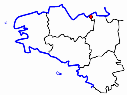
Description: Map for localisazion of cantons of Bretagne region in France Source: made by Hervé Tigier from another large map |
| Date | 25 April 2005 (original upload date) |
| Source | No machine-readable source provided. Own work assumed (based on copyright claims). |
| Author | No machine-readable author provided. TigH assumed (based on copyright claims). |
Licensing
TigH, the copyright holder of this work, hereby publishes it under the following license:
| I, the copyright holder of this work, release this work into the public domain. This applies worldwide. In some countries this may not be legally possible; if so: I grant anyone the right to use this work for any purpose, without any conditions, unless such conditions are required by law. |
File history
Click on a date/time to view the file as it appeared at that time.
| Date/Time | Thumbnail | Dimensions | User | Comment | |
|---|---|---|---|---|---|
| current | 10:36, 25 April 2005 | | 418 × 314 (38 KB) | TigH | '''Description:''' Map for localisazion of cantons of Bretagne region in France '''Source:''' made by Hervé Tigier from another large map {{PD}} Ille-et-Vilaine |
File usage
The following page uses this file:
Global file usage
The following other wikis use this file:
- Usage on br.wikipedia.org
- Usage on ca.wikipedia.org
- Usage on de.wikipedia.org
- Usage on es.wikipedia.org
- Usage on fr.wikipedia.org
- Usage on nl.wikipedia.org
- Usage on sl.wikipedia.org
.PNG)