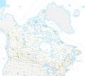
File:Canadian National Parks.png

Size of this preview: 717 × 600 pixels. Other resolutions: 287 × 240 pixels | 574 × 480 pixels | 918 × 768 pixels | 1,224 × 1,024 pixels | 2,449 × 2,048 pixels | 2,750 × 2,300 pixels.
Original file (2,750 × 2,300 pixels, file size: 989 KB, MIME type: image/png)
File history
Click on a date/time to view the file as it appeared at that time.
| Date/Time | Thumbnail | Dimensions | User | Comment | |
|---|---|---|---|---|---|
| current | 22:10, 5 February 2018 |  | 2,750 × 2,300 (989 KB) | Nagualdesign | Added Sable Island National Park Reserve. |
| 04:01, 4 February 2018 |  | 2,750 × 2,300 (989 KB) | Nagualdesign | Optimize (PNG-24 → PNG-8), crop. | |
| 03:21, 4 February 2018 |  | 2,900 × 2,600 (3.12 MB) | Nagualdesign | Colour National Parks. | |
| 01:35, 4 February 2018 |  | 2,900 × 2,600 (3.11 MB) | Nagualdesign | {{Information |Description={{en|1=Map of Canadian National Parks.}} |Source=https://open.canada.ca/data/en/dataset/9e1507cd-f25c-4c64-995b-6563bf9d65bd |Date=2014-03-27 |Author=Government of Canada |Permission={{OGL-C}} |other_versions= }} |
File usage
The following 16 pages use this file:
- List of national parks of Canada
- List of protected areas of New Brunswick
- List of protected areas of Newfoundland and Labrador
- List of protected areas of Nunavut
- List of protected areas of Prince Edward Island
- List of protected areas of Quebec
- List of protected areas of Saskatchewan
- List of protected areas of Yukon
- List of protected areas of the Northwest Territories
- National parks of Canada
- Wildlife of Canada
- User:Nagualdesign
- User:Nagualdesign/Uploads
- User talk:Nagualdesign/Archive 5
- Wikipedia:Graphics Lab/Map workshop/Archive/Nov 2020
- Portal:World
Global file usage
The following other wikis use this file:
- Usage on ban.wikipedia.org
- Usage on de.wikipedia.org
- Usage on he.wikipedia.org
- Usage on hu.wikipedia.org
- Usage on nl.wikipedia.org
- Usage on pa.wikipedia.org
- Usage on pnb.wikipedia.org

