
File:Boyaca Topographic 2.png

Size of this preview: 676 × 599 pixels. Other resolutions: 271 × 240 pixels | 542 × 480 pixels | 866 × 768 pixels | 1,155 × 1,024 pixels | 2,026 × 1,796 pixels.
Original file (2,026 × 1,796 pixels, file size: 8.52 MB, MIME type: image/png)
Summary
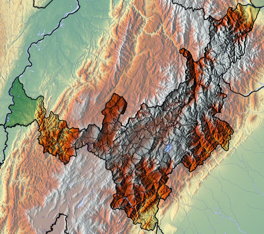
| Description | Français : Boyaca dept Español: Relieve del departamento de Boyacá, Colombia |
| Date | |
| Source | Own work (backgroung : http://www.maps-for-free.com) |
| Author | Dr Brains |
Licensing
I, the copyright holder of this work, hereby publish it under the following licenses:

|
Permission is granted to copy, distribute and/or modify this document under the terms of the GNU Free Documentation License, Version 1.2 only as published by the Free Software Foundation; with no Invariant Sections, no Front-Cover Texts, and no Back-Cover Texts. A copy of the license is included in the section entitled GNU Free Documentation License. | 1.2 only |
|
|
Permission is granted to copy, distribute and/or modify this document under the terms of the GNU Free Documentation License, Version 1.3 or any later version published by the Free Software Foundation; with no Invariant Sections, no Front-Cover Texts, and no Back-Cover Texts. A copy of the license is included in the section entitled GNU Free Documentation License.
|
You may select the license of your choice.
File history
Click on a date/time to view the file as it appeared at that time.
| Date/Time | Thumbnail | Dimensions | User | Comment | |
|---|---|---|---|---|---|
| current | 13:15, 9 June 2012 | | 2,026 × 1,796 (8.52 MB) | Dr Brains |
File usage
The following 10 pages use this file:
- Boyacá Department
- Colombian emeralds
- List of flora and fauna named after the Muisca
- Muisca Confederation
- Ocetá Páramo
- Spanish conquest of New Granada
- Spanish conquest of the Muisca
- Tenza Valley
- Module:Location map/data/Colombia Boyacá Department
- Module:Location map/data/Colombia Boyacá Department/doc
Global file usage
The following other wikis use this file:
- Usage on avk.wikipedia.org
- Usage on bg.wikipedia.org
- Usage on es.wikipedia.org
- Boyacá
- Altiplano cundiboyacense
- Ritacuba Blanco
- Laguna de Iguaque
- Desierto de la Candelaria
- Alto Chicamocha
- Nevado Pan de Azúcar
- Embalse la Esmeralda
- Wikiproyecto:Ilustración/Taller de Cartografía/Realizaciones/América del Sur
- Embalse de La Copa
- Territorio Vásquez
- Plantilla:Mapa de localización de Boyacá
- Lago Sochagota
- Lago de Tota
- Usage on fa.wikipedia.org
- Usage on fr.wikipedia.org
- Boyacá
- Lac Iguaque
- Arcabuco
- Belén (Boyacá)
- Berbeo
- Betéitiva
- Boyacá (Boyacá)
- Briceño (Boyacá)
- Buenavista (Boyacá)
- Busbanzá
- Caldas (Boyacá)
- Campohermoso
- Cerinza
- Ciénega (Boyacá)
- Ventaquemada
- Tópaga
- Togüí
- Paya (Boyacá)
- Tibaná
- Socotá
- Rondón (Boyacá)
- San Mateo (Boyacá)
- Salto de Candelas
- Mine d'émeraude de Muzo
- Mine d'émeraude de Chivor
- Mine d'émeraude de Coscuez
- Modèle:Géolocalisation/Boyacá
- Modèle:Géolocalisation/Boyacá/Documentation
- Laguna de Tota
- Lac de Chivor
- Lac La Copa
- Usage on gl.wikipedia.org
View more global usage of this file.