File:Bjorøy Tunnel map 2.svg

Size of this PNG preview of this SVG file: 311 × 349 pixels. Other resolutions: 214 × 240 pixels | 428 × 480 pixels | 684 × 768 pixels | 912 × 1,024 pixels | 1,825 × 2,048 pixels.
Original file (SVG file, nominally 311 × 349 pixels, file size: 287 KB)
File history
Click on a date/time to view the file as it appeared at that time.
| Date/Time | Thumbnail | Dimensions | User | Comment | |
|---|---|---|---|---|---|
| current | 18:55, 8 March 2011 |  | 311 × 349 (287 KB) | Arsenikk | Added a few new names |
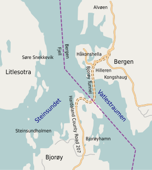
| 18:42, 8 March 2011 |  | 311 × 349 (286 KB) | Arsenikk | {{Information |Description ={{en|1=Map showing the Bjorøy Tunnel, the immediate surrounding areas and places relevant for the article. Some of the data gathered from OpenStreetMaps.}} |Source ={{own}} |Author =[[User:Arsenikk|Alasdair |
File usage
The following page uses this file:
Global file usage
The following other wikis use this file:
- Usage on no.wikipedia.org
