
File:Australia Victoria Indigo Shire location map.svg

Size of this PNG preview of this SVG file: 535 × 363 pixels. Other resolutions: 320 × 217 pixels | 640 × 434 pixels | 1,024 × 695 pixels | 1,280 × 868 pixels | 2,560 × 1,737 pixels.
Original file (SVG file, nominally 535 × 363 pixels, file size: 575 KB)
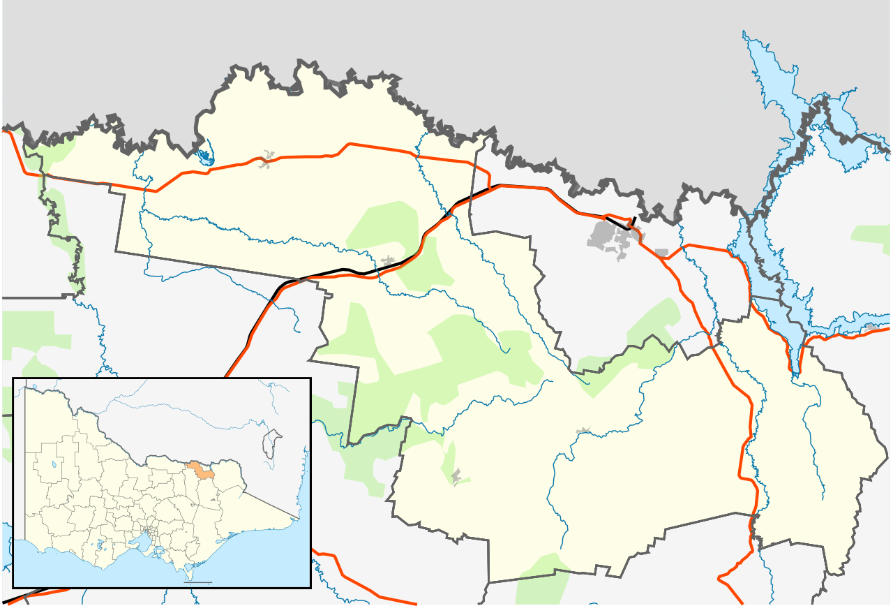
| Description | English: Blank map of w:Indigo Shire, Victoria, Australia, with the following information shown:
Geographic limits:
|
||
| Source | Own work | ||
| Author | Cassowary |

File history
Click on a date/time to view the file as it appeared at that time.
| Date/Time | Thumbnail | Dimensions | User | Comment | |
|---|---|---|---|---|---|
| current | 16:02, 17 February 2011 | | 535 × 363 (575 KB) | Cassowary | {{Information |Description ={{en|1=Blank map of w:Indigo Shire, Victoria, Australia, with the following information shown: * LGA boundaries * Coastline, lakes and rivers * Roads and railways * Urban areas * Parks Geographic limits: * North: 35.9S |
File usage
The following 26 pages use this file:
- Allans Flat, Victoria
- Baarmutha, Victoria
- Barnawartha, Victoria
- Beechworth
- Chiltern, Victoria
- Gooramadda
- Gundowring
- Huon, Victoria
- Indigo Valley, Victoria
- Kergunyah
- Kiewa
- Lake Moodemere
- Mudgegonga
- Rutherglen, Victoria
- Shire of Indigo
- Staghorn Flat
- Stanley, Victoria
- Tangambalanga
- Wahgunyah
- Wooragee
- Yackandandah
- User:ThylacineHunter/LGA
- User:Viatori/sandbox
- Template:Towns in Indigo Shire
- Module:Location map/data/Australia Victoria Shire of Indigo
- Module:Location map/data/Australia Victoria Shire of Indigo/doc
Global file usage
The following other wikis use this file:
- Usage on ar.wikipedia.org
- Usage on ceb.wikipedia.org
- Usage on fa.wikipedia.org
- Usage on id.wikipedia.org
- Usage on kn.wikipedia.org
- Usage on simple.wikipedia.org
- Usage on si.wikipedia.org
- Usage on tr.wikipedia.org
- Usage on uz.wikipedia.org
- Usage on war.wikipedia.org