
File:1821 Atlantic Hurricane Track Map.png

Size of this preview: 646 × 600 pixels. Other resolutions: 259 × 240 pixels | 517 × 480 pixels | 681 × 632 pixels.
Original file (681 × 632 pixels, file size: 15 KB, MIME type: image/png)
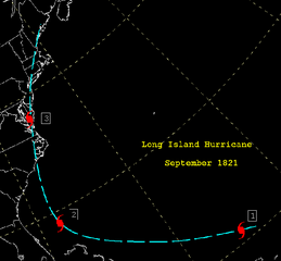
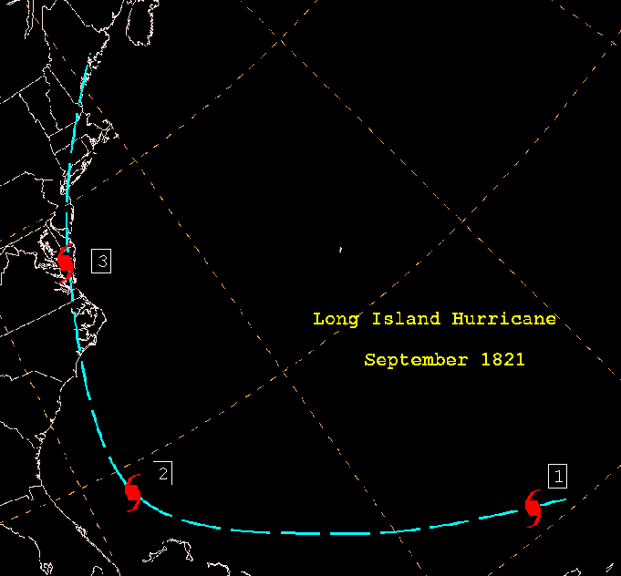
| Description | English: From http://www.wpc.ncep.noaa.gov/research/roth/sp1821.gif, this is a track map of the 1821 Norfolk and Long Island Hurricane. |
| Date | 27 November 2005 (original upload date) |
| Source | Transferred from en.wikipedia to Commons. Transfer was stated to be made by User:bagster. |
| Author | The original uploader was Hurricanehink at English Wikipedia. |
Licensing
- The NOAA emblem is the property of the U.S. Government and a trademark of the United States Department of Commerce.
This image is in the public domain because it contains materials that originally came from the U.S. National Oceanic and Atmospheric Administration, taken or made as part of an employee's official duties.
|
Original upload log
The original description page was here. All following user names refer to en.wikipedia.
- 2005-11-27 21:23 Hurricanehink 681×632×5 (8971 bytes) From http://www.wpc.ncep.noaa.gov/research/roth/sp1821.gif, this is a track map of the 1821 Norfolk and Long Island Hurricane. {{PD-USGov-NOAA}} {{NOAA logo}}
Original upload log
| Date/Time | Dimensions | User | Comment |
|---|---|---|---|
| 3 December 2007, 01:33:40 | 681 × 632 (8971 bytes) | File Upload Bot (Magnus Manske) (talk · contribs) | {{BotMoveToCommons|en.wikipedia}} {{Information |Description={{en|From http://www.hpc.ncep.noaa.gov/research/roth/sp1821.gif, this is a track map of the 1821 Norfolk and Long Island Hurricane.}} |Source=Transfered from [http://en.wikipedia.org en.wikiped |
File history
Click on a date/time to view the file as it appeared at that time.
| Date/Time | Thumbnail | Dimensions | User | Comment | |
|---|---|---|---|---|---|
| current | 16:30, 8 August 2017 | | 681 × 632 (15 KB) | Beyond My Ken | Adjustments for visibility |
| 16:40, 12 July 2014 |  | 681 × 632 (11 KB) | GifTagger | Bot: Converting file to superior PNG file. (Source: 1821_Atlantic_Hurricane_Track_Map.gif). This GIF was problematic due to non-greyscale color table. |
File usage
The following 4 pages use this file:
Global file usage
The following other wikis use this file:
- Usage on sv.wikipedia.org
- Usage on www.wikidata.org