Fagersta
Fagersta | |
|---|---|
 Fagersta railway station | |
| Coordinates: 60°00′15″N 15°47′36″E / 60.00417°N 15.79333°E | |
| Country | Sweden |
| Province | Västmanland |
| County | Västmanland County |
| Municipality | Fagersta Municipality |
| Founded | 1944 |
| Area | |
• Total | 9.47 km2 (3.66 sq mi) |
| Elevation | 102 m (335 ft) |
| Population (31 December 2010)[1] | |
• Total | 11,130 |
| • Density | 1,175/km2 (3,040/sq mi) |
| Time zone | UTC+1 (CET) |
| • Summer (DST) | UTC+2 (CEST) |
| Postal code | 737 xx |
| Area code | (+46) 223 |
| Website | Official website |
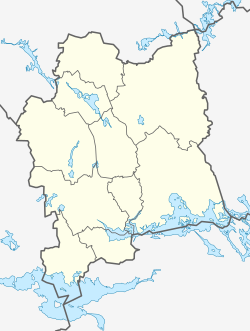
Fagersta is a locality and the seat of Fagersta Municipality in Västmanland County, Sweden, with 11,130 inhabitants in 2010.[1]
Geography
The city is located at the junction of two railways between Ludvika-Västerås and Avesta (Krylbo)-Örebro, in the heart of the historic Bergslagen region which is rich in copper and iron ore. The 60th parallel north passes through the town.
History
There has been mining activity in the Fagersta area since the 15th century but it was not organized until the 17th century and was not made a corporation until 1873, when Fagersta Bruks AB was founded.[2]
Fagersta was made a city in 1944 when the industrial hot spot of Fagersta merged with its service-oriented neighbour Västanfors. It is now the seat of Fagersta Municipality. The Fagersta airspace surveillance tower is a Second World War observation platform located to protect a nearby steel mill.
Industry
Today's industry is focused on hard metal tools (Seco Tools AB and Atlas Copco Secoroc AB) and stainless steel products (Fagersta Stainless AB and OUTOKUMPU Stainless Tubular Products AB).
Notable natives
- Ulf Samuelsson, ice hockey player (NHL)
- Tomas Sandström, ice hockey player (NHL)
- The Hives, garage rock band
- 59 Times the Pain, garage rock band
- Johan August Brinell, metallurgist and inventor of the Brinell hardness test at the Fagersta Iron and Steel Works in 1900
- Kjell Ramstedt, drummer for punk rock band No Fun at All
References
- ^ a b c "Tätorternas landareal, folkmängd och invånare per km2 2005 och 2010" (in Swedish). Statistics Sweden. 14 December 2011. Archived from the original on 2012-01-27. Retrieved 10 January 2012.
- ^ "Allmänna val 17 september 2006".


