Esplanade Avenue, New Orleans
Esplanade Avenue is a historic street in New Orleans, Louisiana. It runs northwest from the Mississippi River to Beauregard Circle at the entrance to City Park.[1]

History


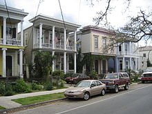
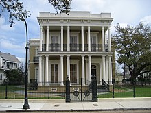
Esplanade Avenue was an important 18th-century portage route of trade between Bayou St. John, which linked to Lake Pontchartrain, and the River. Many 19th-century mansions still line the street; it functioned as a "millionaires row" for the Creole section of the city similar to that of St. Charles Avenue for the Anglophone section in uptown New Orleans.[1]
Esplanade Avenue is the dividing line between the 6th and 7th Wards of the city.
From the River to Claiborne Avenue, Esplanade has one lane of traffic in both directions, with a raised neutral ground (median) in the center. From Claiborne to Carrollton Avenue it has one traffic lane in each direction, a dedicated bicycle lane, and a smaller neutral ground.
The segment from the River to Rampart Street separates the French Quarter from the Faubourg Marigny. Near the river on the French Quarter side is the old New Orleans Mint building.[1]
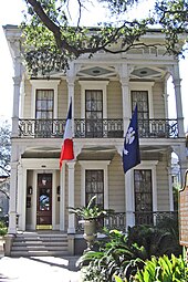
Passing by the Faubourg Treme neighborhood, Esplanade goes through the area known alternatively as Faubourg St. John or Esplanade Ridge, near the New Orleans Fairgrounds. The house where Edgar Degas stayed during his time in New Orleans is in this section.[2][3]
Just past Carrollton Avenue is the entrance to the New Orleans Museum of Art.[1]
Location
| Point | Coordinates (links to map & photo sources) |
Notes |
|---|---|---|
| Mississippi River/Peters Street | 29°57′41″N 90°03′28″W / 29.9614°N 90.0578°W | |
| Mid-point/Miro Street | 29°58′23″N 90°04′26″W / 29.9730°N 90.0738°W | Approximate |
| Beauregard Circle | 29°59′02″N 90°05′24″W / 29.9840°N 90.0899°W |
See also
- New Orleans Mint
- Buildings and architecture of New Orleans
- List of streets of New Orleans
- General Beauregard Equestrian Statue, until 2017 located in Beauregard Circle
 Media related to Esplanade Avenue, New Orleans at Wikimedia Commons
References
- ^ a b c d "Esplanade Avenue". The Official Tourism Site of the City of New Orleans: NewOrleansOnline.com. Retrieved October 23, 2012.
- ^ "Degas in New Orleans". Old New Orleans. Retrieved October 23, 2012.
- ^ "Our Story". Degas House. Archived from the original on November 13, 2012. Retrieved October 23, 2012.
29°58′23″N 90°04′26″W / 29.9730°N 90.0738°W
Further reading
- Mary Louise Christovich; Sally Kittredge Evans; Roulhac Toledano (1995). New Orleans Architecture: The Esplanade Ridge. New Orleans Architecture. Vol. 5. Pelican Publishing. ISBN 978-1-56554-072-9.
