Errachidia
Errashidia الرشيدية | |
|---|---|
City | |
 Main road in Er Rashidia | |
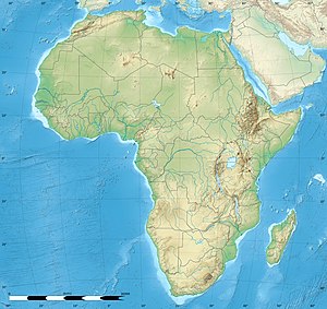
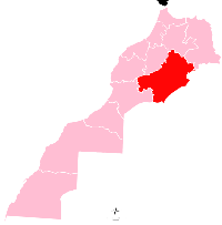
location of Errachidia in Morocco | |
| Coordinates: 31°55′55″N 4°25′28″W / 31.93194°N 4.42444°W | |
| Country | |
| Region | Drâa-Tafilalet |
| Province | Errachidia |
| Elevation | 1,009 m (3,310 ft) |
| Population (2014)[1] | |
• Total | 92,374 |
Errashidia (Arabic: الرشيدية, romanized: ar-Rashidiyyah), formerly known as Ksar es-Souk, (Arabic: قصر السوق, romanized: Qaṣr as-Sūq) is a city in Morocco, located in the Errachidia Province, and is the capital of the Drâa-Tafilalet region.
Toponymy
Formerly known as "Ksar es-Souk" (Arabic: قصر السوق, romanized: Qaṣr as-Sūq), the city was renamed Errachidia around 1975 in honor of the second son of Hassan II, Moulay Rachid.
Culture
The city was part of the route of the 2006 and 2007 Dakar Rally.
Climate
Errachidia has a hot desert climate (Köppen climate classification BWh). The highest temperature ever registered in Errachidia was 43.9 °C (111.0 °F), on July 17, 2021.[2]
| Climate data for Errachidia (1991–2020) | |||||||||||||
|---|---|---|---|---|---|---|---|---|---|---|---|---|---|
| Month | Jan | Feb | Mar | Apr | May | Jun | Jul | Aug | Sep | Oct | Nov | Dec | Year |
| Record high °C (°F) | 27.0 (80.6) |
28.2 (82.8) |
32.3 (90.1) |
36.3 (97.3) |
39.5 (103.1) |
41.9 (107.4) |
44.7 (112.5) |
43.7 (110.7) |
39.7 (103.5) |
36.6 (97.9) |
29.8 (85.6) |
26.7 (80.1) |
44.7 (112.5) |
| Mean daily maximum °C (°F) | 15.9 (60.6) |
18.2 (64.8) |
22.1 (71.8) |
26.1 (79.0) |
30.3 (86.5) |
35.4 (95.7) |
39.5 (103.1) |
38.2 (100.8) |
32.9 (91.2) |
26.8 (80.2) |
20.6 (69.1) |
16.7 (62.1) |
26.9 (80.4) |
| Daily mean °C (°F) | 9.0 (48.2) |
11.4 (52.5) |
15.6 (60.1) |
19.6 (67.3) |
23.8 (74.8) |
28.7 (83.7) |
32.7 (90.9) |
31.5 (88.7) |
26.4 (79.5) |
20.5 (68.9) |
14.1 (57.4) |
10.1 (50.2) |
20.3 (68.5) |
| Mean daily minimum °C (°F) | 2.0 (35.6) |
4.6 (40.3) |
8.8 (47.8) |
13.0 (55.4) |
17.3 (63.1) |
22.0 (71.6) |
25.8 (78.4) |
24.9 (76.8) |
19.9 (67.8) |
14.2 (57.6) |
7.7 (45.9) |
3.5 (38.3) |
13.6 (56.5) |
| Record low °C (°F) | −8.1 (17.4) |
−4.5 (23.9) |
−0.4 (31.3) |
4.8 (40.6) |
5.4 (41.7) |
12.2 (54.0) |
16.5 (61.7) |
16.3 (61.3) |
11.7 (53.1) |
6.1 (43.0) |
−0.6 (30.9) |
−3.8 (25.2) |
−8.1 (17.4) |
| Average precipitation mm (inches) | 10.0 (0.39) |
12.6 (0.50) |
14.0 (0.55) |
9.4 (0.37) |
8.7 (0.34) |
5.6 (0.22) |
3.1 (0.12) |
6.3 (0.25) |
18.2 (0.72) |
20.8 (0.82) |
16.3 (0.64) |
8.0 (0.31) |
133.0 (5.24) |
| Average precipitation days (≥ 1 mm) | 1.4 | 1.7 | 1.9 | 1.4 | 1.5 | 1.3 | 0.9 | 1.7 | 2.8 | 2.8 | 2.4 | 1.5 | 21.3 |
| Mean monthly sunshine hours | 252.3 | 242.6 | 277.1 | 294.5 | 317.0 | 315.8 | 310.1 | 293.8 | 267.0 | 262.3 | 246.7 | 242.3 | 3,321.5 |
| Source: NOAA (sun 1981–2010)[3][4] | |||||||||||||
Notable people
- Abdalaati Iguider - 1500m runner
- Rachid Neqrouz - Former footballer
- Mohamed Ounajem - professional footballer
- Meir Sheetrit - Former Member of the Knesset and Minister in Israel
References
- ^ "POPULATION LÉGALE DES RÉGIONS, PROVINCES, PRÉFECTURES, MUNICIPALITÉS, ARRONDISSEMENTS ET COMMUNES DU ROYAUME D'APRÈS LES RÉSULTATS DU RGPH 2014" (in Arabic and French). High Commission for Planning, Morocco. 8 April 2015. Retrieved 29 September 2017.
- ^ "60210: Errachidia (Morocco)". ogimet.com. OGIMET. 17 July 2021. Retrieved 18 July 2021.
- ^ "World Meteorological Organization Climate Normals for 1991–2020". National Oceanic and Atmospheric Administration. Archived from the original on 5 October 2023. Retrieved 5 October 2023.
- ^ "World Meteorological Organization Climate Normals for 1981–2010". World Meteorological Organization. Retrieved 10 November 2021.
External links
 Media related to Errachidia at Wikimedia Commons
 Errachidia travel guide from Wikivoyage


